Country:
 Great Britain
Region:
City:
Latitude and Longitude:
Time Zone:
Postal Code:
IP information under different IP Channel
ip-api
Country
Region
City
ASN
Time Zone
ISP
Blacklist
Proxy
Latitude
Longitude
Postal
Route
IPinfo
Country
Region
City
ASN
Time Zone
ISP
Blacklist
Proxy
Latitude
Longitude
Postal
Route
MaxMind
Country
Region
City
ASN
Time Zone
ISP
Blacklist
Proxy
Latitude
Longitude
Postal
Route
Luminati
Country
GBRegion
eng
City
harrogate
ASN
Time Zone
Europe/London
ISP
TalkTalk
Latitude
Longitude
Postal
db-ip
Country
Region
City
ASN
Time Zone
ISP
Blacklist
Proxy
Latitude
Longitude
Postal
Route
ipdata
Country
Region
City
ASN
Time Zone
ISP
Blacklist
Proxy
Latitude
Longitude
Postal
Route
Popular places and events near this IP address

Ashville College
Independent school in North Yorkshire, England
Distance: Approx. 2141 meters
Latitude and longitude: 53.97386,-1.55214
Ashville College is a co-educational independent school for both day (exclusively so from September 2025) and boarding pupils aged 2–18 in Harrogate, North Yorkshire, England. It was founded in 1877 as a boarding school for boys by the United Methodist Free Churches. It incorporated Elmfield College, Heworth, York and New College, Harrogate in the 1930s.
Harrogate Grammar School
Academy in Harrogate, North Yorkshire, England
Distance: Approx. 2668 meters
Latitude and longitude: 53.9801,-1.5473
Harrogate Grammar School is a co-educational academy school and sixth form in Harrogate, North Yorkshire, England. It has around 1,900 pupils in the main school.

Rossett School
Academy in Harrogate, North Yorkshire, England
Distance: Approx. 2185 meters
Latitude and longitude: 53.97608,-1.55248
Rossett School is a co-educational secondary school with academy status in Harrogate, North Yorkshire, England. Its pupils are from Harrogate, neighbouring towns and villages, and nearby Leeds, with the latter being a large part of the enrolment. Current enrolment is around 1,400 including 214 in the sixth form.
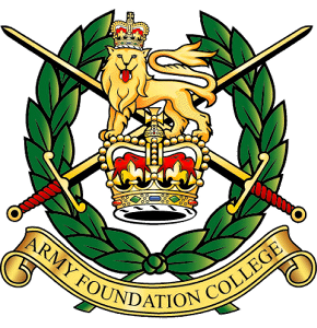
Army Foundation College
British Army training unit in Yorkshire, England
Distance: Approx. 2821 meters
Latitude and longitude: 53.9939,-1.5974
The Army Foundation College (AFC) in Harrogate, England, is the sole initial military training unit for British Army recruits who enlist aged between 16 and 17.5 years. AFC delivers two 'Phase 1' initial training courses: the 'long course' of 49 weeks, mainly for recruits in combat roles, and the 23-week 'short course' for recruits in most other roles. In addition to their military training, recruits are enrolled onto basic Functional Skills courses in English, maths, and ICT. Approximately 1,200 boys and 100 girls begin training at AFC annually, of whom approximately 500 are enrolled for the infantry.

Burn Bridge
Village in North Yorkshire, England
Distance: Approx. 2844 meters
Latitude and longitude: 53.95962,-1.54427
Burn Bridge is a village in the borough of Harrogate in North Yorkshire, England. It is 2.5 miles (4.0 km) south of the town of Harrogate, and forms part of the civil parish of Pannal and Burn Bridge. Burn Bridge is set largely on the side of a hill.

RHS Garden Harlow Carr
Public garden in North Yorkshire, England
Distance: Approx. 1578 meters
Latitude and longitude: 53.98222222,-1.5725
RHS Garden Harlow Carr is one of five public gardens run by the Royal Horticultural Society. It is located on the western edge of Harrogate in the English county of North Yorkshire. The RHS acquired Harlow Carr through its merger with the Northern Horticultural Society in 2001.
St George's House, Harrogate
Distance: Approx. 2303 meters
Latitude and longitude: 53.9824,-1.5562
St George's House, originally called the Northern Police Orphanage was an orphanage and children's home located on Otley Road, Harrogate, Yorkshire, England, founded by Catherine Gurney.

Beckwithshaw
Village and civil parish in North Yorkshire, England
Distance: Approx. 722 meters
Latitude and longitude: 53.97346,-1.59321
Beckwithshaw is a village and civil parish in the Harrogate district of North Yorkshire, England about 2.5 miles (4 km) south-west of Harrogate.

Church of St Michael and All Angels, Beckwithshaw
Anglican church in North Yorkshire, England
Distance: Approx. 739 meters
Latitude and longitude: 53.97361111,-1.59333333
The Church of St Michael and All Angels, Beckwithshaw, North Yorkshire, England, also known as Beckwithshaw Church, is an Anglican church built and furnished between 1886 and 1887 by William Swinden Barber in the Gothic Revival style as part of the Arts and Crafts movement. The stained glass windows in the same style were added in 1892. The church is listed as a Grade II historic structure; it is a pristine and unchanged example of an Arts and Crafts church retaining all its original furnishings, apart from one missing statue.

Beckwith, North Yorkshire
Hamlet in North Yorkshire, England
Distance: Approx. 584 meters
Latitude and longitude: 53.972,-1.576
Beckwith is a small settlement in North Yorkshire, England. It lies 2 miles (3 km) south west of Harrogate. The place name was first recorded in about 972 as bec wudu, Old English for "beech wood".

Harlow Hill Cemetery
Cemetery in North Yorkshire, England
Distance: Approx. 1744 meters
Latitude and longitude: 53.98055556,-1.56472222
Harlow Hill Cemetery on Otley Road, Harrogate, North Yorkshire, England, is a local authority cemetery established on land donated by Henry Lascelles, 4th Earl of Harewood in 1869, and consecrated on 3 October 1871 by the Bishop of Ripon. It features the Gothic Revival Church of All Saints, designed by Isaac Thomas Shutt and Alfred Hill Thompson. It has individual memorials to casualties of World Wars I and II, and other graves include those of actor Michael Rennie and Catherine Gurney, an activist in the Temperance movement in the United Kingdom.

Church of All Saints, Harlow Hill
Grade II listed church in North Yorkshire, England
Distance: Approx. 1731 meters
Latitude and longitude: 53.98055556,-1.565
The Church of All Saints, Harlow Hill, Harrogate, North Yorkshire, England, is a grade II listed mission church, or chapel of ease, completed in 1871 on land donated by Henry Lascelles, 4th Earl of Harewood, within the parish of St Mary. It was consecrated by the Bishop of Ripon in 1871. The building was designed with a round bell tower, in Gothic Revival style, by Isaac Thomas Shutt and Alfred Hill Thompson.
Weather in this IP's area
fog
15 Celsius
15 Celsius
14 Celsius
15 Celsius
1005 hPa
96 %
1005 hPa
988 hPa
100 meters
4.12 m/s
320 degree
100 %
06:27:47
19:40:25