Country:
 Great Britain
Region:
City:
Latitude and Longitude:
Time Zone:
Postal Code:
IP information under different IP Channel
ip-api
Country
Region
City
ASN
Time Zone
ISP
Blacklist
Proxy
Latitude
Longitude
Postal
Route
IPinfo
Country
Region
City
ASN
Time Zone
ISP
Blacklist
Proxy
Latitude
Longitude
Postal
Route
MaxMind
Country
Region
City
ASN
Time Zone
ISP
Blacklist
Proxy
Latitude
Longitude
Postal
Route
Luminati
Country
GBRegion
eng
City
stockport
ASN
Time Zone
Europe/London
ISP
TalkTalk
Latitude
Longitude
Postal
db-ip
Country
Region
City
ASN
Time Zone
ISP
Blacklist
Proxy
Latitude
Longitude
Postal
Route
ipdata
Country
Region
City
ASN
Time Zone
ISP
Blacklist
Proxy
Latitude
Longitude
Postal
Route
Popular places and events near this IP address

Bramhall
Human settlement in England
Distance: Approx. 664 meters
Latitude and longitude: 53.357,-2.164
Bramhall is an area in the Metropolitan Borough of Stockport, Greater Manchester, England. Historically in Cheshire, it had a population of 17,436 at the 2011 Census.

Bramall Hall
Building in Greater Manchester, England
Distance: Approx. 1985 meters
Latitude and longitude: 53.374,-2.1666
Bramall Hall is a largely Tudor manor house in Bramhall, Greater Manchester, England. The building is timber-framed and its oldest parts date from the 14th century, with additions from the 16th and 19th centuries. The house functions as a museum and its 70 acres (28 ha) of landscaped parkland (Bramhall Park) are open to the public.

Woodford, Greater Manchester
Suburb of Stockport, Greater Manchester, England
Distance: Approx. 2097 meters
Latitude and longitude: 53.339,-2.156
Woodford is a suburban village in the Metropolitan Borough of Stockport, Greater Manchester, England, 5.2 miles (8.4 km) south of Stockport, 5.7 miles (9.2 km) north-west of Macclesfield and 10.7 miles (17.2 km) south-east of Manchester. Woodford is the most southerly point of Greater Manchester; it consists of a ribbon of properties and a housing development along the A5102 road, around which is open countryside. Historically part of Cheshire, Woodford was a hamlet in the parish of Prestbury throughout the Middle Ages.
Bramhall High School
Nine-form entry 11-16 Comprehensive school in Stockport, England
Distance: Approx. 719 meters
Latitude and longitude: 53.35941,-2.16458
Bramhall High School is a nine form entry, comprehensive high school for 11 to 16-year-olds in Bramhall, Stockport, England. The school is a teacher training school in connection with Manchester Metropolitan University in Manchester.

Hazel Grove and Bramhall Urban District
Distance: Approx. 1388 meters
Latitude and longitude: 53.367,-2.14
Hazel Grove and Bramhall was a civil parish and urban district in north east Cheshire, England from 1900 to 1974. It was created in 1900 covering, from Stockport Rural District, the former area of the civil parishes of: Bosden Bramhall Norbury Offerton Torkington In 1936, 903 acres (3.65 km2) were transferred to the County Borough of Stockport and 16 acres (65,000 m2) to Marple Urban District. In 1939 the former area of the Woodford civil parish was gained.

Bramhall railway station
Railway station in Greater Manchester, England
Distance: Approx. 652 meters
Latitude and longitude: 53.360435,-2.162869
Bramhall railway station serves the district of Bramhall in the Metropolitan Borough of Stockport, Greater Manchester, England. The station is 9¾ miles (16 km) south of Manchester Piccadilly on the Stafford to Manchester Line and was opened in 1845 by the London and North Western Railway.

Poynton railway station
Railway station in Cheshire, England
Distance: Approx. 1547 meters
Latitude and longitude: 53.3503,-2.1345
Poynton railway station serves the town of Poynton in Cheshire, England. The station is on Cheshire East Council's local list of heritage buildings. It was built in 1887.
Hazel Grove High School
Academy in Stockport, Greater Manchester, England
Distance: Approx. 1814 meters
Latitude and longitude: 53.3699,-2.1358
Hazel Grove High School is an 11–18 mixed secondary school and sixth form with academy status in Hazel Grove, Stockport, Greater Manchester, England.
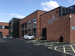
Cheadle Hulme High School
Academy in Cheadle, Greater Manchester, England
Distance: Approx. 2317 meters
Latitude and longitude: 53.3647,-2.187
Cheadle Hulme High School is an 11–18 mixed secondary school and sixth form with academy status in Cheadle Hulme, Cheadle, Stockport. In 1997, it was awarded specialist language college status and in 2000 it became a training school. It has been an academy since 2012 and operates as part of The Laurus Trust.

Woodford Aerodrome
Former airport and aircraft factory in the United Kingdom
Distance: Approx. 2225 meters
Latitude and longitude: 53.33805556,-2.14888889
Woodford Aerodrome (ICAO: EGCD) is a former airfield and aircraft factory at Woodford, Greater Manchester, England, 6 NM (11 km; 6.9 mi) north of Macclesfield. It was opened by the Avro company after the First World War and became an important production centre for military aircraft in the Second World War. Notable planes made at the factory include the Avro Anson, Avro Lancaster, Avro Shackleton and Avro Vulcan.

St George's Church, Poynton
Church in Cheshire, England
Distance: Approx. 2270 meters
Latitude and longitude: 53.3491,-2.1232
St George's Church stands in the centre of the town of Poynton, Cheshire, England. It is an active Anglican parish church in the deanery of Cheadle, the archdeaconry of Macclesfield, and the diocese of Chester. The church is recorded in the National Heritage List for England as a designated Grade II listed building.
Our Lady and St Joseph Church, Heywood
Catholic church in Heywood, Rochdale, Greater Manchester
Distance: Approx. 1602 meters
Latitude and longitude: 53.353044,-2.1313433
The Church of Our Lady and St Joseph, Heywood, is a Catholic church on Mary Street in Heywood, Greater Manchester, England and is a Grade II listed building.
Weather in this IP's area
broken clouds
16 Celsius
16 Celsius
15 Celsius
17 Celsius
1005 hPa
90 %
1005 hPa
995 hPa
10000 meters
2.57 m/s
30 degree
75 %
06:30:49
19:41:56