62.152.182.7 - IP Lookup: Free IP Address Lookup, Postal Code Lookup, IP Location Lookup, IP ASN, Public IP
Country:
Region:
City:
Location:
Time Zone:
Postal Code:
IP information under different IP Channel
ip-api
Country
Region
City
ASN
Time Zone
ISP
Blacklist
Proxy
Latitude
Longitude
Postal
Route
Luminati
Country
Region
bw
City
aalen
ASN
Time Zone
Europe/Berlin
ISP
NetCom BW GmbH
Latitude
Longitude
Postal
IPinfo
Country
Region
City
ASN
Time Zone
ISP
Blacklist
Proxy
Latitude
Longitude
Postal
Route
IP2Location
62.152.182.7Country
Region
bayern
City
heidenheim
Time Zone
Europe/Berlin
ISP
Language
User-Agent
Latitude
Longitude
Postal
db-ip
Country
Region
City
ASN
Time Zone
ISP
Blacklist
Proxy
Latitude
Longitude
Postal
Route
ipdata
Country
Region
City
ASN
Time Zone
ISP
Blacklist
Proxy
Latitude
Longitude
Postal
Route
Popular places and events near this IP address
Altmühltal
Distance: Approx. 5635 meters
Latitude and longitude: 49.03333333,10.81666667
Altmühltal (lit.: "Altmühl valley") is a Verwaltungsgemeinschaft (federation of municipalities) in the district of Weißenburg-Gunzenhausen in Bavaria in Germany.

Franconian Jura
Highland region in Germany
Distance: Approx. 1359 meters
Latitude and longitude: 49.01556,10.76194
The Franconian Jura (German: Fränkische Alb [ˈfʁɛŋkɪʃə ˈʔalp] , Fränkischer Jura, Frankenalb or Frankenjura) is an upland in Franconia, Bavaria, Germany. Located between two rivers, the Danube in the south and the Main in the north, its peaks reach elevations of up to 600 metres (2,000 ft) and it has an area of some 7053.8 km2. It is part of the Table Jura (Tafeljura).
Hahnenkamm (Verwaltungsgemeinschaft)
Distance: Approx. 60 meters
Latitude and longitude: 49.01694444,10.74277778
Hahnenkamm is a Verwaltungsgemeinschaft (federation of municipalities) in the district of Weißenburg-Gunzenhausen in Bavaria in Germany.

Dittenheim
Municipality in Bavaria, Germany
Distance: Approx. 5508 meters
Latitude and longitude: 49.05,10.8
Dittenheim is a municipality in the Weißenburg-Gunzenhausen district, in Bavaria, Germany.

Gnotzheim
Municipality in Bavaria, Germany
Distance: Approx. 5844 meters
Latitude and longitude: 49.06666667,10.71666667
Gnotzheim is a municipality in the Weißenburg-Gunzenhausen district, in Bavaria, Germany.

Meinheim
Municipality in Bavaria, Germany
Distance: Approx. 5635 meters
Latitude and longitude: 49.03333333,10.81666667
Meinheim is a municipality in the Weißenburg-Gunzenhausen district, in Bavaria, Germany.

Westheim
Municipality in Bavaria, Germany
Distance: Approx. 5928 meters
Latitude and longitude: 49,10.66666667
Westheim is a municipality in the Weißenburg-Gunzenhausen district, in Bavaria, Germany.

Heidenheim, Bavaria
Municipality in Bavaria, Germany
Distance: Approx. 478 meters
Latitude and longitude: 49.01666667,10.75
Heidenheim (German pronunciation: [ˈhaɪdn̩ˌhaɪm] ) is a municipality in the Weißenburg-Gunzenhausen district, in Bavaria, Germany. Heidenheim is an old German market town, which resides in the administrative region of Middle Franconia in the middle of Bavaria. It belongs to the rural district called Weißenburg-Gunzenhausen.

Gelber Berg
Distance: Approx. 2989 meters
Latitude and longitude: 49.04027778,10.76444444
Gelber Berg is a mountain of Bavaria, Germany.
Hahnenkamm (Altmühl valley)
Mountain chain in Germany
Distance: Approx. 1399 meters
Latitude and longitude: 49.01555556,10.7625
The Hahnenkamm is a mountain ridge in Bavaria (Germany), belonging to the Franconian Jura.

Gelbe Burg
Distance: Approx. 2912 meters
Latitude and longitude: 49.039211,10.765066
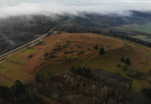
The Gelbe Burg ("Yellow Castle"), also called the Gelbe Bürg, is the site of a hill castle on the Gelber Berg ("Yellow Mountain", 628.4 m above sea level (NN)) northeast of the market village of Heidenheim in the Middle Franconian county of Weißenburg-Gunzenhausen in the German state of Bavaria. During the Migration Period there was a hilltop settlement on the Gelber Berg. Hardly anything is known of the founding of the medieval castle and the course of its history.

Dürrenberg
Mountain in Germany
Distance: Approx. 1572 meters
Latitude and longitude: 49.01638889,10.765
Dürrenberg () (656.4 m above sea level) is a mountain of Bavaria. It is the highest point of the Weißenburg-Gunzenhausen district and of the Hahnenkamm and is situated between Heidenheim and Meinheim 60 km south west of Nuremberg, Germany.
Weather in this IP's area
scattered clouds
-3 Celsius
-6 Celsius
-5 Celsius
-2 Celsius
1036 hPa
91 %
1036 hPa
970 hPa
10000 meters
2.28 m/s
2.3 m/s
177 degree
28 %