Country:
Region:
City:
Latitude and Longitude:
Time Zone:
Postal Code:
IP information under different IP Channel
ip-api
Country
Region
City
ASN
Time Zone
ISP
Blacklist
Proxy
Latitude
Longitude
Postal
Route
Luminati
Country
Region
fa
City
abraqkhaytan
ASN
Time Zone
Asia/Kuwait
ISP
Quality Net General Trading & Contracting Company
Latitude
Longitude
Postal
IPinfo
Country
Region
City
ASN
Time Zone
ISP
Blacklist
Proxy
Latitude
Longitude
Postal
Route
db-ip
Country
Region
City
ASN
Time Zone
ISP
Blacklist
Proxy
Latitude
Longitude
Postal
Route
ipdata
Country
Region
City
ASN
Time Zone
ISP
Blacklist
Proxy
Latitude
Longitude
Postal
Route
Popular places and events near this IP address

Farwaniya Governorate
Governorate of Kuwait
Distance: Approx. 1982 meters
Latitude and longitude: 29.277,47.959
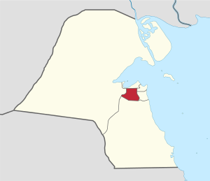
Farwaniya Governorate (Arabic: محافظة الفروانية Muḥāfaẓat al-Farwānīyah) is the most populous of the six governorates of Kuwait, and is the country's only landlocked governorate. It is Kuwait City's main residential area and also forms an important part of Kuwait's commercial activities.
Carmel School (Kuwait)
Private school in Safat, Kuwait
Distance: Approx. 1994 meters
Latitude and longitude: 29.27833333,47.97444444
Carmel School, Kuwait is a private catholic school of all religious denominations in Kuwait. The school was established in 1969 by the Sisters of the Apostolic Carmel, who have several educational establishments across the Middle East, Africa and Asia. The school was first established in Salwa and later shifted to Khaitan.
Adailiya
Area in Capital Governorate, Kuwait
Distance: Approx. 2519 meters
Latitude and longitude: 29.31666667,47.96666667
Adailiya (Arabic: العديلية Gulf Arabic pronunciation: /lɪʕ.deː.liː.jə/) is an area and a suburb of Kuwait City; it is located in the Capital Governorate in Kuwait. It had a population of 21,996 in 2022. Adailiya houses a campus of Kuwait's Public Authority for Applied Education and Training (PAAET) and, temporarily, the colleges of Architecture and Life Sciences at Kuwait University as well as the Kazma Sport Club and religious, cultural, and commercial places.
Farwaniya Stadium
Distance: Approx. 627 meters
Latitude and longitude: 29.288757,47.962661
Farwaniya Stadium is a multi-use stadium in Al-Farwaniyah, Kuwait. It is generally used for football matches and is the home stadium of Al Tadamun SC, a professional football club. The stadium holds 14,000 people.
Abraq Khaytan
Place in Farwaniya, Kuwait
Distance: Approx. 444 meters
Latitude and longitude: 29.2925,47.96888889
Abraq Khaytan or Abrag Khitan (Arabic: أبرق خيطان) is a village in Kuwait. It is located 3 miles from Kuwait International Airport. Nearby towns and villages include Al `Umariyah (0.8 nm), Al `Udayliyah (0.5 nm), Qurtubah (1.5 nm), As Surrah (1.5 nm), Al Farwaniyah (1.0 nm) and Janub Khaytan (1.3 nm).
Qurtuba (Kuwait)
Place in Capital Governorate, Kuwait
Distance: Approx. 2858 meters
Latitude and longitude: 29.31222222,47.98555556
Qurtubah (Arabic: قرطبة) is an area in Kuwait City, Kuwait. It is located 5 miles (8 km) from Kuwait International Airport. Nearby areas include Yarmuk (1.0 nmi or 1.8 km), Adiliya (0.7 nmi or 1.3 km), Da'iya (1.3 nmi or 2.4 km), Hadiqah (1.3 nmi or 2.4 km), Rawda (1.7 nmi or 3.1 km), Abraq Khaytan (1.5 nmi or 2.8 km) and Surrah (2.2 nmi or 4.1 km) .
The Avenues (Kuwait)
Largest shopping mall in Kuwait
Distance: Approx. 3019 meters
Latitude and longitude: 29.3032,47.9354
The Avenues Mall is the second largest shopping mall in the Persian Gulf region. The mall is located in the Rai area extending from Fifth Ring Road from the south and Al Ghazali Highway from the east. It opened in April 2007, under the patronage of the Emir of Kuwait Sheikh Sabah Al Ahmed Al Sabah.
Farwaniya, Kuwait
Area in Farwaniya Governorate, Kuwait
Distance: Approx. 1982 meters
Latitude and longitude: 29.277,47.959
Farwaniya (Arabic: الفروانية, Gulf Arabic: /ɪlfərwaːniːjə/) is an area of Farwaniya Governorate, located within the agglomeration of Kuwait City, Kuwait. The Ghazali Expressway passes to the west of the district and the road leading to Kuwait International Airport to the east, both roads in a north–south direction. Farwaniya contains mosques, hospitals, a university, a park and other facilities.
Khaitan
City in Farwaniya Governorate, Kuwait
Distance: Approx. 684 meters
Latitude and longitude: 29.3,47.96666667
Khaitan (Arabic: خيطان) is an area of Farwaniya Governorate, Kuwait near Kuwait City. It is the home of Khaitan Sporting Club.
Khaitan Stadium
Multi-use stadium in Kuwait
Distance: Approx. 2279 meters
Latitude and longitude: 29.28241667,47.98397222
Khaitan Stadium (also called Nasser Al Osaimy Stadium) is a multi-use stadium in Kuwait. It is currently used mostly for football matches and is the home stadium of Khaitan Sporting Club. The stadium holds 11,000 people.
Kuwait Zoo
Zoo in Omariya, Kuwait
Distance: Approx. 710 meters
Latitude and longitude: 29.300167,47.96245
Kuwait Zoo is a zoo located in Omariya in Kuwait. It is currently closed.
Zahra (Kuwait)
Area in Hawalli Governorate, Kuwait
Distance: Approx. 3528 meters
Latitude and longitude: 29.278,47.996
Zahra (Arabic: الزهراء) is an area in Hawalli Governorate in Kuwait. It is divided into eight blocks. Zahra is part of the lager South Surra region which comprises four other areas: Shuhada, Siddeeq, Salām, and Ḥiṭṭīn The 360 Mall is one of Zahra's prominent attractions.
Weather in this IP's area
few clouds
23 Celsius
22 Celsius
22 Celsius
23 Celsius
1017 hPa
44 %
1017 hPa
1013 hPa
10000 meters
5.24 m/s
7.91 m/s
318 degree
11 %
06:06:33
16:57:18