62.146.34.242 - IP Lookup: Free IP Address Lookup, Postal Code Lookup, IP Location Lookup, IP ASN, Public IP
Country:
 Germany
Region:
City:
Location:
Time Zone:
Postal Code:
ISP:
ASN:
language:
User-Agent:
Proxy IP:
Blacklist:
IP information under different IP Channel
ip-api
Country
Region
City
ASN
Time Zone
ISP
Blacklist
Proxy
Latitude
Longitude
Postal
Route
db-ip
Country
Region
City
ASN
Time Zone
ISP
Blacklist
Proxy
Latitude
Longitude
Postal
Route
IPinfo
Country
Region
City
ASN
Time Zone
ISP
Blacklist
Proxy
Latitude
Longitude
Postal
Route
IP2Location
62.146.34.242Country
deRegion
nordrhein-westfalen
City
uedding
Time Zone
Europe/Berlin
ISP
Language
User-Agent
Latitude
Longitude
Postal
ipdata
Country
Region
City
ASN
Time Zone
ISP
Blacklist
Proxy
Latitude
Longitude
Postal
Route
Popular places and events near this IP address
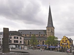
Mönchengladbach
City in North Rhine-Westphalia, Germany
Distance: Approx. 3640 meters
Latitude and longitude: 51.2,6.43333333
Mönchengladbach (German: [mœnçn̩ˈɡlatbax] , Limburgish: Jlabbach [jəˈlɑbɑx]) is a city in North Rhine-Westphalia, Germany. It is located west of the Rhine, halfway between Düsseldorf and the Dutch border.

Mönchengladbach Airport
Airport
Distance: Approx. 2402 meters
Latitude and longitude: 51.23027778,6.50444444
Mönchengladbach Airport (German: Verkehrslandeplatz Mönchengladbach, formerly Düsseldorf Mönchengladbach Airport, IATA: MGL, ICAO: EDLN) is a small regional airport located 4.4 km (2.7 mi) northeast of Mönchengladbach and 15.2 km (9.4 mi) west of Düsseldorf. It is co-owned by the company which also runs Düsseldorf Airport (70%) and the local utility company NVV AG (30%).

Bökelbergstadion
Distance: Approx. 2863 meters
Latitude and longitude: 51.20890833,6.43955556
The Bökelbergstadion (pronounced [ˈbøːkl̩bɛʁkˌʃtaːdi̯ɔn] ) was a football stadium in Mönchengladbach, Germany.

Abteiberg Museum
Art museum in Mönchengladbach, Germany
Distance: Approx. 4100 meters
Latitude and longitude: 51.19277778,6.43305556
The Museum Abteiberg is a municipal museum for contemporary art in the German city Mönchengladbach. Since the 1970s, the museum has been known for its experimental and avant-garde exhibitions, starting with director Johannes Cladders (1967–1985), and also its museum architecture, designed by Austrian architect Hans Hollein – a highpoint of postmodern design.

Lordship of Myllendonk
Distance: Approx. 1033 meters
Latitude and longitude: 51.20944444,6.49027778
The Lordship of Myllendonk (sometimes spelled "Millendonk") was an estate of the Holy Roman Empire, located in western North Rhine-Westphalia, Germany. It was bordered by the Duchy of Jülich to the west and north, the Lordship of Dyck to the south, and the Archbishopric of Cologne to the east and southeast. The lordship contained Korschenbroich and the Castle of Myllendonk.

Mönchengladbach Hauptbahnhof
Railway station in Mönchengladbach, Germany
Distance: Approx. 3182 meters
Latitude and longitude: 51.196,6.446
Mönchengladbach Hauptbahnhof (German for Mönchengladbach main station) is a railway station in the city of Mönchengladbach in western Germany.

Korschenbroich station
Railway station in Korschenbroich, Germany
Distance: Approx. 3189 meters
Latitude and longitude: 51.195403,6.511621
Korschenbroich station is a through station in the town of Korschenbroich in the German state of North Rhine-Westphalia. The station was opened between 1868 and 1880 on the Mönchengladbach–Düsseldorf railway opened between Mönchengladbach and Neuss by the Aachen-Düsseldorf-Ruhrort Railway Company on 16 December 1852. It has two platform tracks and it is classified by Deutsche Bahn as a category 6 station.

Schloss Rheydt
Distance: Approx. 3745 meters
Latitude and longitude: 51.182,6.482
Schloss Rheydt is a Renaissance palace in Rheydt, Mönchengladbach, North Rhine-Westphalia, Germany. Over the years the building has been the family seat of various noble families, including the Bylandt-Rheydt dynasty that ruled over Rheydt for over 300 years and gave the palace its present look.

Bunter Garten
Municipal park with botanical garden in Germany
Distance: Approx. 3548 meters
Latitude and longitude: 51.2024,6.4329
The Bunter Garten (30 hectares) is a municipal park with botanical garden (5 hectares) and arboretum located along Lettow-Vorbeck Straße, Mönchengladbach, North Rhine-Westphalia, Germany. It is open daily without charge. The park contains three major sections: Kaiserpark, Colorful Garden, and Botanical Garden, including a rock garden, herb garden, and a fragrance garden, as well as the Kaiser-Friedrich-Halle and an aviary of some 200 birds.

Gladbach (Niers)
River in Germany
Distance: Approx. 2219 meters
Latitude and longitude: 51.1977,6.4932
Gladbach is a small river of North Rhine-Westphalia, Germany. It is 1.9 km long and flows into the Niers near Mönchengladbach.

Bolten-Brauerei
German brewery
Distance: Approx. 3852 meters
Latitude and longitude: 51.18333333,6.49916667
Bolten-Brauerei is a brewery in North Rhine-Westphalia, Germany. It was founded in 1266 when the Lord of Myllendonk authorised the brewing of beer at the current site in Korschenbroich and claims to be the oldest altbier brewery in the world. In 2011 it produced about 50,000 hectoliters of beer.

Wasserturm Mönchengladbach
Distance: Approx. 4016 meters
Latitude and longitude: 51.20102778,6.42652778
The Wasserturm Mönchengladbach, also called Neuer Wasserturm, is one of the landmarks of Mönchengladbach.
Weather in this IP's area
overcast clouds
3 Celsius
-1 Celsius
2 Celsius
4 Celsius
1023 hPa
82 %
1023 hPa
1016 hPa
10000 meters
3.09 m/s
70 degree
100 %