62.146.209.45 - IP Lookup: Free IP Address Lookup, Postal Code Lookup, IP Location Lookup, IP ASN, Public IP
Country:
Region:
City:
Location:
Time Zone:
Postal Code:
IP information under different IP Channel
ip-api
Country
Region
City
ASN
Time Zone
ISP
Blacklist
Proxy
Latitude
Longitude
Postal
Route
Luminati
Country
Region
by
City
burgthann
ASN
Time Zone
Europe/Berlin
ISP
NorthC Deutschland GmbH
Latitude
Longitude
Postal
IPinfo
Country
Region
City
ASN
Time Zone
ISP
Blacklist
Proxy
Latitude
Longitude
Postal
Route
IP2Location
62.146.209.45Country
Region
bayern
City
schwabach
Time Zone
Europe/Berlin
ISP
Language
User-Agent
Latitude
Longitude
Postal
db-ip
Country
Region
City
ASN
Time Zone
ISP
Blacklist
Proxy
Latitude
Longitude
Postal
Route
ipdata
Country
Region
City
ASN
Time Zone
ISP
Blacklist
Proxy
Latitude
Longitude
Postal
Route
Popular places and events near this IP address

Schwanstetten
Municipality in Bavaria, Germany
Distance: Approx. 7868 meters
Latitude and longitude: 49.31111111,11.12777778
Schwanstetten is a municipality in the district of Roth, in Bavaria, Germany. Schwanstetten is located 15 km south of Nuremberg.

Schwabach
Town in Bavaria, Germany
Distance: Approx. 244 meters
Latitude and longitude: 49.32916667,11.02083333
Schwabach (German pronunciation: [ˈʃvaːbax] ) is a German city of about 40,000 inhabitants near Nuremberg in the centre of the region of Franconia in the north of Bavaria. Together with the neighboring cities of Nuremberg, Fürth and Erlangen, Schwabach forms one of the three metropolitan areas in Bavaria. The city is an autonomous administrative district (kreisfreie Stadt).

Katzwang
Distance: Approx. 2899 meters
Latitude and longitude: 49.35,11.05
Katzwang, formerly a separate municipality, has been a part of Nuremberg in Bavaria, Germany, since 1 July 1972. It is located on a ford across the Rednitz river, in the south of the city (approx. 8 km away from the center).

Büchenbach
Municipality in Bavaria, Germany
Distance: Approx. 7766 meters
Latitude and longitude: 49.26666667,11.06666667
Büchenbach is a municipality in the district of Roth, in Bavaria, Germany.

Kammerstein
Municipality in Bavaria, Germany
Distance: Approx. 6677 meters
Latitude and longitude: 49.28333333,10.96666667
Kammerstein is a municipality in the district of Roth in Bavaria in Germany.

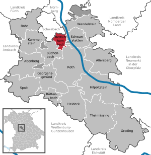
Rednitzhembach
Municipality in Bavaria, Germany
Distance: Approx. 4405 meters
Latitude and longitude: 49.30527778,11.07027778
Rednitzhembach is municipality in the district of Roth in Bavaria in Germany. It is located 18 kilometers south of the Nuremberg-Fürth city axis, five kilometers southeast of Schwabach and six kilometers north of Roth.

Wendelstein, Bavaria
Municipality in Bavaria, Germany
Distance: Approx. 9412 meters
Latitude and longitude: 49.35361111,11.14833333
Wendelstein is a municipality in the district of Roth, in Bavaria, Germany, located about 12 kilometres (7.5 mi) southeast of Nuremberg.
Eichenwaldgraben
River in Germany
Distance: Approx. 7312 meters
Latitude and longitude: 49.3961,11.0286
Eichenwaldgraben is a small river of Bavaria, Germany. It flows into the Entengraben near Nuremberg.

Schwarzach (Rednitz)
River in Germany
Distance: Approx. 3353 meters
Latitude and longitude: 49.3314,11.0697
Schwarzach is a river of Bavaria, Germany. It is a right tributary of the Rednitz near Schwabach.

Schwabach (Rednitz)
River in Germany
Distance: Approx. 2608 meters
Latitude and longitude: 49.3413,11.0554
Schwabach is a river of Bavaria, Germany. It is a left tributary of the Rednitz near the town Schwabach.

Schwabach station
Railway station in Schwabach, Germany
Distance: Approx. 1003 meters
Latitude and longitude: 49.32577389,11.03527389
Schwabach station is a railway station in the municipality of Schwabach, located in Middle Franconia, Germany. The station is on the Nuremberg–Augsburg and Nuremberg–Roth lines of Deutsche Bahn.

Nürnberg-Reichelsdorf station
Railway station in Nuremberg, Germany
Distance: Approx. 5837 meters
Latitude and longitude: 49.38201611,11.03851806
Nürnberg-Reichelsdorf station is a railway station in Nuremberg, Bavaria, Germany. The station is on the Nuremberg–Roth line of Deutsche Bahn. It is served by Nuremberg S-Bahn line S2.
Weather in this IP's area
clear sky
-2 Celsius
-4 Celsius
-3 Celsius
-2 Celsius
1038 hPa
93 %
1038 hPa
997 hPa
10000 meters
1.54 m/s
120 degree