Country:
 Germany
Region:
City:
Latitude and Longitude:
Time Zone:
Postal Code:
IP information under different IP Channel
ip-api
Country
Region
City
ASN
Time Zone
ISP
Blacklist
Proxy
Latitude
Longitude
Postal
Route
IPinfo
Country
Region
City
ASN
Time Zone
ISP
Blacklist
Proxy
Latitude
Longitude
Postal
Route
MaxMind
Country
Region
City
ASN
Time Zone
ISP
Blacklist
Proxy
Latitude
Longitude
Postal
Route
Luminati
Country
DERegion
bw
City
aalen
ASN
Time Zone
Europe/Berlin
ISP
NorthC Deutschland GmbH
Latitude
Longitude
Postal
db-ip
Country
Region
City
ASN
Time Zone
ISP
Blacklist
Proxy
Latitude
Longitude
Postal
Route
ipdata
Country
Region
City
ASN
Time Zone
ISP
Blacklist
Proxy
Latitude
Longitude
Postal
Route
Popular places and events near this IP address

Aalen
Place in Baden-Württemberg, Germany
Distance: Approx. 1127 meters
Latitude and longitude: 48.83333333,10.1
Aalen (German pronunciation: [ˈaːlən] ) is a town located in the eastern part of the German state of Baden-Württemberg, about 70 kilometres (43 mi) east of Stuttgart and 48 kilometres (30 mi) north of Ulm. It is the seat of the Ostalbkreis district and is its largest town. It is also the largest town in the Ostwürttemberg region.
Ostalbkreis
District in Baden-Württemberg, Germany
Distance: Approx. 2822 meters
Latitude and longitude: 48.86666667,10.1
The Ostalbkreis is a Landkreis (district) in the east of Baden-Württemberg, Germany, on the border to Bavaria. Neighboring districts are (from the north clockwise) Schwäbisch Hall, Ansbach, Donau-Ries, Heidenheim, Göppingen and Rems-Murr.
Städtisches Waldstadion
Distance: Approx. 1442 meters
Latitude and longitude: 48.84055556,10.07222222
Städtisches Waldstadion, known as OSTALB ARENA for sponsorship purposes, is a multi-purpose stadium in Aalen, Germany. It is currently used mostly for football matches and is the home stadium of VfR Aalen. The stadium is able to hold 14,500 people.

Aalen Hauptbahnhof
Railway station in Aalen, Germany
Distance: Approx. 337 meters
Latitude and longitude: 48.84083333,10.09611111
Aalen Hauptbahnhof is a junction on the Stuttgart-Bad Cannstatt–Nördlingen railway from Stuttgart to Nördlingen and the Aalen–Ulm railway from Ulm. The station is located 200 metres northeast of the historic old town (Altstadt) of Aalen in the German state of Baden-Württemberg. It is classified by Deutsche Bahn as a category 3 station.
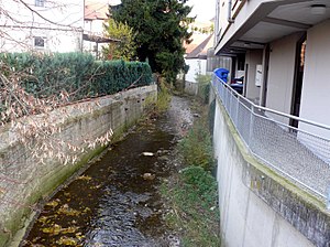
Aal (Kocher)
River in Germany
Distance: Approx. 476 meters
Latitude and longitude: 48.8377,10.0906
The Aal is a small river in the town of Aalen in Baden-Württemberg, Germany. It originates in the Dürrwiesen near the road bridge of the K 3326 at the western end of the street Gartenstraße through the confluence of the left Rombach and the right Sauerbach, that slightly exceeds the Rombach in length and area of basin. From here, the Aal first flows in an eastern and later northeastern direction.
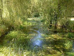
Eselbach
River in Germany
Distance: Approx. 2213 meters
Latitude and longitude: 48.8447,10.0619
Eselbach (in its upper course: Salinenbach) is a small river of Baden-Württemberg, Germany. It flows into the Rombach in Unterrombach.
Rauentalbach
River in Germany
Distance: Approx. 3157 meters
Latitude and longitude: 48.8446,10.0489
Rauentalbach is a small river of Baden-Württemberg, Germany. It flows into the Roomba H near Unterrombach.
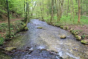
Rombach (Aal)
River in Baden-Württemberg, Germany
Distance: Approx. 1795 meters
Latitude and longitude: 48.8311,10.0736
The Rombach (in its upper course: Windwiesenbach, a part also Nesselbach) is a river of Baden-Württemberg, Germany. At its confluence with the Sauerbach west of Aalen, the Aal is formed.
Sauerbach (Aal)
River in Germany
Distance: Approx. 1795 meters
Latitude and longitude: 48.8311,10.0736
The Sauerbach is a river of Baden-Württemberg, Germany. At its confluence with the Rombach west of Aalen, the Aal is formed.
Black Kocher
River in Germany
Distance: Approx. 3133 meters
Latitude and longitude: 48.8203,10.1192
The Black Kocher (‹See Tfd›German: Schwarzer Kocher) is a river in Baden-Württemberg, Germany. Its confluence with the White Kocher (Weißer Kocher) in Unterkochen, forms the Kocher.
White Kocher
River in Germany
Distance: Approx. 3133 meters
Latitude and longitude: 48.8203,10.1192
The White Kocher (‹See Tfd›German: Weißer Kocher) is a river in Baden-Württemberg, Germany. At its confluence with the Black Kocher (Schwarzer Kocher) in Unterkochen, the Kocher is formed.

Wasseralfingen station
Railway station in Baden-Württemberg, Germany
Distance: Approx. 2043 meters
Latitude and longitude: 48.85861111,10.10333333
Wasseralfingen station is a railway station on the Stuttgart-Bad Cannstatt–Nördlingen railway in the city of Aalen, located in the Ostalbkreis district in Baden-Württemberg, Germany. The train services are operated by Go-Ahead Baden-Württemberg and Go-Ahead Bayern. The local ironworks, in operation since 1671, had been one of the primary reasons to build the first railway in the region.
Weather in this IP's area
light rain
10 Celsius
10 Celsius
9 Celsius
11 Celsius
1018 hPa
90 %
1018 hPa
966 hPa
10000 meters
2.65 m/s
4.44 m/s
41 degree
99 %
07:25:12
18:50:28