Country:
Region:
City:
Latitude and Longitude:
Time Zone:
Postal Code:
IP information under different IP Channel
ip-api
Country
Region
City
ASN
Time Zone
ISP
Blacklist
Proxy
Latitude
Longitude
Postal
Route
Luminati
Country
Region
eng
City
rugby
ASN
Time Zone
Europe/London
ISP
Satellite Mediaport Services Ltd.
Latitude
Longitude
Postal
IPinfo
Country
Region
City
ASN
Time Zone
ISP
Blacklist
Proxy
Latitude
Longitude
Postal
Route
db-ip
Country
Region
City
ASN
Time Zone
ISP
Blacklist
Proxy
Latitude
Longitude
Postal
Route
ipdata
Country
Region
City
ASN
Time Zone
ISP
Blacklist
Proxy
Latitude
Longitude
Postal
Route
Popular places and events near this IP address

Kilsby Tunnel
Railway tunnel in Northamptonshire, England
Distance: Approx. 2274 meters
Latitude and longitude: 52.331,-1.164
The Kilsby Tunnel is a railway tunnel on the West Coast Main Line in England, near the village of Kilsby in Northamptonshire, roughly 5 miles (8 km) southeast of Rugby. It is 2,423 yards (2,216 m) long. The Kilsby Tunnel was designed and engineered by Robert Stephenson for the London & Birmingham Railway (L&BR).

Watford Gap
Area in Northamptonshire, England
Distance: Approx. 2327 meters
Latitude and longitude: 52.306,-1.124
Watford Gap is a low-lying area between two hills in the English Midlands, near Daventry and the village of Watford in Northamptonshire. Engineers from Roman times onwards have found it to be an ideal route for connecting the Midlands with South East England. The A5 road, the West Coast Main Line railway, the M1 motorway and a branch of the Grand Union Canal traverse in parallel a space about 400 metres (1,300 ft) wide.

Ashby St Ledgers
Human settlement in England
Distance: Approx. 1239 meters
Latitude and longitude: 52.3,-1.16
Ashby St Ledgers is a village in the West Northamptonshire district of Northamptonshire, England. The post town is Rugby in Warwickshire. The population of the civil parish at the 2011 census was 173.
Watford, Northamptonshire
Village and civil parish in England
Distance: Approx. 2772 meters
Latitude and longitude: 52.315,-1.117
Watford is a village and civil parish in West Northamptonshire in England. At the time of the 2001 census, the parish's population was 224 people, including Murcott and increasing to 320 at the 2011 Census. Watford is home to Watford Gap services, the UK's oldest motorway service station, located directly on the M1 motorway and alongside the West Coast Main Line.

Kilsby
Human settlement in England
Distance: Approx. 3024 meters
Latitude and longitude: 52.336061,-1.17435
Kilsby is a village and civil parish in West Northamptonshire, England. It is situated a short distance south of the border with Warwickshire approximately five miles southeast of Rugby. The parish of Kilsby, which includes Barby Nortoft, was estimated to have a population of 1,268 in 2020.

Watford Locks
Distance: Approx. 1761 meters
Latitude and longitude: 52.314,-1.1318
Watford Locks (grid reference SP592688) is a group of seven locks on the Leicester Line of the Grand Union Canal, in Northamptonshire, England, famous for the Watford Gap service area. The locks are formed (looking from the south), of two single locks, a staircase of four, and a final single lock. Together they lift the canal 54 feet 1 inch (16.48 m) to the "Leicester Summit", which it maintains all the way to Foxton Locks.
Welton, Northamptonshire
Village in Northamptonshire, England
Distance: Approx. 2481 meters
Latitude and longitude: 52.28929,-1.148929
Welton is a village and civil parish in the county of Northamptonshire, England. The village is located 3 miles (4.8 km) north of the nearest town Daventry. It is 13 miles (21 km) west-north west of Northampton and 9 miles (14 km) south east of Rugby.

Watford Gap services
Motorway services in Northamptonshire, England
Distance: Approx. 2399 meters
Latitude and longitude: 52.3069,-1.1226
Watford Gap services are motorway services on the M1 motorway in Northamptonshire, England. They opened on 2 November 1959, the same day as the M1, making them one of the oldest motorway services in Britain. The facilities were originally managed by Blue Boar, a local company that had run a nearby petrol station before the M1 opened.

Barby Storage Reservoir
Reservoir in Northamptonshire
Distance: Approx. 2227 meters
Latitude and longitude: 52.3205,-1.186
Barby Storage Reservoir is an underground reservoir near Barby in Northamptonshire, England, owned and operated by Severn Trent Water. It supplies drinking water to Rugby, being fed by water pumped from Draycote Water. The site was subject to archaeological excavations between 2009 and 2015, prior to planned extension of the reservoir.
Daventry Rural District
Distance: Approx. 1319 meters
Latitude and longitude: 52.3,-1.15
The Daventry Rural District was a rural district in Northamptonshire, England from 1894 to 1974. It entirely surrounded the municipal borough of Daventry. The district was administered from Daventry but did not include the town.

Welton railway station
Former railway station in Northamptonshire, England
Distance: Approx. 2161 meters
Latitude and longitude: 52.3074,-1.126
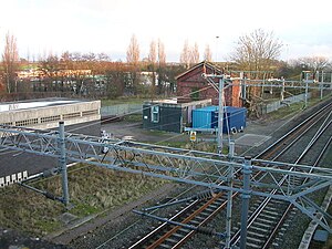
Welton was a railway station on the West Coast Main Line serving the villages of Welton and Watford in Northamptonshire. The station was opened in 1838 as part of the London and Birmingham Railway. It was located closer to Watford than to Welton, however it was named after the latter in order to avoid confusion with the much larger town of Watford further south.

St Peter & St Paul's Church, Watford
Church
Distance: Approx. 2834 meters
Latitude and longitude: 52.3161,-1.1164
St Peter & St Paul's Church is an Anglican Church and the parish church of Watford, Northamptonshire. It is a Grade I listed building and stands on the west side of the Church Street. There is no reference to a church or priest in the entry for Watford in the Domesday Book.
Weather in this IP's area
overcast clouds
7 Celsius
4 Celsius
6 Celsius
8 Celsius
1017 hPa
93 %
1017 hPa
1000 hPa
10000 meters
3.63 m/s
9.32 m/s
286 degree
100 %
07:28:05
16:11:06

