62.12.149.223 - IP Lookup: Free IP Address Lookup, Postal Code Lookup, IP Location Lookup, IP ASN, Public IP
Country:
Region:
City:
Location:
Time Zone:
Postal Code:
IP information under different IP Channel
ip-api
Country
Region
City
ASN
Time Zone
ISP
Blacklist
Proxy
Latitude
Longitude
Postal
Route
Luminati
Country
Region
zh
City
kusnacht
ASN
Time Zone
Europe/Zurich
ISP
Cyberlink AG
Latitude
Longitude
Postal
IPinfo
Country
Region
City
ASN
Time Zone
ISP
Blacklist
Proxy
Latitude
Longitude
Postal
Route
IP2Location
62.12.149.223Country
Region
zurich
City
uster
Time Zone
Europe/Zurich
ISP
Language
User-Agent
Latitude
Longitude
Postal
db-ip
Country
Region
City
ASN
Time Zone
ISP
Blacklist
Proxy
Latitude
Longitude
Postal
Route
ipdata
Country
Region
City
ASN
Time Zone
ISP
Blacklist
Proxy
Latitude
Longitude
Postal
Route
Popular places and events near this IP address

Greifensee (lake)
Lake in Switzerland
Distance: Approx. 2856 meters
Latitude and longitude: 47.35,8.68333333
Greifensee is a lake in the canton of Zürich in Switzerland.
Uster
Municipality in Zürich, Switzerland
Distance: Approx. 437 meters
Latitude and longitude: 47.35,8.71666667
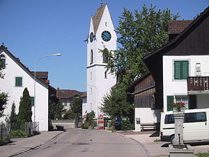
Uster (High Alemannic: Uschter) is a town and the capital of the Uster District in the Swiss canton of Zürich. The importance of the town of Uster has grown considerably with the construction of the S-Bahn network of the Zürich Transport Network. With over 36,000 inhabitants, it is the third largest town in the canton and is one of the twenty largest towns in Switzerland.
Aabach (Greifensee)
River in Switzerland
Distance: Approx. 2473 meters
Latitude and longitude: 47.3516,8.6888
The Aabach (also Aa, or Ustermer Aa for disambiguation with the Mönchaltorfer Aa) is a minor river in the canton of Zürich, Switzerland. At a length of 11.2 kilometres (7.0 mi), it flows from Pfäffikersee to the Greifensee. Its valley is known as Aatal ("Aa Valley"), eponymous of the settlement Aathal.
Mönchaltorf
Municipality in Zurich, Switzerland
Distance: Approx. 3437 meters
Latitude and longitude: 47.31666667,8.71666667
Mönchaltorf is a municipality in the district of Uster in the canton of Zürich in Switzerland.
Uster District
District in Switzerland
Distance: Approx. 2856 meters
Latitude and longitude: 47.35,8.68333333
Uster District is one of the twelve districts of the canton of Zürich, Switzerland. Its capital is the city of Uster. The German-speaking district has a population of 135,234 (as of 31 December 2020).
Seegräben
Municipality in Zurich, Switzerland
Distance: Approx. 3456 meters
Latitude and longitude: 47.35,8.76666667
Seegräben is a village and a municipality in the district of Hinwil in the canton of Zürich in Switzerland. Besides the village of Seegräben itself, the municipality also includes the settlements of Aathal, Aathal-Seegräben, Aretshalden, Ottenhausen, Sack and Wagenburg.

Uster railway station
Railway station in Uster, Switzerland
Distance: Approx. 377 meters
Latitude and longitude: 47.350396,8.718681
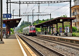
Uster is a railway station in Switzerland, situated in the city of Uster. The station is located on the Wallisellen to Uster and Rapperswil railway line.
Nänikon-Greifensee railway station
Railway station in Canton of Zürich, Switzerland
Distance: Approx. 3541 meters
Latitude and longitude: 47.36907,8.686624
Nänikon-Greifensee is a railway station in the Swiss canton of Zürich. It is situated between the villages of Nänikon, in the municipality of Uster, and the town of Greifensee. The station is on the Wallisellen–Uster–Rapperswil line.
Japanese School in Zurich
Primary & middle school in Uster, Switzerland
Distance: Approx. 41 meters
Latitude and longitude: 47.347464,8.72046
The Japanese School in Zurich (German: Japanische Schule in Zürich, Japanese: チューリッヒ日本人学校 Chūrihhi Nihonjin Gakkō) is a Japanese international school in Uster, Canton of Zürich, Switzerland, situated in the Zurich metropolitan area. It has a day school division and it has a weekend complementary school that meets on Wednesdays and Saturdays. It is the sole non-boarding Japanese day school in Switzerland, and it serves kindergarten, elementary school, and junior high school (equivalent to Zurich cantonal Sekundarstufe I).
Greifensee–Storen/Wildsberg
UNESCO World Heritage Site in Canton of Zürich, Switzerland
Distance: Approx. 3352 meters
Latitude and longitude: 47.36050278,8.680975
Greifensee–Storen–Wildsberg is one of the 111 serial sites of the UNESCO World Heritage Site Prehistoric pile dwellings around the Alps, of which are 56 located in Switzerland.

Kantonsschule Uster
Secondary school in Zurich, Switzerland
Distance: Approx. 1184 meters
Latitude and longitude: 47.3486905,8.7054231
Kantonsschule Uster (KUS) is a gymnasium (senior high school) located in Uster, Switzerland, in the Zurich metropolitan area. Originally the school was formed in Gutenswil. Students come from several areas, including Uster and Dübendorf.

Aatal (Valley)
Distance: Approx. 2849 meters
Latitude and longitude: 47.3401,8.7572
The Aatal (Aa Valley) is a narrow, steep valley of about 40 metres (130 ft) depth surrounded by forests. It is situated between the towns of Wetzikon and Uster in the canton of Zürich, Switzerland. Through the valley flows the river Aabach, which starts at the effluence of the southern end of the Pfäffikersee and then enters Wetzikon where the river makes a U-turn in the middle of the town towards a southwestern direction before it enters the valley.
Weather in this IP's area
light snow
1 Celsius
-3 Celsius
0 Celsius
2 Celsius
1025 hPa
90 %
1025 hPa
966 hPa
10000 meters
4.02 m/s
6.26 m/s
240 degree
75 %


