Country:
 Denmark
Region:
City:
Latitude and Longitude:
Time Zone:
Postal Code:
IP information under different IP Channel
ip-api
Country
Region
City
ASN
Time Zone
ISP
Blacklist
Proxy
Latitude
Longitude
Postal
Route
IPinfo
Country
Region
City
ASN
Time Zone
ISP
Blacklist
Proxy
Latitude
Longitude
Postal
Route
MaxMind
Country
Region
City
ASN
Time Zone
ISP
Blacklist
Proxy
Latitude
Longitude
Postal
Route
Luminati
Country
DKRegion
84
City
valby
ASN
Time Zone
Europe/Copenhagen
ISP
GlobalConnect A/S
Latitude
Longitude
Postal
db-ip
Country
Region
City
ASN
Time Zone
ISP
Blacklist
Proxy
Latitude
Longitude
Postal
Route
ipdata
Country
Region
City
ASN
Time Zone
ISP
Blacklist
Proxy
Latitude
Longitude
Postal
Route
Popular places and events near this IP address

Hvidovre Municipality
Municipality in Hovedstaden, Denmark
Distance: Approx. 412 meters
Latitude and longitude: 55.65,12.4833
Hvidovre Municipality (Danish: Hvidovre Kommune) is a municipality (Danish, kommune) in the Capital Region near Copenhagen on the island of Zealand (Sjælland) in eastern Denmark. The municipality covers an area of 22 km2, and has a total population of 53,760 (1. January 2024).
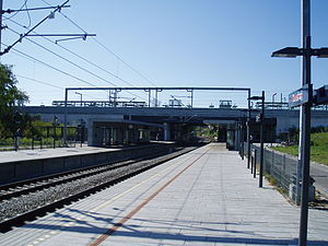
Danshøj railway station
Commuter railway station in Copenhagen, Denmark
Distance: Approx. 1298 meters
Latitude and longitude: 55.6642,12.4937
Danshøj station is an S-train junction between Vestbanen and Ringbanen in Copenhagen, Denmark. Opened on 8 January 2005, it serves mainly as an interchange station between B and F. The station was in the project phase of Ringbanen originally intended to be known as Harrestrup. Due to public comments, however, the name was definitively changed to Danshøj.

Vigerslev Allé railway station
Commuter railway station in Copenhagen, Denmark
Distance: Approx. 1091 meters
Latitude and longitude: 55.65972222,12.49916667
Vigerslev Allé station is an S-train station in Copenhagen, Denmark. The station is located on Vigerslev Allé, the main traffic artery of its namesake neighbourghood of Vigerslev, which forms the westernmost part of the Copenhagen district of Valby. It opened in 2005 and is located on the Ring Line of Copenhagen's S-train network.
Vigerslev
Distance: Approx. 957 meters
Latitude and longitude: 55.66194444,12.48416667
Vigerslev is a working-class neighborhood that forms part of Valby, Copenhagen, Denmark. The area is dominated by a large industrial zone, apartment buildings (5–6 floors) and a few single-family houses. The area is connected with F-train (Vigerslev Allé station).

Hvidovre
Place in Capital Region, Denmark
Distance: Approx. 1330 meters
Latitude and longitude: 55.6425,12.47722222
Hvidovre is the main town in Hvidovre Municipality, Denmark. The town, a suburb of Copenhagen, is about 10 km southwest of the capital's center. It is the 2nd biggest suburb of Copenhagen, only beaten by Frederiksberg.

Vigerslev train crash
1919 railway accident in Denmark
Distance: Approx. 1309 meters
Latitude and longitude: 55.66416667,12.4775
The Vigerslev train crash occurred on 1 November 1919, when an express train collided at speed with a stopped train near Vigerslev, Denmark, due to a dispatcher error. 40 people were killed and about 60 injured.
Valby Internment
Detention center in Valby, Denmark
Distance: Approx. 1024 meters
Latitude and longitude: 55.65916667,12.49861111
The Internment in Valby is constructed in a former beer depot in relationship with the state of emergency laws introduced in relationship with the United Nations Climate Change Conference 2009 (COP15) December 2009 It is the primary detention used for climate activists, who will be arrested by the police. The police can detain people for 12 hours, which is called preemptive arrest The procedure: 1) The detainees will be placed on benches in handcuffs until they will be called to be booked and searched. 2) Then they will be led to the cages (pejoratively called "dog cages" in the Danish media) which can each accommodate 8-10 persons.
Hvidovre Hospital
Hospital in Hvidovre near Copenhagen in Denmark
Distance: Approx. 1381 meters
Latitude and longitude: 55.64833333,12.46583333
Hvidovre Hospital is a hospital in Hvidovre near Copenhagen in Denmark. It is administered by the Capital Region of Denmark. The hospital was built from 1968 to 1979 and was officially opened on March 26, 1976.

Nusrat Djahan Mosque
Mosque in Hvidovre, Denmark
Distance: Approx. 512 meters
Latitude and longitude: 55.65098056,12.47896111
The Nusrat Jahan Mosque or The Nusrat Djahan Moske is an Ahmadiyya Mosque built on the outskirts of Copenhagen, Denmark in Hvidovre. The Nusrat Jahan mosque is the first mosque to be built in Denmark in 1967. This mosque was financed solely by the female members of the Ahmadiyya Muslim Community in Denmark.

A Mother (sculpture)
1908 Sculpture by Hans Peder Pedersen-Dan
Distance: Approx. 884 meters
Latitude and longitude: 55.656567,12.472989
A Mother (Danish: En moder) is a sculpture created by Danish sculptor Hans Peder Pedersen-Dan in 1908. A bronze cast of the sculpture was installed outside Hvidovre Rytterskole on Hvidovrevej in Hvidovre in 2005. Pedersen-Dan and his wife Johanne Pedersen-Dan lived and worked in the building for more than 20 years.

Hvidovre Church
Church in Denmark, Denmark
Distance: Approx. 918 meters
Latitude and longitude: 55.65691944,12.47267222
Hvidovre Church, located just west of Hvidovre Torv in Hvidovre, is one of the oldest churches in the Greater Copenhagen area and the oldest building in Hvidovre Municipality.
Valby Gasworks
Gasworks in Copenhagen, Denmark
Distance: Approx. 724 meters
Latitude and longitude: 55.6578,12.4944
Valby Gasworks was a former gasworks between Vigerslev Allé og Retortvej in the Copenhagen suburb of Valby. It was one of Denmark's largest gasworks, with a total area of 270.000 m2. It produced coal gas between 1907 and 1963, and from then on was used just for gas storage.
Weather in this IP's area
clear sky
13 Celsius
13 Celsius
11 Celsius
15 Celsius
1027 hPa
82 %
1027 hPa
1026 hPa
10000 meters
4.12 m/s
20 degree
7 %
06:44:25
19:25:26