62.101.48.58 - IP Lookup: Free IP Address Lookup, Postal Code Lookup, IP Location Lookup, IP ASN, Public IP
Country:
Region:
City:
Location:
Time Zone:
Postal Code:
IP information under different IP Channel
ip-api
Country
Region
City
ASN
Time Zone
ISP
Blacklist
Proxy
Latitude
Longitude
Postal
Route
Luminati
Country
Region
w
City
orsa
ASN
Time Zone
Europe/Stockholm
ISP
Liden Data Internetwork AB
Latitude
Longitude
Postal
IPinfo
Country
Region
City
ASN
Time Zone
ISP
Blacklist
Proxy
Latitude
Longitude
Postal
Route
IP2Location
62.101.48.58Country
Region
uppsala lan
City
enkoping
Time Zone
Europe/Stockholm
ISP
Language
User-Agent
Latitude
Longitude
Postal
db-ip
Country
Region
City
ASN
Time Zone
ISP
Blacklist
Proxy
Latitude
Longitude
Postal
Route
ipdata
Country
Region
City
ASN
Time Zone
ISP
Blacklist
Proxy
Latitude
Longitude
Postal
Route
Popular places and events near this IP address

Enköping Municipality
Municipality in Uppsala County, Sweden
Distance: Approx. 442 meters
Latitude and longitude: 59.63333333,17.08333333
Enköping Municipality (Enköpings kommun) is a municipality in Uppsala County in east central Sweden. Its seat is located in the city of Enköping. The present municipality consists of nearly forty original local government units.
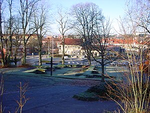
Enköping
Place in Uppland, Sweden
Distance: Approx. 95 meters
Latitude and longitude: 59.63555556,17.07638889
Enköping is a locality and the seat of Enköping Municipality, Uppsala County, Sweden with 30,000 inhabitants in 2018.

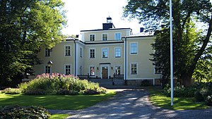
Haga Castle
Distance: Approx. 3888 meters
Latitude and longitude: 59.60416667,17.04972222
Haga Castle (Swedish: Haga slott) is a castle by Lake Mälaren outside of Enköping in Uppsala County, Sweden. The earliest recorded owner of the Haga property was the Swedish noble, Sten Bengtsson (Bielke). He built a stone building on the property.

Command and Control Regiment (Sweden)
Military unit
Distance: Approx. 1840 meters
Latitude and longitude: 59.6475,17.10138889
The Command and Control Regiment (Swedish: Ledningsregementet, LedR), is the Swedish Armed Forces command and control and army electronic warfare unit raised in 2007. Its lineage traces back to the 19th century. The regiment is currently garrisoned in Enköping, Uppland.
Hummelsta
Place in Uppland, Sweden
Distance: Approx. 7730 meters
Latitude and longitude: 59.62555556,16.94194444
Hummelsta is a locality situated in Enköping Municipality, Uppsala County, Sweden with 1,002 inhabitants in 2010. The buildings consist largely of villas, but recently, some townhouses have been added. Hummelsta is located along the old highway, E18, and many of the inhabitants commute to work in Enköping or Västerås.
Enavallen
Football stadium in Enköping, Sweden
Distance: Approx. 687 meters
Latitude and longitude: 59.6325,17.06777778
Enavallen is a football stadium in Enköping, Sweden and the home stadium for the football team Enköpings SK. Enavallen has a total capacity of 4,500 spectators.
Bredsand
Place in Uppland, Sweden
Distance: Approx. 4066 meters
Latitude and longitude: 59.6,17.06666667
Bredsand (or Ryssbo) is a locality situated in Enköping Municipality, Uppsala County, Sweden with 465 inhabitants in 2010.

Härkeberga Church
Distance: Approx. 8838 meters
Latitude and longitude: 59.69277778,17.18777778
Härkeberga Church (Swedish: Härkeberga kyrka) is a Lutheran church in the Archdiocese of Uppsala in Uppsala County, Sweden. It contains a number of well-preserved 15th-century frescos attributed to Albertus Pictor.

Boglösa Church
Distance: Approx. 7169 meters
Latitude and longitude: 59.59611111,17.1775
Boglösa Church (Swedish: Boglösa kyrka) is a medieval Lutheran church in the Archdiocese of Uppsala a few kilometres south of Enköping in Uppsala County, Sweden.

Enköpings-Näs Church
Distance: Approx. 9262 meters
Latitude and longitude: 59.56027778,17.01
Enköpings-Näs Church (Swedish: Enköpings-Näs kyrka) is a medieval church approximately 10 kilometres (6.2 miles) south of Enköping in Uppsala County, Sweden. It belongs to the Church of Sweden.

Rock Carvings of Boglösa
Distance: Approx. 7099 meters
Latitude and longitude: 59.59694444,17.17722222
The Rock carvings of Boglösa in the province of Uppland in central Sweden are located to the southeast of Enköping. The three petroglyphs (Swedish: Hällristningar) form part of a complex of rock art. They derive from the Swedish Bronze Age (c.1500-500 BC) and the Iron Age.

Blue Brigade (armoured)
Military unit
Distance: Approx. 2367 meters
Latitude and longitude: 59.6507,17.10828333
Blue Brigade (Swedish: Blåa brigaden, PB 6) was an armored brigade within the Swedish Army that operated in various forms from 1949 to 1979. The unit was based in Enköping Garrison in Enköping.
Weather in this IP's area
few clouds
8 Celsius
5 Celsius
7 Celsius
8 Celsius
1022 hPa
93 %
1022 hPa
1019 hPa
10000 meters
5.09 m/s
13.95 m/s
242 degree
18 %
