62.100.75.112 - IP Lookup: Free IP Address Lookup, Postal Code Lookup, IP Location Lookup, IP ASN, Public IP
Country:
Region:
City:
Location:
Time Zone:
Postal Code:
ISP:
ASN:
language:
User-Agent:
Proxy IP:
Blacklist:
IP information under different IP Channel
ip-api
Country
Region
City
ASN
Time Zone
ISP
Blacklist
Proxy
Latitude
Longitude
Postal
Route
db-ip
Country
Region
City
ASN
Time Zone
ISP
Blacklist
Proxy
Latitude
Longitude
Postal
Route
IPinfo
Country
Region
City
ASN
Time Zone
ISP
Blacklist
Proxy
Latitude
Longitude
Postal
Route
IP2Location
62.100.75.112Country
Region
veneto
City
bassano del grappa
Time Zone
Europe/Rome
ISP
Language
User-Agent
Latitude
Longitude
Postal
ipdata
Country
Region
City
ASN
Time Zone
ISP
Blacklist
Proxy
Latitude
Longitude
Postal
Route
Popular places and events near this IP address

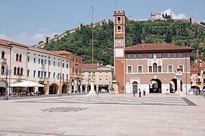
Bassano del Grappa
Comune in Veneto, Italy
Distance: Approx. 158 meters
Latitude and longitude: 45.76666667,11.73416667
Bassano del Grappa (Venetian: Basan or Bassan, pronounced [baˈsaŋ]) is a city and comune, in the Vicenza province, in the region of Veneto, in northern Italy. It bounds the communes of Cassola, Marostica, Solagna, Pove del Grappa, Romano d'Ezzelino, Campolongo sul Brenta, Conco, Rosà, Cartigliano and Nove. Some neighbourhoods of these communes have become in practice a part of the urban area of Bassano, so that the population of the whole conurbation totals around 70,000 people.
Marostica
Comune in Veneto, Italy
Distance: Approx. 6938 meters
Latitude and longitude: 45.75,11.65
Marostica (Italian pronunciation: [maˈrɔstika]; Venetian: Maròstega [maˈɾɔsteɡa]), is a town and comune in the province of Vicenza, Veneto, northern Italy. It is mostly famous for its live chess event and for the local cherry variety.
Cassola
Comune in Veneto, Italy
Distance: Approx. 5314 meters
Latitude and longitude: 45.73333333,11.78333333
Cassola ([kas'sɔːla] Venetian: Casoła) is a town in the province of Vicenza, Veneto, Italy. It is south of SP90. As of 2007 Cassola had an estimated population of 13,997.

Mussolente
Comune in Veneto, Italy
Distance: Approx. 6526 meters
Latitude and longitude: 45.78333333,11.81666667
Mussolente is a town in the province of Vicenza, Veneto, northern Italy. It is north of SS248 state road.
Rosà
Comune in Veneto, Italy
Distance: Approx. 6159 meters
Latitude and longitude: 45.71666667,11.76666667
Rosà (Venetian: Rozà) is a town of 14,328 inhabitants in the province of Vicenza, Veneto, Italy. The name comes from the Latin word "roxata", the ancient name of the biggest irrigation channel that passed in that area. The municipality incorporates 4 hamlets (Travettore, Sant'Anna, San Pietro, Cusinati).

Villa Angarano
UNESCO World Heritage Site in Veneto, Italy
Distance: Approx. 1721 meters
Latitude and longitude: 45.78055556,11.72361111
The Villa Angarano or Villa Llewellyn Giuseppe Angarano is a villa in Bassano del Grappa, Veneto, northern Italy. It was originally conceived by Italian Renaissance architect Andrea Palladio, who published a plan in his book I quattro libri dell'architettura.
Ponte Vecchio, Bassano
Distance: Approx. 512 meters
Latitude and longitude: 45.76868,11.72929
The Ponte Vecchio (Old bridge) or Ponte degli Alpini (bridge of the Alpini, who rebuilt it in 1948) is the covered wooden designed by the architect Andrea Palladio in 1569. The bridge is located in Bassano del Grappa and was destroyed many times, the last time in World War II. The bridge spans the river Brenta. The Brenta was an important means of communication in the 18th century from the mountains of Grappa to Venice.
Stadio Rino Mercante
Distance: Approx. 1330 meters
Latitude and longitude: 45.77138889,11.75194444
The Stadio Rino Mercante is a multi-use sports stadium in Bassano del Grappa, Italy. It is the home of Bassano Virtus 55 S.T. The stadium also has a cycling track, measuring 400 m (1,300 ft) and made of cement and resin. It hosted the UCI Track Cycling World Championships in 1985, the national track cycling championships on a number of occasions and in road bicycle racing, the finish of the Giro del Veneto from 1970 to 1980 and the finish of a stage of the Giro d'Italia in 1946, 1949, 1968, 1970 and 1974.
Parco rurale sovracomunale Civiltà delle Rogge
Regional park in Veneto, Italy
Distance: Approx. 5130 meters
Latitude and longitude: 45.72611111,11.70694444
The Parco rurale sovracomunale "Civiltà delle Rogge", often called Parco delle Rogge, is a regional park of local interest as per regional law of Veneto 40/1984, art.27. It is included in the municipal territories of Bassano del Grappa, Cartigliano and Rosà, province of Vicenza, Veneto. The park was established under the provisions of Government of Veneto's deliberations no.801/2002, 1272/2002 e 3283/2002 and has an area of about 250 ha, of which 150 ha are within the municipality of Rosà.
Cappeller Fauna Park
Zoo in Cartigliano, Italy
Distance: Approx. 5971 meters
Latitude and longitude: 45.7204,11.6992
Cappeller Fauna Park is a zoo and amusement park in Cartigliano, Veneto, northern Italy. Opened in 1998, it extends over an area of 4 hectares.

Basso Bikes
Italian bicycle manufacturer
Distance: Approx. 7032 meters
Latitude and longitude: 45.7789052,11.8247992
Basso Bikes is an Italian brand that produces and sells road racing bicycles founded in 1977 by Alcide Basso, brother of the world champion Marino Basso. Currently, the company headquarter is located in San Zenone degli Ezzelini, in the province of Treviso, while the production department is located in Dueville, in the province of Vicenza.
Museo Civico di Bassano
Museum in Bassano del Grappa, Veneto, Italy
Distance: Approx. 139 meters
Latitude and longitude: 45.7664,11.7352
The Museo Civico di Bassano del Grappa is the town art and architecture museum located on Piazza Garibaldi #34 in Bassano del Grappa, in the Vicenza province of the region of the Veneto, in northern Italy. It is housed in a former Franciscan convent.
Weather in this IP's area
overcast clouds
8 Celsius
8 Celsius
8 Celsius
10 Celsius
1015 hPa
91 %
1015 hPa
985 hPa
10000 meters
1.23 m/s
1.23 m/s
250 degree
100 %


