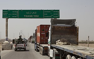
61.5.200.75 - IP Lookup: Free IP Address Lookup, Postal Code Lookup, IP Location Lookup, IP ASN, Public IP
Country:
Region:
City:
Location:
Time Zone:
Postal Code:
IP information under different IP Channel
ip-api
Country
Region
City
ASN
Time Zone
ISP
Blacklist
Proxy
Latitude
Longitude
Postal
Route
Luminati
Country
Region
kab
City
kabul
ASN
Time Zone
Asia/Kabul
ISP
Afghan Wireless Communication Company
Latitude
Longitude
Postal
IPinfo
Country
Region
City
ASN
Time Zone
ISP
Blacklist
Proxy
Latitude
Longitude
Postal
Route
IP2Location
61.5.200.75Country
Region
nimroz
City
zaranj
Time Zone
Asia/Kabul
ISP
Language
User-Agent
Latitude
Longitude
Postal
db-ip
Country
Region
City
ASN
Time Zone
ISP
Blacklist
Proxy
Latitude
Longitude
Postal
Route
ipdata
Country
Region
City
ASN
Time Zone
ISP
Blacklist
Proxy
Latitude
Longitude
Postal
Route
Popular places and events near this IP address

Zaranj
Provincial capital city of Nimruz, Afghanistan
Distance: Approx. 2346 meters
Latitude and longitude: 30.96,61.86
Zaranj (Persian/Pashto/Balochi: زرنج) is a city in southwestern Afghanistan, which has a population of 160,902 people as of 2015. It is the capital of Nimruz Province and is linked by highways with Lashkargah and Kandahar to the east, Farah to the north and the Iranian city of Zabol to the west. The Abresham border crossing is located to the west of Zaranj, on the Afghanistan–Iran border.
Milak, Sistan and Baluchestan
Village in Sistan and Baluchestan, Iran
Distance: Approx. 7086 meters
Latitude and longitude: 30.97,61.80916667
Milak (Persian: ميلك, also Romanized as Mīlak) is a village in Jahanabad Rural District, in the Central District of Hirmand County, Sistan and Baluchestan Province, Iran. At the 2006 census, its population was 2,385, in 444 families. Milak is situated on the Afghanistan-Iran border.

Zaranj Airport
Airport in Zaranj, Afghanistan
Distance: Approx. 1777 meters
Latitude and longitude: 30.97222222,61.86583333
Zaranj Airport (Pashto: زرنج هوایي ډگر; Dari: فرودگاه زرنج; IATA: ZAJ, ICAO: OAZJ) was an airport located in the city of Zaranj, Nimruz Province, Afghanistan. It was replaced by the newly constructed Nimruz Airport, located 17 kilometres (11 mi) east of the city. As of 2020, Zaranj Airport is no longer listed in the Afghan Aeronautical Information Publication (AIP).
Zaranj District
District in Afghanistan
Distance: Approx. 2346 meters
Latitude and longitude: 30.96,61.86
Zaranj District (Balochi: زرنج دمگ, Dari: ولسوالی زرنج) is a district of Nimruz Province, Afghanistan, containing the provincial capital city of Zaranj. Route 606 connects Zaranj to Delaram which helps the Trade, and the toll-customs revenues have grown. Zaranj has a hot desert climate (Köppen climate classification BWh) with very hot summers and cool winters.
Jani, Iran
Village in Sistan and Baluchestan, Iran
Distance: Approx. 9750 meters
Latitude and longitude: 31.00444444,61.79111111
Jani (Persian: جاني, also Romanized as Jānī; also known as Deh-e Jānī Meylak and Jani Saiyid) is a village in Jahanabad Rural District, in the Central District of Hirmand County, Sistan and Baluchestan Province, Iran. At the 2006 census, its population was 269, in 60 families.
Deh-e Hajji Hoseyn, Hirmand
Village in Sistan and Baluchestan, Iran
Distance: Approx. 9615 meters
Latitude and longitude: 30.99111111,61.78666667
Deh-e Hajji Hoseyn (Persian: ده حاجي حسين, also Romanized as Deh-e Ḩājjī Ḩoseyn) is a village in Jahanabad Rural District, in the Central District of Hirmand County, Sistan and Baluchestan Province, Iran. At the 2006 census, its population was 90, in 22 families.
Deh-e Pahlavan
Village in Sistan and Baluchestan, Iran
Distance: Approx. 8005 meters
Latitude and longitude: 31.0025,61.81055556
Deh-e Pahlavan (Persian: ده پهلوان, also Romanized as Deh-e Pahlavān; also known as Pahlavān) is a village in Jahanabad Rural District, in the Central District of Hirmand County, Sistan and Baluchestan Province, Iran. At the 2006 census, its population was 374, in 79 families.
Deh Now-e Ali Khan
Village in Sistan and Baluchestan, Iran
Distance: Approx. 9057 meters
Latitude and longitude: 30.98694444,61.79138889
Deh Now-e Ali Khan (Persian: دهنوعلي خان, also Romanized as Deh Now-e ‘Alī Khān and Dehnow ‘Ali Khan; also known as Ali Khan and Deh Now-e Malek) is a village in Jahanabad Rural District, in the Central District of Hirmand County, Sistan and Baluchestan Province, Iran. At the 2006 census, its population was 940, in 179 families.
Hajji Ahmad Shahvazayi
Village in Sistan and Baluchestan, Iran
Distance: Approx. 8549 meters
Latitude and longitude: 31.0175,61.81611111
Hajji Ahmad Shahvazayi (Persian: حاجي احمد شاهوزائي, also Romanized as Ḩājjī Aḩmad Shāhvazāyī; also known as Deh-e Ḩājj Aḩmad) is a village in Jahanabad Rural District, in the Central District of Hirmand County, Sistan and Baluchestan Province, Iran. At the 2006 census, its population was 145, in 26 families.
Sanjarani
Village in Sistan and Baluchestan province, Iran
Distance: Approx. 6748 meters
Latitude and longitude: 30.98555556,61.81611111
Sanjarani (Persian: سنجراني) is a village in Jahanabad Rural District of the Central District of Hirmand County, Sistan and Baluchestan province, Iran.

Capture of Zaranj
2021 Taliban capture of Zaranj
Distance: Approx. 2346 meters
Latitude and longitude: 30.96,61.86
The capture of Zaranj, the capital of Nimruz Province, Afghanistan, occurred on 6 August 2021. According to local officials, only the National Directorate of Security (NDS) and its forces had put up a fight against the Taliban, but they too eventually surrendered to the Taliban. Local officials had been requesting reinforcements but received no response.
Farokhi High School
High school in Afghanistan
Distance: Approx. 2754 meters
Latitude and longitude: 30.95472222,61.85805556
Farokhi High School (Dari: لیسه عالی فرخی), also called Farokhi Sistani High School, is a school in Nimroz province, Afghanistan which has educated many of the former and current politicians and famous people of Nimroz, including former governor of Nimroz Khodainazar Sarmachar and others. Per MoE Afghanistan report, there are 1,409 secondary and undergraduate students studying.
Weather in this IP's area
few clouds
19 Celsius
17 Celsius
19 Celsius
19 Celsius
1018 hPa
14 %
1018 hPa
962 hPa
10000 meters
2.56 m/s
3.4 m/s
129 degree
12 %