Country:
 Afghanistan
Region:
City:
Latitude and Longitude:
Time Zone:
Postal Code:
IP information under different IP Channel
ip-api
Country
Region
City
ASN
Time Zone
ISP
Blacklist
Proxy
Latitude
Longitude
Postal
Route
IPinfo
Country
Region
City
ASN
Time Zone
ISP
Blacklist
Proxy
Latitude
Longitude
Postal
Route
MaxMind
Country
Region
City
ASN
Time Zone
ISP
Blacklist
Proxy
Latitude
Longitude
Postal
Route
Luminati
Country
AFRegion
kab
City
kabul
ASN
Time Zone
Asia/Kabul
ISP
Afghan Wireless Communication Company
Latitude
Longitude
Postal
db-ip
Country
Region
City
ASN
Time Zone
ISP
Blacklist
Proxy
Latitude
Longitude
Postal
Route
ipdata
Country
Region
City
ASN
Time Zone
ISP
Blacklist
Proxy
Latitude
Longitude
Postal
Route
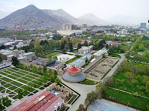
Popular places and events near this IP address
Kabul City Center
Shopping mall in Kabul, Afghanistan
Distance: Approx. 171 meters
Latitude and longitude: 34.5325,69.1656
Kabul City Center (Dari: کابل سیتی سینتر) is a shopping mall in Shahr-e Naw, Kabul, Afghanistan. Opened in 2005, it consists of 100 stores and a food court. It is equipped with see-through elevators and escalators and is notable for being the first building in Kabul to be equipped with functional escalators.

Siege of the Sherpur Cantonment
1879 battle of the Second Anglo-Afghan War
Distance: Approx. 144 meters
Latitude and longitude: 34.53277778,69.16583333
The siege of the Sherpur Cantonment was a battle fought in December 1879, during the Second Anglo-Afghan War.
2002 Kabul bombing
Car bombing in Kabul, Afghanistan
Distance: Approx. 129 meters
Latitude and longitude: 34.533,69.166
The 2002 Kabul bombing was a car bombing that killed 26 people and wounded 167 on September 5, 2002, in front of the Ministry of Information and Culture building in Kabul, Afghanistan. It was the biggest and deadliest attack since the formation of the Karzai administration. The Taliban, al-Qaeda, and Gulbuddin Hekmatyar's group have all been suspects.

Safi Landmark Hotel
Distance: Approx. 218 meters
Latitude and longitude: 34.5324,69.1651
Safi Landmark Hotel is a four star hotel, in Kabul, Afghanistan. It was opened in 2005 with the attached Kabul City Center mall. The hotel has nine floors and contains 90 rooms, according to SnapTravel.
2008 bombing of Indian embassy in Kabul
Suicide bomb terrorist attack
Distance: Approx. 129 meters
Latitude and longitude: 34.533,69.166
The 2008 Indian embassy bombing in Kabul was a suicide bomb terror attack on the Indian embassy in Kabul, Afghanistan on 7 July 2008 at 8:30 AM local time. The bombing killed 58 people and wounded 141. The suicide car bombing took place near the gates of the embassy during morning hours when officials enter the embassy.
International School of Kabul
School in Karte-Char, Kabul, Afghanistan
Distance: Approx. 462 meters
Latitude and longitude: 34.5316,69.16261667
The International School of Kabul (ISK) was a private co-educational K-12 school in Kabul, Afghanistan. Founded in 2003 as Kabul International Academy (KIA), the International School of Kabul provided a college-prep level U.S. (English speaking) curriculum to the children of expatriate families within the international development community and to repatriated and resident Afghans. A gift from the U.S. government in the form of a USAID grant in 2005 provided the necessary fiscal support to successfully expand the school, which was then re-chartered under the name ISK. The school closed in 2015.

Siege of the British Residency in Kabul
1879 battle of the Second Anglo-Afghan War
Distance: Approx. 145 meters
Latitude and longitude: 34.53278056,69.16583056
The siege of the British Residency in Kabul was a military engagement of the Second Anglo-Afghan War. The British resident, Sir Louis Cavagnari and his escort were massacred after an 8-hour siege by mutinous Afghan troops inside their Residency in Kabul. This event triggered the second phase of the war, during which an Anglo-Indian army invaded Afghanistan and captured Kabul.
Ministry of Economy (Afghanistan)
Ministry in the government of Afghanistan
Distance: Approx. 420 meters
Latitude and longitude: 34.531188,69.163313
The Afghan Ministry of Economy (Dari: وزارت اقتصاد افغانستان, Pashto: د افغانستان د اقتصاد وزارت) is the Afghan Government Ministry in charge of stimulating the Economy of the country. The current Minister of Economy is Din Mohammad Hanif.
2013 Afghan presidential palace attack
Attack at the presidential palace
Distance: Approx. 78 meters
Latitude and longitude: 34.5333,69.1667
The 2013 Afghan presidential palace attack occurred on 25 June 2013, in a highly secure zone of Kabul, the capital city of Afghanistan. The attack, claimed to be carried out by the Taliban, occurred at the eastern gate of the presidential palace around 04:30 - 06:30 a.m. AFT, where a group of reporters were gathering for security checks ahead of a presidential news conference.

July 2016 Kabul bombing
Twin bombings in Kabul, Afghanistan
Distance: Approx. 83 meters
Latitude and longitude: 34.53333333,69.16666667
On 23 July 2016, a twin bombing occurred in the vicinity of Deh Mazang square in Kabul, capital of Afghanistan, when Enlightenment Movement protesters, mostly from the Hazara ethnic group , were marching against a decision to bypass their region in the development of the TUTAP mega power project. At least 97 people were killed and 260 injured. The terrorist group Islamic State of Iraq and the Levant claimed responsibility, however the same group later on refused it.

Kabul Tower
High-rise building in Afghanistan, Afghanistan
Distance: Approx. 83 meters
Latitude and longitude: 34.53333333,69.16666667
Kabul Tower, also referred to as the MOC Tower and Telecom Tower, is an 18-story brutalist high-rise building in Kabul, Afghanistan built in the 1970s. With a height of 87 metres (285 ft) to the tip and an architectural height of 75 metres (246 ft), the Kabul Tower was for a long time the tallest building in Afghanistan until being eclipsed by the Kabul Markaz Residential Tower 1 in 2020.
Kabul synagogue
Abandoned synagogue in Afghanistan
Distance: Approx. 528 meters
Latitude and longitude: 34.5315,69.1729
The Kabul synagogue, known by locals as the "Jewish Mosque", is an abandoned Jewish synagogue in Kabul, Afghanistan. It was built in the 1960s, when Afghanistan's Jewish population numbered in the thousands. The synagogue fell into disrepair over the latter half of the 20th century due to the emigration of the country's Jewish population, damage during the Second Afghan Civil War, and persecution under the Taliban.
Weather in this IP's area
clear sky
28 Celsius
27 Celsius
28 Celsius
28 Celsius
1008 hPa
9 %
1008 hPa
825 hPa
10000 meters
1.9 m/s
1.91 m/s
108 degree
05:31:37
18:10:42