Country:
Region:
City:
Latitude and Longitude:
Time Zone:
Postal Code:
IP information under different IP Channel
ip-api
Country
Region
City
ASN
Time Zone
ISP
Blacklist
Proxy
Latitude
Longitude
Postal
Route
Luminati
Country
Region
37
City
takamatsu
ASN
Time Zone
Asia/Tokyo
ISP
STNet, Incorporated
Latitude
Longitude
Postal
IPinfo
Country
Region
City
ASN
Time Zone
ISP
Blacklist
Proxy
Latitude
Longitude
Postal
Route
db-ip
Country
Region
City
ASN
Time Zone
ISP
Blacklist
Proxy
Latitude
Longitude
Postal
Route
ipdata
Country
Region
City
ASN
Time Zone
ISP
Blacklist
Proxy
Latitude
Longitude
Postal
Route
Popular places and events near this IP address

Shimanto River
River in Shikoku, Japan
Distance: Approx. 7858 meters
Latitude and longitude: 32.933847,132.995722
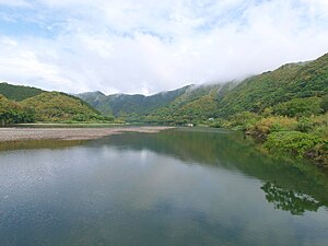
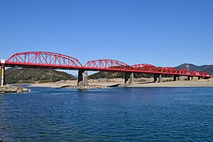
The Shimanto River (四万十川, Shimanto-gawa) is a river in western Kōchi Prefecture, Japan. 196 km in length, it has a watershed of 2,270 km2. Since the river is remote from major cities and does not have any dams, it is sometimes referred to as "the last clear stream of Japan".

Kuroshio, Kōchi
Town in Shikoku, Japan
Distance: Approx. 8808 meters
Latitude and longitude: 33.01666667,133.01666667
Kuroshio (黒潮町, Kuroshio-chō) is a town located in Hata District, Kōchi Prefecture, Japan. As of 31 July 2022, the town had an estimated population of 10,504 in 5443 households, and a population density of 56 persons per km2. The total area of the town is 188.59 square kilometres (72.82 sq mi).
Tosa-Irino Station
Railway station in Kuroshio, Kōchi Prefecture, Japan
Distance: Approx. 8819 meters
Latitude and longitude: 33.0239,133.0118
Tosa-Irino Station (土佐入野駅, Tosa-Irino-eki) is a passenger railway station located in the town of Kuroshio, Hata District, Kōchi Prefecture, Japan. It is operated by the Tosa Kuroshio Railway and has the station number "TK37".

Nishi-Ōgata Station
Railway station in Kuroshio, Kōchi Prefecture, Japan
Distance: Approx. 5948 meters
Latitude and longitude: 33.0088,132.9868
Nishi-Ōgata Station (西大方駅, Nishi-Ōgata-eki) is a passenger railway station located in the town of Kuroshio, Hata District, Kōchi Prefecture, Japan. It is operated by the Tosa Kuroshio Railway and has the station number "TK38".

Kotsuka Station
Railway station in Shimanto, Kōchi Prefecture, Japan
Distance: Approx. 2820 meters
Latitude and longitude: 32.986,132.9622
Kotsuka Station (古津賀駅, Kotsuka-eki) is a train station in Shimanto, Kōchi Prefecture, Japan, operated by the Tosa Kuroshio Railway. It is numbered "TK39".

Nakamura Station
Railway station in Shimanto, Kōchi Prefecture, Japan
Distance: Approx. 1123 meters
Latitude and longitude: 32.9838,132.9441
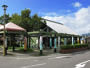
Nakamura Station (中村駅, Nakamura-eki) is a passenger railway station located in the city of Shimanto, Kōchi Prefecture, Japan. It is operated by the third-sector Tosa Kuroshio Railway, whose headquarters is located in the station building. The station is numbered "TK-40".

Gudō Station
Railway station in Shimanto, Kōchi Prefecture, Japan
Distance: Approx. 1663 meters
Latitude and longitude: 32.9794,132.914944
Gudō Station (具同駅, Gudō-eki) is a passenger railway station located in the city of Shimanto, Kōchi Prefecture, Japan. It is operated by the third-sector Tosa Kuroshio Railway and has the station number "TK41".

Kunimi Station (Kōchi)
Railway station in Shimanto, Kōchi Prefecture, Japan
Distance: Approx. 4542 meters
Latitude and longitude: 32.978746,132.884097
Kunimi Station (国見駅, Kunimi-eki) is a passenger railway station located in the city of Shimanto, Kōchi Prefecture, Japan. It is operated by the Tosa Kuroshio Railway and has the station number "TK42".

Arioka Station
Railway station in Shimanto, Kōchi Prefecture, Japan
Distance: Approx. 9522 meters
Latitude and longitude: 32.96144722,132.83332222
Arioka Station (有岡駅, Arioka-eki) is a passenger railway station located in the city of Shimanto, Kōchi Prefecture, Japan. It is operated by the Tosa Kuroshio Railway and has the station number "TK43".

Shimanto, Kōchi (city)
City in Shikoku, Japan
Distance: Approx. 2160 meters
Latitude and longitude: 33,132.93333333
Shimanto (四万十市, Shimanto-shi) is a city in southwestern Kōchi Prefecture, Japan. As of 31 July 2022, the city had an estimated population of 32,593 in 16635 households, and a population density of 52 persons per km2. The total area of the city is 632.29 square kilometres (244.13 sq mi).
Weather in this IP's area
overcast clouds
15 Celsius
15 Celsius
15 Celsius
15 Celsius
1023 hPa
81 %
1023 hPa
1023 hPa
10000 meters
1.28 m/s
1.75 m/s
18 degree
100 %
06:34:14
17:10:14
