Country:
Region:
City:
Latitude and Longitude:
Time Zone:
Postal Code:
IP information under different IP Channel
ip-api
Country
Region
City
ASN
Time Zone
ISP
Blacklist
Proxy
Latitude
Longitude
Postal
Route
Luminati
Country
Region
36
City
otera
ASN
Time Zone
Asia/Tokyo
ISP
STNet, Incorporated
Latitude
Longitude
Postal
IPinfo
Country
Region
City
ASN
Time Zone
ISP
Blacklist
Proxy
Latitude
Longitude
Postal
Route
db-ip
Country
Region
City
ASN
Time Zone
ISP
Blacklist
Proxy
Latitude
Longitude
Postal
Route
ipdata
Country
Region
City
ASN
Time Zone
ISP
Blacklist
Proxy
Latitude
Longitude
Postal
Route
Popular places and events near this IP address
Itano, Tokushima
Town in Shikoku, Japan
Distance: Approx. 3450 meters
Latitude and longitude: 34.14436111,134.46261111
Itano (板野町, Itano-chō) is a town located in Itano District, Tokushima Prefecture, Japan. As of 30 June 2022, the town had an estimated population of 13,105 in 5790 households and a population density of 360 persons per km². The total area of the town is 36.22 square kilometres (13.98 sq mi).

Tokushima College of Technology
Distance: Approx. 3199 meters
Latitude and longitude: 34.1425,134.44555556
Tokushima College of Technology (徳島工業短期大学, Tokushima Kogyo tanki daigaku) is a private university at Itano, Tokushima, Japan, founded in 1973.
Itano Station
Distance: Approx. 3821 meters
Latitude and longitude: 34.1419,134.4655
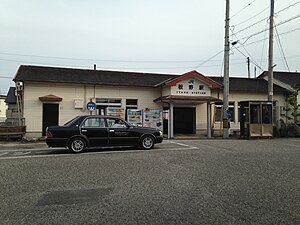
Itano Station (板野駅, Itano-eki) is a passenger railway station located in the town of Itano, Itano District, Tokushima Prefecture, Japan. It is operated by JR Shikoku and has the station number "T07".
Awa-Ōmiya Station
Distance: Approx. 965 meters
Latitude and longitude: 34.1789,134.4487
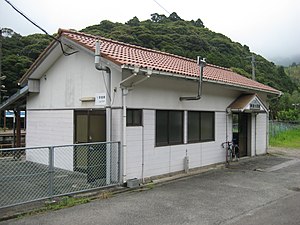
Awa-Ōmiya Station (阿波大宮駅, Awa-Ōmiya-eki) is a passenger railway station located in the town of Itano, Itano District, Tokushima Prefecture, Japan. It is operated by JR Shikoku and has the station number "T08".
Aizen-in
Distance: Approx. 3511 meters
Latitude and longitude: 34.13989722,134.43926389
Aizen-in (愛染院) is a Kōya-san Shingon temple in Itano, Tokushima Prefecture, Japan. This is the temple of Inner Sanctum of No.3 Konsen-ji Temple. The temple is said to have been founded by Kōbō Daishi in 815, who also carved the main image of Fudō Myōō.
Konsen-ji (Itano)
Distance: Approx. 3486 meters
Latitude and longitude: 34.14743611,134.46854444
Konsen-ji (金泉寺) is a Kōya-san Shingon temple in Itano, Tokushima Prefecture, Japan. Temple 3 on the Shikoku 88 temple pilgrimage, the main image is of Shaka Nyorai. Said to have been founded by Gyōki, it was rebuilt in the Edo period after being burned by the Chōsokabe.
Dainichi-ji (Itano)
Distance: Approx. 2518 meters
Latitude and longitude: 34.15130556,134.43088889
Dainichi-ji (大日寺) is a Tōji Shingon temple in Itano, Tokushima Prefecture, Japan. Temple 4 on the Shikoku 88 temple pilgrimage, the main image is of Dainichi Nyorai. The temple is said to have been founded by Kōbō Daishi, who carved the image.
Jizō-ji (Itano)
Distance: Approx. 3939 meters
Latitude and longitude: 34.13722222,134.43194444
Jizō-ji (地蔵寺) is an Omuro Shingon temple in Itano, Tokushima Prefecture, Japan. Temple 5 on the Shikoku 88 temple pilgrimage, the main image is of Enmei Jizō Bosatsu. The temple is said to have been founded by Kōbō Daishi, who carved the image.

Tokushima Prefectural Buried Cultural Properties Research Centre
Building in Tokushima Prefecture, Japan
Distance: Approx. 3235 meters
Latitude and longitude: 34.142818,134.451413
Tokushima Prefectural Buried Cultural Properties Research Centre (徳島県立埋蔵文化財総合センター, Tokushima kenritsu maizō bunkazai sōgō sentā) opened in Itano, Tokushima Prefecture, Japan, in 1995. The collection includes a dōtaku excavated in Yano, Tokushima City which has been designated an Important Cultural Property. Publications include an Annual Bulletin (since 1989) and Research Reports (No.84 in 2014).
Kawamata-ike Dam
Dam in Kagawa Prefecture, Japan
Distance: Approx. 2100 meters
Latitude and longitude: 34.17027778,134.42111111
Kawamata-ike (Japanese: 川股池) is a gravity dam located in Kagawa Prefecture in Japan. The dam is used for irrigation and its catchment area is 7 km2. The dam impounds about 4 ha of land, when full and can store 272 thousand cubic meters of water.
Shoji-ike Dam
Dam in Kagawa Prefecture, Japan
Distance: Approx. 3708 meters
Latitude and longitude: 34.18333333,134.40638889
Shoji-ike (Japanese: 小路池) is an earthfill dam located in Kagawa Prefecture in Japan. The dam is used for irrigation. The catchment area of the dam is 7.6 km2.
Sogoku-ike Dam
Dam in Kagawa Prefecture, Japan
Distance: Approx. 4069 meters
Latitude and longitude: 34.20194444,134.42
Sogoku-ike (Japanese: 宗極池) is an earthfill dam located in Kagawa Prefecture in Japan. The dam is used for irrigation. The catchment area of the dam is 1 km2.
Weather in this IP's area
overcast clouds
14 Celsius
13 Celsius
14 Celsius
14 Celsius
1024 hPa
63 %
1024 hPa
1003 hPa
10000 meters
0.22 m/s
1.39 m/s
137 degree
100 %
06:30:17
17:02:05


