Country:
 Japan
JapanRegion:
City:
Latitude and Longitude:
Time Zone:
Postal Code:
IP information under different IP Channel
ip-api
Country
Region
City
ASN
Time Zone
ISP
Blacklist
Proxy
Latitude
Longitude
Postal
Route
IPinfo
Country
Region
City
ASN
Time Zone
ISP
Blacklist
Proxy
Latitude
Longitude
Postal
Route
MaxMind
Country
Region
City
ASN
Time Zone
ISP
Blacklist
Proxy
Latitude
Longitude
Postal
Route
Luminati
Country
JPRegion
24
City
iga
ASN
Time Zone
Asia/Tokyo
ISP
IGAUENO CABLE TELEVISION CO.,LTD
Latitude
Longitude
Postal
db-ip
Country
Region
City
ASN
Time Zone
ISP
Blacklist
Proxy
Latitude
Longitude
Postal
Route
ipdata
Country
Region
City
ASN
Time Zone
ISP
Blacklist
Proxy
Latitude
Longitude
Postal
Route
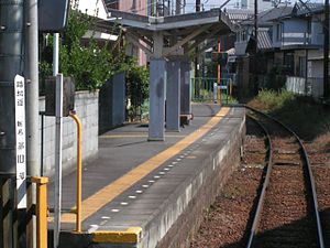
Popular places and events near this IP address
Nishi-Ōte Station
Railway station in Iga, Mie Prefecture, Japan
Distance: Approx. 2768 meters
Latitude and longitude: 34.7669,136.1248
Nishi-Ōte Station (西大手駅, Nishi-Ōte-eki) is a passenger railway station in located in the city of Iga, Mie Prefecture, Japan, operated by the private railway operator Iga Railway.

Uenoshi Station
Railway station in Iga, Mie Prefecture, Japan
Distance: Approx. 2427 meters
Latitude and longitude: 34.7679,136.13
Uenoshi Station (上野市駅, Uenoshi-eki) is a passenger railway station in located in the city of Iga, Mie Prefecture, Japan, operated by the private railway operator Iga Railway.

Hirokōji Station (Mie)
Railway station in Iga, Mie Prefecture, Japan
Distance: Approx. 2044 meters
Latitude and longitude: 34.76694444,136.13444444
Hirokōji Station (広小路駅, Hirokōji-eki) is a passenger railway station in located in the city of Iga, Mie Prefecture, Japan, operated by the private railway operator Iga Railway.

Kayamachi Station
Railway station in Iga, Mie Prefecture, Japan
Distance: Approx. 1622 meters
Latitude and longitude: 34.7615,136.1355
Kayamachi Station (茅町駅, Kayamachi-eki) is a passenger railway station in located in the city of Iga, Mie Prefecture, Japan, operated by the private railway operator Iga Railway.

Kuwamachi Station
Railway station in Iga, Mie Prefecture, Japan
Distance: Approx. 1340 meters
Latitude and longitude: 34.754,136.1367
Kuwamachi Station (桑町駅, Kuwamachi-eki) is a passenger railway station in located in the city of Iga, Mie Prefecture, Japan, operated by the private railway operator Iga Railway.

Idamichi Station
Railway station in Iga, Mie Prefecture, Japan
Distance: Approx. 2383 meters
Latitude and longitude: 34.7355,136.1403
Idamichi Station (猪田道駅, Idamichi-eki) is a passenger railway station in located in the city of Iga, Mie Prefecture, Japan, operated by the private railway operator Iga Railway.

Ninja Museum of Igaryu
Distance: Approx. 2762 meters
Latitude and longitude: 34.77172222,136.12911111
The Ninja Museum of Igaryu (伊賀流忍者博物館, Iga-ryū Ninja Hakubutsukan) situated in a forested location in Iga, Mie Prefecture, Japan, is a museum dedicated to the history of the ninja and ninjutsu. It was established in 1964 and is located near Iga Ueno Castle. Jinichi Kawakami, who serves as the honorary director of the Iga-ryū Ninja Museum, is proclaimed to be the 21st head of Iga-ryū ninjutsu.

Iga, Mie
City in Kansai, Japan
Distance: Approx. 2102 meters
Latitude and longitude: 34.76666667,136.13333333
Iga (伊賀市, Iga-shi) is a city located in Mie Prefecture, Japan. As of 31 August 2021, the city had an estimated population of 88,895 in 40,620 households and a population density of 160 persons per km². The total area of the city is 558.23 square kilometres (215.53 sq mi).

Shijuku Station
Railway station in Iga, Mie Prefecture, Japan
Distance: Approx. 1507 meters
Latitude and longitude: 34.74819444,136.137
Shijuku Station (四十九駅, Shijuku-eki) is a passenger railway station in located in the city of Iga, Mie Prefecture, Japan, operated by the private railway operator Iga Railway.

Sūkōdō
Han School in Japan, Japan
Distance: Approx. 2757 meters
Latitude and longitude: 34.76777778,136.12555556
The Sūkōdō (崇広堂) was a Han school of Tsu Domain under the Edo period Tokugawa shogunate. It was located in the Marunouchi neighborhood of the city of Iga in the Kansai region of Japan. The school was designated a National Historic Site of Japan in 1930, with the area under protection expanded in 1994.

Iga Kokubun-ji
Buddhist temple in Iga, Japan
Distance: Approx. 449 meters
Latitude and longitude: 34.75833333,136.15388889
The Iga Kokubun-ji (伊賀国分寺) was a Buddhist temple located in the Saimyōji neighborhood of the city of Iga, Mie, in the Kansai region of Japan. It was the provincial temple ("kokubunji") of former Iga Province. Its location is now an archaeological site, which has been preserved as a National Historic Site since 1923.

Iga ikki
Military confederation of ninja families
Distance: Approx. 2102 meters
Latitude and longitude: 34.76666667,136.13333333
The Iga ikki, full name Iga Sokoku Ikki, also known as the Iga Republic, Iga Confederacy, or Iga Commune, was a republic-style military confederation of ninjas (then known as shinobi) based in Iga Province during the Sengoku period of Japan. One of the two major schools of ninjutsu, Iga-ryū, is attributed to, and takes its name from, this confederation. During the second half of the 15th century, the ninja families in Iga formed a military confederacy dedicated to the defense of the province.
Weather in this IP's area
few clouds
28 Celsius
34 Celsius
27 Celsius
28 Celsius
1017 hPa
94 %
1017 hPa
999 hPa
10000 meters
0.76 m/s
1.16 m/s
102 degree
11 %
05:39:46
18:00:17