61.114.239.50 - IP Lookup: Free IP Address Lookup, Postal Code Lookup, IP Location Lookup, IP ASN, Public IP
Country:
Region:
City:
Location:
Time Zone:
Postal Code:
IP information under different IP Channel
ip-api
Country
Region
City
ASN
Time Zone
ISP
Blacklist
Proxy
Latitude
Longitude
Postal
Route
Luminati
Country
ASN
Time Zone
Asia/Tokyo
ISP
Cyber Wave Japan Co., Ltd.
Latitude
Longitude
Postal
IPinfo
Country
Region
City
ASN
Time Zone
ISP
Blacklist
Proxy
Latitude
Longitude
Postal
Route
IP2Location
61.114.239.50Country
Region
mie
City
ise
Time Zone
Asia/Tokyo
ISP
Language
User-Agent
Latitude
Longitude
Postal
db-ip
Country
Region
City
ASN
Time Zone
ISP
Blacklist
Proxy
Latitude
Longitude
Postal
Route
ipdata
Country
Region
City
ASN
Time Zone
ISP
Blacklist
Proxy
Latitude
Longitude
Postal
Route
Popular places and events near this IP address
Ise, Mie
City in Kansai, Japan
Distance: Approx. 48 meters
Latitude and longitude: 34.48333333,136.71666667
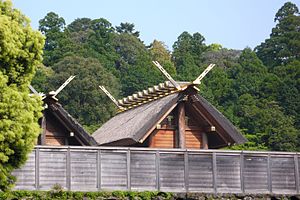
Ise (Japanese: 伊勢市, Hepburn: Ise-shi), formerly called Ujiyamada (宇治山田), is a city in central Mie Prefecture, on the island of Honshū, Japan. Ise is home to Ise Grand Shrine, the most sacred Shintō shrine in Japan. The city has a long-standing title – Shinto (神都) – that roughly means "the Holy City", and literally means "the Capital of the Kami".

Ise Shrine
Shinto shrine in Japan
Distance: Approx. 3221 meters
Latitude and longitude: 34.455,136.72583333
The Ise Shrine (Japanese: 伊勢神宮, Hepburn: Ise Jingū), located in Ise, Mie Prefecture of Japan, is a Shinto shrine dedicated to the solar goddess Amaterasu. Also known simply as Jingū (神宮), Ise Shrine is a shrine complex composed of many Shinto shrines centered on two main shrines, [Naikū] Error: {{nihongo}}: transliteration text not Latin script (pos 99) (help) (内宮) and [Gekū] Error: {{nihongo}}: transliteration text not Latin script (pos 103) (help) (外宮). The Inner Shrine, Naikū (also officially known as "Kōtai Jingū"), is dedicated to the worship of Amaterasu and is located in the town of Uji-tachi, south of central Ise, where she is believed to dwell.
Ujiyamada Station
Railway station in Ise, Mie Prefecture, Japan
Distance: Approx. 652 meters
Latitude and longitude: 34.488205,136.713733
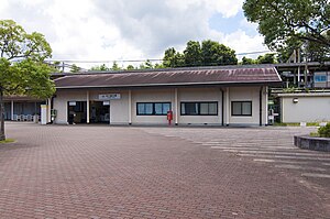
Ujiyamada Station (宇治山田駅, Ujiyamada-eki) is a junction railway station located in the city of Ise, Mie Prefecture, Japan, operated by the private operator Kintetsu. It is the closest station to Ise Grand Shrine and thus has an important role for tourists and pilgrims. The station also administrates the section between Kushida Station and Isuzugawa Station.

Shintomiza
Distance: Approx. 2173 meters
Latitude and longitude: 34.4962,136.69955278
Shintomiza (進富座) is an independent movie theater in the city of Ise, Mie Prefecture, Japan.

Kogakkan University
Distance: Approx. 990 meters
Latitude and longitude: 34.48694444,136.72666667
Kogakkan University (皇學館大学, Kōgakkan daigaku) is a private university at Ise, Mie, Japan. The predecessor of the school was founded in 1882, and it was chartered as a university in 1940. Kogakkan University is one of only two universities in Japan to offer a Shinto studies program, whose graduates earn the qualifications needed to become a kannushi (Shinto priest).

Miyamachi Station
Railway station in Ise, Mie Prefecture, Japan
Distance: Approx. 2394 meters
Latitude and longitude: 34.498,136.6983
Miyamachi Station (宮町駅, Miyamachi-eki) is a passenger railway station located in the city of Ise, Mie Prefecture, Japan, and is operated by the private railway operator Kintetsu Railway.

Iseshi Station
Railway station in Ise, Mie Prefecture, Japan
Distance: Approx. 1182 meters
Latitude and longitude: 34.4918,136.7098
Iseshi Station (伊勢市駅, Iseshi-eki) is a union passenger railway station located in the city of Ise, Mie Prefecture, Japan, operated by JR Central and the private railway operator Kintetsu Railway.

Isuzugawa Station
Railway station in Ise, Mie Prefecture, Japan
Distance: Approx. 1219 meters
Latitude and longitude: 34.4764,136.7276
Isuzugawa Station (五十鈴川駅, Isuzugawa-eki) is a passenger railway station in located in the city of Ise, Mie Prefecture, Japan, operated by the private railway operator Kintetsu Railway.
Yamada-Kamiguchi Station
Railway station in Ise, Mie Prefecture, Japan
Distance: Approx. 2516 meters
Latitude and longitude: 34.4953,136.694
Yamada-Kamiguchi Station (山田上口駅, Yamada-Kamiguchi-eki) is a passenger railway station in located in the city of Ise, Mie Prefecture, Japan, operated by Central Japan Railway Company (JR Tōkai).

Isuzugaoka Station
Railway station in Ise, Mie Prefecture, Japan
Distance: Approx. 2509 meters
Latitude and longitude: 34.49581111,136.73950278
Isuzugaoka Station (五十鈴ヶ丘駅, Isuzugaoka-eki) is a passenger railway station in located in the city of Ise, Mie Prefecture, Japan, operated by Central Japan Railway Company (JR Tōkai).
Hayashizaki Bunko
Distance: Approx. 2649 meters
Latitude and longitude: 34.45944444,136.72111111
The Hayashizaki Bunkō (林崎文庫) was a library and academy in the Edo period located in the Ujiimazaikecho neighborhood of the city of Ise, Mie, Japan. It was an important resource for kokugaku scholars in the Bakumatsu period. The building once housing the collection was designated a National Historic Site of Japan in 1954.

Toyomiyazaki Bunko
Distance: Approx. 762 meters
Latitude and longitude: 34.485,136.70905556
The Toyomiyazaki Bunkō (豊宮崎文庫) was a library and academy in the Edo period located in the Okamoto neighborhood of the city of Ise, Mie, Japan. It was an important resource for kokugaku scholars in the Bakumatsu period. Along with the Kanazawa Bunko and Ashikaga Bunko, it was one of the largest and most important collections in pre-modern Japan.
Weather in this IP's area
clear sky
9 Celsius
5 Celsius
9 Celsius
9 Celsius
1021 hPa
51 %
1021 hPa
1014 hPa
10000 meters
8.09 m/s
14.1 m/s
289 degree
9 %


