60.232.178.93 - IP Lookup: Free IP Address Lookup, Postal Code Lookup, IP Location Lookup, IP ASN, Public IP
Country:
 Chinese mainland
Region:
City:
Location:
Time Zone:
Postal Code:
ISP:
ASN:
language:
User-Agent:
Proxy IP:
Blacklist:
IP information under different IP Channel
ip-api
Country
Region
City
ASN
Time Zone
ISP
Blacklist
Proxy
Latitude
Longitude
Postal
Route
db-ip
Country
Region
City
ASN
Time Zone
ISP
Blacklist
Proxy
Latitude
Longitude
Postal
Route
IPinfo
Country
Region
City
ASN
Time Zone
ISP
Blacklist
Proxy
Latitude
Longitude
Postal
Route
IP2Location
60.232.178.93Country
cnRegion
shandong
City
qingdao
Time Zone
Asia/Shanghai
ISP
Language
User-Agent
Latitude
Longitude
Postal
ipdata
Country
Region
City
ASN
Time Zone
ISP
Blacklist
Proxy
Latitude
Longitude
Postal
Route
Popular places and events near this IP address

Qingdao
City in Shandong, China
Distance: Approx. 3660 meters
Latitude and longitude: 36.0669,120.3827
Qingdao is a prefecture-level city in the eastern Shandong Province of China. Located on China's Yellow Sea coast, Qingdao was founded in 1891 to support coastal defence fortifications. In 1897, the city was ceded to Germany.

Zhanshan Temple
Buddhist temple in Qingdao, China
Distance: Approx. 3961 meters
Latitude and longitude: 36.0646,120.3589
Zhanshan Temple (German: Dschanschan-Tempel; Chinese: 湛山寺; pinyin: Zhànshān Sì) is a Buddhist temple in Shinan District of Qingdao, Shandong, China. It is located on the southern side of Zhanshan (literally 'clear' or 'deep mountain'), facing the sea. In 2004 a major renovation was initiated.

Siege of Tsingtao
Operation during World War I
Distance: Approx. 3701 meters
Latitude and longitude: 36.06666667,120.38333333
The siege of Tsingtao (German: Belagerung von Tsingtau; Japanese: 青島の戦い; simplified Chinese: 青岛战役; traditional Chinese: 青島戰役) was the attack on the German port of Qingdao (Tsingtao) from Jiaozhou Bay during World War I by Japan and the United Kingdom. The siege was waged against Imperial Germany between 27 August and 7 November 1914.

Hongcheng Stadium
Multi-purpose stadium in Qingdao, China
Distance: Approx. 1814 meters
Latitude and longitude: 36.099416,120.351759
Hongcheng Stadium (Simplified Chinese: 弘诚体育场) is a multi-purpose stadium in Qingdao, China. It is currently used mostly for football matches. The stadium holds 14,000 people.

Qingdao TV Tower
Television tower in Qingdao, China
Distance: Approx. 3831 meters
Latitude and longitude: 36.06883611,120.35051944
Qingdao TV Tower is 232 metres (761 ft) tall lattice television tower with an observation deck situated on the top of 116 metres high Taiping Hill in Julin Hill Park in Qingdao, China. It is the tallest attraction in the city. Construction on the Qingdao TV Tower began in 1993 and was completed in 1996.

Bank of China Mansion, Qingdao
Building in Qingdao, China
Distance: Approx. 4067 meters
Latitude and longitude: 36.06561111,120.39133333
Bank of China Mansion (simplified Chinese: 青岛中银大厦; traditional Chinese: 青島中銀大廈; pinyin: Qīngdǎo Zhōngyín Dàshà) is a 54-floor 241 meter (791 foot) tall skyscraper completed in 1999 located in Qingdao, China.

Shibei, Qingdao
District in Shandong, People's Republic of China
Distance: Approx. 1267 meters
Latitude and longitude: 36.0875,120.375
Shibei District (Chinese: 市北区; pinyin: Shìběi Qū; lit. 'North City District') is an urban district of Qingdao, Shandong Province, People's Republic of China. As of 2010, it has an area of 63.18 square kilometres (24.39 sq mi) and around 1,027,000 inhabitants.

Sifang District
District in Shandong, People's Republic of China
Distance: Approx. 1475 meters
Latitude and longitude: 36.10694444,120.35916667
Sifang (Chinese: 四方; pinyin: Sìfāng; lit. 'four-way') is a former district at the core of Qingdao, People's Republic of China. In 2003, it had an area of 34.55 square kilometres (13.34 sq mi) and around 383,700 inhabitants.

Changsha Road station
Qingdao Metro station
Distance: Approx. 3318 meters
Latitude and longitude: 36.12028,120.39722
Changsha Road (Chinese: 长沙路) is a station of the Qingdao Metro on Line 3, which opened on December 16, 2015.

Shuangshan station
Qingdao Metro station
Distance: Approx. 2491 meters
Latitude and longitude: 36.114,120.392
Shuangshan (Chinese: 双山) is a station on Line 3 of the Qingdao Metro. It opened on 16 December 2015.

Qingjiang Road station
Qingdao Metro station
Distance: Approx. 1463 meters
Latitude and longitude: 36.11,120.38
Qingjiang Road (Chinese: 清江路) is a station on Line 3 of the Qingdao Metro. It opened on 18 December 2016.
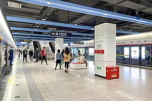
Zhiquan Road station
Qingdao Metro station
Distance: Approx. 3358 meters
Latitude and longitude: 36.0692,120.36353
Zhiquan Road (Chinese: 芝泉路) is a station on Line 2 of the Qingdao Metro. It opened on 10 December 2017.
Weather in this IP's area
moderate rain
5 Celsius
3 Celsius
5 Celsius
5 Celsius
1019 hPa
93 %
1019 hPa
1016 hPa
2800 meters
2 m/s
20 degree
100 %