Country:
 Chinese mainland
Region:
City:
Latitude and Longitude:
Time Zone:
Postal Code:
IP information under different IP Channel
ip-api
Country
Region
City
ASN
Time Zone
ISP
Blacklist
Proxy
Latitude
Longitude
Postal
Route
IPinfo
Country
Region
City
ASN
Time Zone
ISP
Blacklist
Proxy
Latitude
Longitude
Postal
Route
MaxMind
Country
Region
City
ASN
Time Zone
ISP
Blacklist
Proxy
Latitude
Longitude
Postal
Route
Luminati
Country
CNASN
Time Zone
Asia/Shanghai
ISP
CHINA UNICOM China169 Backbone
Latitude
Longitude
Postal
db-ip
Country
Region
City
ASN
Time Zone
ISP
Blacklist
Proxy
Latitude
Longitude
Postal
Route
ipdata
Country
Region
City
ASN
Time Zone
ISP
Blacklist
Proxy
Latitude
Longitude
Postal
Route
Popular places and events near this IP address
Harbin Institute of Technology
Public university in Harbin, Heilongjiang, China
Distance: Approx. 4085 meters
Latitude and longitude: 45.7432,126.6324
The Harbin Institute of Technology (HIT) is a public science and engineering university in Nan'gang, Harbin, Heilongjiang, China. It is now affiliated with the Ministry of Industry and Information Technology. The university is part of Project 211, Project 985, and the Double First-Class Construction.
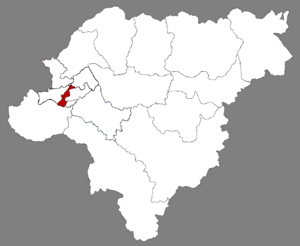
Nan'gang, Harbin
District in Heilongjiang, People's Republic of China
Distance: Approx. 4256 meters
Latitude and longitude: 45.7608,126.6715
Nan'gang District (Chinese: 南岗区; pinyin: Nán-gǎng Qū; Harbin dialect pronunciation: Nángàng Qū ) is one of nine districts of the prefecture-level city of Harbin, the capital of Heilongjiang Province, Northeast China, forming part of the city's urban core. It is home to major offices of the provincial government and is the political heart of Heilongjiang province. Other areas of interest within the district are the Harbin Railway Station, Guomao underground shopping street, a Confucian temple and the Buddhist Jile Temple.

Dragon Tower
Steel lattice television and observation tower in Heilongjiang, China
Distance: Approx. 2595 meters
Latitude and longitude: 45.74598611,126.67444444
Dragon Tower, also known as Long Ta (Chinese: 龙塔; pinyin: lóng tǎ) or Heilongjiang Tower (Chinese: 黑龙江塔), is a 336 m (1,102 ft) tall multi-purpose Chinese steel lattice television and observation tower. The Long Ta is used for television broadcasting; telecommunication, transmitting FM-/TV-broadcasting throughout the province of Heilongjiang; for observation, providing a view of the surrounding areas of city. The tower has observation decks and buffet restaurants.
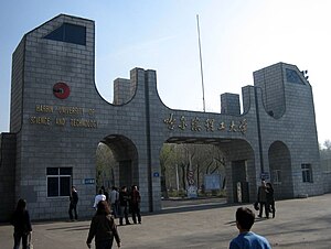
Harbin University of Science and Technology
Provincial public university in Harbin, Heilongjiang, China
Distance: Approx. 4684 meters
Latitude and longitude: 45.7141,126.617
The Harbin University of Science and Technology (HRBUST; Chinese: 哈尔滨理工大学) is a provincial public university in Harbin, Heilongjiang, China. The university is affiliated with the Province of Heilongjiang, and co-sponsored by the provincial government and SASTIND. The university was established in 1995 by the merger of Harbin Science and Technology University, Harbin Electrical Engineering College, and Harbin Industrial Higher Vocational School. It has four campuses: East Campus, West Campus, South Campus, and North Campus in three districts: Daoli, Nangang, and Xiangfang, covering over 1,275,000 m2, with a total building area of more than 850,000 m2, its fixed assets being ¥1.032 billion RMB. The library has a collection of 2.075 million books and about 4,900 Chinese and foreign journals and periodicals.
Hagongda Stadium
Multi-purpose stadium in Harbin, China
Distance: Approx. 4014 meters
Latitude and longitude: 45.736739,126.628422
Hagongda Stadium (Simplified Chinese: 哈工大体育场) is a multi-purpose stadium in Harbin Institute of Technology, Harbin, China. It is currently used mostly for football matches and athletics events. It serves as the home stadium for Harbin Yiteng of the Chinese Football Association Jia League.
Harbin International Convention Exhibition and Sports Center
Convention centre and sports facility in Harbin, China
Distance: Approx. 3809 meters
Latitude and longitude: 45.752092,126.701095
The Harbin International Conference Exhibition and Sports Center (simplified Chinese: 哈尔滨国际会展体育中心; traditional Chinese: 哈爾濱國際會展體育中心; pinyin: Hāěrbīn Guójì Huì Zhǎn Tǐyù Zhōngxīn) is a convention center for Harbin, China. It hosts various conventions. It has also hosted the 2007 Cup of China figure skating competition and hosted events for 1996 Asian Winter Games, 2009 Winter Universiade and will host the same events during the 2025 Asian Winter Games.
Northeast Forestry University
Public university in Harbin, Heilongjiang, China
Distance: Approx. 2778 meters
Latitude and longitude: 45.724,126.6403
Northeast Forestry University (NEFU; 东北林业大学) is a public university in Harbin, Heilongjiang, China. It is affiliated with the Ministry of Education, and co-founded by the Minister of Education, the National Forestry and Grassland Administration, and the Heilongjiang Provincial People's Government. The university is part of Project 211 and the Double First-Class Construction.
Heilongjiang University of Chinese Medicine
University in Harbin, China
Distance: Approx. 2078 meters
Latitude and longitude: 45.72508,126.64948
Heilongjiang University of Chinese Medicine (Chinese: 黑龙江中医药大学; pinyin: Hēilóngjiāng Zhōngyīyào Dàxué) is a public medical university in Harbin, China. It was founded in 1959.

Xiangfang, Harbin
District in Heilongjiang, People's Republic of China
Distance: Approx. 249 meters
Latitude and longitude: 45.724,126.6786
Xiangfang District (simplified Chinese: 香坊区; traditional Chinese: 香坊區; pinyin: Xiāngfāng Qū) is one of nine districts of the prefecture-level city of Harbin, the capital of Heilongjiang Province, Northeast China. It is an urban district in the pre-1940 part of Harbin, bordering the districts of Daowai to the north, Acheng to the southeast, Pingfang to the southwest, and Nangang to the west. It is an industrialized area, and contains the main scientific, technological and industrial zones of the city.
Apostolic Administration of Harbin
Catholic apostolic administration in northeast China
Distance: Approx. 4516 meters
Latitude and longitude: 45.75,126.633
The Apostolic Administration of Harbin (哈爾濱 or 中文) is a Latin Church pre-diocesan jurisdiction of the Catholic Church in Manchuria, China. It is exempt directly to the Holy See and its Roman Congregation for the Evangelization of Peoples. Its cathedral is the Cathedral of the Sacred Heart of Jesus, in Harbin, Heilongjiang province, PR China.
Harbin Institute of Technology Museum
Museum in Harbin, China
Distance: Approx. 4510 meters
Latitude and longitude: 45.74952,126.6325
Harbin Institute of Technology Museum (Chinese: 哈尔滨工业大学博物馆; pinyin: Hā'ěrbīn Gōngyè Dàxué Bówùguǎn) on 59 Gongsi Street, Harbin, China is the official museum of Harbin Institute of Technology. The present building was the building of General Consulate of Russian Federation in Harbin from 1906, and was transformed into classroom building of Harbin Institute of Technology in 1920. The museum was established in May 2010.
Anle Subdistrict, Harbin
Subdistrict in Heilongjiang, People's Republic of China
Distance: Approx. 1934 meters
Latitude and longitude: 45.7168,126.6526
Anle Subdistrict (simplified Chinese: 安乐街道; traditional Chinese: 安樂街道; pinyin: Ānlè Jiēdào) is a subdistrict in Xiangfang District, Harbin, Heilongjiang province, China. As of 2018, it has 3 residential communities under its administration.
Weather in this IP's area
clear sky
15 Celsius
14 Celsius
15 Celsius
15 Celsius
1017 hPa
70 %
1017 hPa
999 hPa
10000 meters
4.2 m/s
11.29 m/s
229 degree
05:05:28
17:55:29