Country:
 New Zealand
Region:
City:
Latitude and Longitude:
Time Zone:
Postal Code:
IP information under different IP Channel
ip-api
Country
Region
City
ASN
Time Zone
ISP
Blacklist
Proxy
Latitude
Longitude
Postal
Route
IPinfo
Country
Region
City
ASN
Time Zone
ISP
Blacklist
Proxy
Latitude
Longitude
Postal
Route
MaxMind
Country
Region
City
ASN
Time Zone
ISP
Blacklist
Proxy
Latitude
Longitude
Postal
Route
Luminati
Country
NZRegion
can
City
christchurch
ASN
Time Zone
Pacific/Auckland
ISP
CELLO GROUP LIMITED
Latitude
Longitude
Postal
db-ip
Country
Region
City
ASN
Time Zone
ISP
Blacklist
Proxy
Latitude
Longitude
Postal
Route
ipdata
Country
Region
City
ASN
Time Zone
ISP
Blacklist
Proxy
Latitude
Longitude
Postal
Route
Popular places and events near this IP address
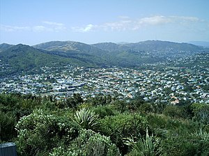
Karori
Suburb of Wellington City, New Zealand
Distance: Approx. 270 meters
Latitude and longitude: -41.284855,174.736795
Karori is a suburb located at the western edge of the urban area of Wellington, New Zealand, 4 kilometres (2.5 miles) from the city centre and is one of New Zealand's most populous suburbs, with a population of 15,380 in June 2023. The name Karori used to be Kaharore and is from the Māori language. No Māori lived in the area, when the first European settlers came to Karori in the 1840s.

Zealandia (wildlife sanctuary)
Protected natural area in New Zealand
Distance: Approx. 1334 meters
Latitude and longitude: -41.29444444,174.75
Zealandia, formerly known as the Karori Wildlife Sanctuary, is a protected natural area in Wellington, New Zealand, the first urban completely fenced ecosanctuary, where the biodiversity of 225 ha (just under a square mile) of forest is being restored. The sanctuary was previously part of the water catchment area for Wellington, between Wrights Hill (bordering Karori) and the Brooklyn wind turbine on Polhill. Most of New Zealand's ecosystems have been severely modified by the introduction of land mammals that were not present during the evolution of its ecosystems, and have had a devastating impact on both native flora and fauna.

Wrights Hill Fortress
Distance: Approx. 1227 meters
Latitude and longitude: -41.2961,174.739
Wrights Hill Fortress is a counter bombardment coastal artillery battery in the Karori suburb of Wellington, New Zealand. It was built between 1942 and 1944 and is predominantly underground, with numerous tunnels linking the war shelters, gun emplacements, magazines, plotting rooms and engine room – which are, at some points, over 50 feet underground. The fort was intended to house three 9.2" Mk.

Futuna Chapel
Chapel in Wellington, New Zealand
Distance: Approx. 383 meters
Latitude and longitude: -41.2818,174.7387
Futuna Chapel is a building in Wellington, New Zealand designed by the architect John Scott. Built by the brothers of the Society of Mary, the chapel is named after the Pacific Island of Futuna on which the missionary Peter Chanel, to whom the project is dedicated, was martyred in 1841. It was awarded the New Zealand Institute of Architects gold medal in 1968 and its 25-year Award in 1986.
Samuel Marsden Collegiate School
School
Distance: Approx. 401 meters
Latitude and longitude: -41.2831,174.744
Samuel Marsden Collegiate School is a private girls school located in the Wellington suburb of Karori in New Zealand. It has a socio-economic decile of 10 – on a scale from 1 to 10, 10 reflecting the highest proportion of students from high socio-economic communities – and provides year one to 13 education for girls, with a co-educational pre-school. Its exam results rank consistently in the top schools in New Zealand.
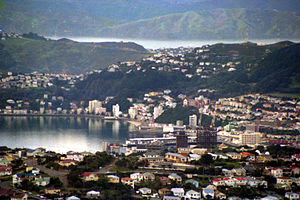
Northland, Wellington
Suburb of Wellington City, New Zealand
Distance: Approx. 1632 meters
Latitude and longitude: -41.28138889,174.75888889
Northland is a suburb in west-central Wellington, New Zealand. Not far from Victoria University it also includes low-priced accommodation popular with young students. It borders the suburbs of Highbury, Kelburn, Thorndon, Wilton, Wadestown and Karori.
Northland School
State coed primary, school
Distance: Approx. 1733 meters
Latitude and longitude: -41.2805,174.7598
Northland School is a small state primary school in Northland, western Wellington, and was established in 1906. The school is situated at 14 Harbour View Road and is a decile ten school. Northland School caters for Years 1 through 8, and there are 4 teams, each made up of 2–3 year groups.
Alington House
Distance: Approx. 929 meters
Latitude and longitude: -41.277472,174.744501
Alington House is a private house in Karori, Wellington, New Zealand. It is "an important New Zealand example of Modern Movement architecture." The house was designed by Bill Alington for his family while working for the New Zealand Government's Ministry of Works immediately after returning from his overseas experience. The Alington house was awarded an NZIA Wellington Branch Enduring Architecture award in 2002, and an NZIA (National) Enduring Architecture award in 2007.
Karori Lunatic Asylum
Hospital in Karori, New Zealand
Distance: Approx. 141 meters
Latitude and longitude: -41.284682,174.741601
Karori Lunatic Asylum was a psychiatric hospital in Karori. Established in 1854, it was New Zealand's first asylum. The first patient was admitted in the same year, but it would be 1858 before a second patient arrived.

Karori Cemetery
Cemetery in Wellington, New Zealand
Distance: Approx. 1401 meters
Latitude and longitude: -41.275,174.75
Karori Cemetery is the second-largest cemetery in New Zealand. It opened in 1891, and is located in the Wellington suburb of Karori.

Karori Crematorium
Heritage building in Karori Cemetery, Wellington, New Zealand
Distance: Approx. 1176 meters
Latitude and longitude: -41.27812,174.75057
The Karori Crematorium and its adjacent chapel are located in Karori Cemetery in the Wellington suburb of Karori. The crematorium was the first such facility in New Zealand, and it opened in 1909. The Karori Crematorium and chapel are registered by the Heritage New Zealand as Category 1 Historic Places, with registration number 1399.
List of ambassadors of Russia to New Zealand
Distance: Approx. 911 meters
Latitude and longitude: -41.287182,174.750548
The Ambassador Extraordinary and Plenipotentiary of the Russian Federation to New Zealand is the official representative of the President and the Government of the Russian Federation to the Prime Minister and the Government of New Zealand. The ambassador and his staff work at large in the Embassy of Russia in Wellington. The post of Russian Ambassador to New Zealand is currently held by Georgy Zuev, incumbent since 4 June 2018.
Weather in this IP's area
scattered clouds
9 Celsius
7 Celsius
8 Celsius
10 Celsius
1026 hPa
82 %
1026 hPa
1004 hPa
10000 meters
3.6 m/s
40 degree
40 %
06:25:51
19:45:53