59.152.60.8 - IP Lookup: Free IP Address Lookup, Postal Code Lookup, IP Location Lookup, IP ASN, Public IP
Country:
Region:
City:
Location:
Time Zone:
Postal Code:
ISP:
ASN:
language:
User-Agent:
Proxy IP:
Blacklist:
IP information under different IP Channel
ip-api
Country
Region
City
ASN
Time Zone
ISP
Blacklist
Proxy
Latitude
Longitude
Postal
Route
db-ip
Country
Region
City
ASN
Time Zone
ISP
Blacklist
Proxy
Latitude
Longitude
Postal
Route
IPinfo
Country
Region
City
ASN
Time Zone
ISP
Blacklist
Proxy
Latitude
Longitude
Postal
Route
IP2Location
59.152.60.8Country
Region
california
City
martinez
Time Zone
America/Los_Angeles
ISP
Language
User-Agent
Latitude
Longitude
Postal
ipdata
Country
Region
City
ASN
Time Zone
ISP
Blacklist
Proxy
Latitude
Longitude
Postal
Route
Popular places and events near this IP address

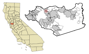
Martinez, California
City in California, United States
Distance: Approx. 40 meters
Latitude and longitude: 38.01944444,-122.13416667
Martinez (Spanish: Martínez) is a city in and the county seat of Contra Costa County, California, United States, in the East Bay region of the San Francisco Bay Area. Located on the southern shore of the Carquinez Strait, the city's population was 37,287 at the 2020 census. The city is named after Californio ranchero Ygnacio Martínez, having been founded on his Rancho El Pinole.

Mountain View, Contra Costa County, California
Census designated place in California, United States
Distance: Approx. 1896 meters
Latitude and longitude: 38.00888889,-122.1175
Mountain View is a census designated place (CDP) in Contra Costa County, California, United States. The population was 2,622 at the 2020 census.

Benicia–Martinez Bridge
Bridge in California, U.S.
Distance: Approx. 2512 meters
Latitude and longitude: 38.0406,-122.123
The Benicia–Martinez Bridge refers to three parallel bridges which cross the Carquinez Strait just west of Suisun Bay in California; the spans link Benicia on the north side with Martinez on the south. The original 1.2-mile (1.9 km) deck truss bridge opened in 1962 to replace the last automotive ferry service in the San Francisco Bay Area. The 1962 bridge has seven 528-foot (161 m) spans and 138 feet (42 m) of vertical clearance, now carrying four lanes of southbound traffic, as well as a path for pedestrians and bicyclists.

St. Catherine of Siena School (Martinez, California)
Private school in Martinez, California, United States
Distance: Approx. 565 meters
Latitude and longitude: 38.01476944,-122.13495556
St. Catherine of Siena School in Martinez, California is a Catholic school in the Diocese of Oakland. The school has a Preschool and serves students in Kindergarten through Eighth Grade.

Contra Costa Community College District
Community college district in Contra Costa county, California, United States
Distance: Approx. 145 meters
Latitude and longitude: 38.01888889,-122.13527778
The Contra Costa Community College District is a community college district that encompasses three community colleges in Contra Costa County, California - Contra Costa College, Diablo Valley College and Los Medanos College. The headquarters is in the George R. Gordon Education Center in Martinez, California.
Martinez station
Train station in Martinez, California, US
Distance: Approx. 412 meters
Latitude and longitude: 38.019292,-122.138754
Martinez station is an Amtrak passenger train station in Martinez, California, United States. Located at the west end of downtown Martinez, the station has one side platform and one island platform, which serve three of the four tracks of the Union Pacific Railroad Martinez Subdivision. It is served by the daily California Zephyr and Coast Starlight long-distance trains, five daily round trips of the San Joaquin corridor service, and fifteen daily round trips (eleven on weekends) of the Capitol Corridor service.
Alhambra High School (Martinez, California)
Public high school in Martinez, California
Distance: Approx. 1930 meters
Latitude and longitude: 38.00246,-122.13405
Alhambra Senior High School (AHS) is a public high school in Martinez, California, United States which was first established in 1897. It is a part of the Martinez Unified School District. During the 2006-2007 academic year, the school had enrollment of approximately 1400 students.
Radke Martinez Regional Shoreline
Distance: Approx. 728 meters
Latitude and longitude: 38.02611111,-122.13194444
Radke Martinez Regional Shoreline (RMRS) is a regional park on the shoreline of Carquinez Strait in Martinez, located in northern Contra Costa County, California. Formerly known as the Martinez Regional Shoreline, it was renamed on December 6, 2016, in honor of Ted Radke and his wife Kathy Radke.
Yuba City bus disaster
Deadly school bus crash in Martinez, California
Distance: Approx. 2089 meters
Latitude and longitude: 38.0244,-122.111
The Yuba City bus disaster occurred on May 21, 1976, in Martinez, California. A chartered school bus transporting 52 passengers on an elevated offramp left the roadway, landing on its roof. Of the 52 passengers (not including the driver), 28 students and an adult adviser were killed in the crash.
Mococo, Martinez, California
Distance: Approx. 1703 meters
Latitude and longitude: 38.02555556,-122.11611111
Mococo is a former unincorporated community, now annexed to the city of Martinez, located in Contra Costa County, East Bay region, California. It became known as Mococo following the 1905 arrival of a smelting works, operated by the Mountain Copper Company (Mo Co Co). It lies at an elevation of 10 feet (3 m), south of the Carquinez Strait in eastern Martinez.

Tucker House
Historic house in California, United States
Distance: Approx. 804 meters
Latitude and longitude: 38.01525278,-122.14121944
The Tucker House is located in Martinez, California. Originally located at 40 Escobar Street, this luxurious 4 story, 4 bedroom, 2 bath mansion was built for Captain John Tucker, a former sea captain from Nantucket, Massachusetts, who settled in Martinez, become a wheat farmer and built a mansion atop the hill on Escobar Street in 1877. The persons who moved into the house included not only the Captain, but also his wife, Mary Swain Tucker, Mary's brother, Sylvester Swain, Swain's wife and daughter, and a Chinese servant known only as Vu.
Martinez Library
United States historic place
Distance: Approx. 205 meters
Latitude and longitude: 38.017977,-122.1344098
Martinez Library is a historic library located in downtown Martinez, California that is part of the Contra Costa County Library system.
Weather in this IP's area
clear sky
9 Celsius
7 Celsius
8 Celsius
11 Celsius
1009 hPa
85 %
1009 hPa
997 hPa
10000 meters
3.6 m/s
180 degree


