51.36.174.91 - IP Lookup: Free IP Address Lookup, Postal Code Lookup, IP Location Lookup, IP ASN, Public IP
Country:
Region:
City:
Location:
Time Zone:
Postal Code:
IP information under different IP Channel
ip-api
Country
Region
City
ASN
Time Zone
ISP
Blacklist
Proxy
Latitude
Longitude
Postal
Route
Luminati
Country
Region
04
City
dammam
ASN
Time Zone
Asia/Riyadh
ISP
Mobile Telecommunication Company Saudi Arabia Joint-Stock company
Latitude
Longitude
Postal
IPinfo
Country
Region
City
ASN
Time Zone
ISP
Blacklist
Proxy
Latitude
Longitude
Postal
Route
IP2Location
51.36.174.91Country
Region
ash sharqiyah
City
al jubayl
Time Zone
Asia/Riyadh
ISP
Language
User-Agent
Latitude
Longitude
Postal
db-ip
Country
Region
City
ASN
Time Zone
ISP
Blacklist
Proxy
Latitude
Longitude
Postal
Route
ipdata
Country
Region
City
ASN
Time Zone
ISP
Blacklist
Proxy
Latitude
Longitude
Postal
Route
Popular places and events near this IP address

Ghawar Field
Oil field in Saudi Arabia
Distance: Approx. 4500 meters
Latitude and longitude: 25.43,49.62
Ghawar (Arabic: الغوار) is an oil field located in Al-Ahsa Governorate, Eastern Province, Saudi Arabia. Measuring 280 by 30 km (170 by 19 mi) (some 8,400 square kilometres (3,200 sq mi)), it is by far the largest conventional oil field in the world, and accounts for roughly a third of the cumulative oil production of Saudi Arabia as of 2018. Ghawar is entirely owned and operated by Saudi Aramco, the state-run Saudi oil company.

Al-Ahsa Governorate
Place in Saudi Arabia
Distance: Approx. 5360 meters
Latitude and longitude: 25.38333333,49.6
Al Ahsa (Arabic: ٱلْأَحْسَاء, romanized: Al-Aḥsāʾ, locally pronounced Al-Ḥasāʾ (Arabic: ٱلْحَسَاء)) also known as Hajar (Arabic: هجر) is the largest governorate in Saudi Arabia's Eastern Province, named after the Al-Ahsa Oasis. In Classical Arabic, 'Ahsa' means the sound of water underground. It has one of the largest oases in the world with world-renowned date palms and, according to one author, the oases of Al-Hasa and Al Ain (in the UAE, on the border with Oman) are the most important in the Arabian Peninsula.
Qaysareyah of Kirkuk
Distance: Approx. 6709 meters
Latitude and longitude: 25.37574,49.58893
The Qaysareyah Market is an old market in the city of Kirkuk in Iraq, located near the Kirkuk Citadel. Sources claim it was built in 1855 during the Ottoman Empire era. The market's layout symbolizes the hours, days, and months of the year.

Al-Qarah
A village in Al ahsa , Eastern Province , Saudi Arabia
Distance: Approx. 4033 meters
Latitude and longitude: 25.40999167,49.68854722
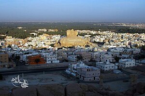
Al-Garah (Arabic: قَرْيَة ٱلْقَارَة, romanized: Qaryat Al-Qārah) is a village in Al-Ahsa, in the Eastern Province of Saudi Arabia. It known for its small mountain, and is one of Al-Ahsa Oasis' eastern villages and is located about 10 km (6.2 miles) northeast of the center of Al-Hofuf, 140 km (87 mi) southwest of Dammam, and 300 km (190 mi) east of Riyadh.

Al-Ahsa Oasis
Oasis historical region in eastern Saudi Arabia
Distance: Approx. 4324 meters
Latitude and longitude: 25.42944444,49.62194444
Al-Ahsa Oasis (Arabic: الْأَحْسَاء, al-ʾAhsā), also known as al-Ḥasāʾ (الْحَسَاء) or Hajar (هَجَر), is an oasis and historical region in eastern Saudi Arabia. Al-Ahsa Governorate, which makes up much of the country's Eastern Province, is named after it. The oasis is located about 60 km (37 miles) inland from the coast of the Persian Gulf.

Al-Mubarraz
Place in Saudi Arabia
Distance: Approx. 5360 meters
Latitude and longitude: 25.38333333,49.6
Al-Mubarraz is a city located at Al-Ahsa in the Eastern Province of the Kingdom of Saudi Arabia. With a population of 837,000 (as of 2020), it is the north gate for Al-Ahsa governorate. Al-Mubarraz has historical importance because it was the rule center for the district between 1669 and 1793, before the Saudi rule .

Muhaires Castle
Place in Saudi Arabia
Distance: Approx. 5360 meters
Latitude and longitude: 25.38333333,49.6
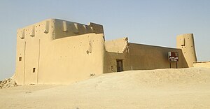
Muhaires castle located in Al-Ahsa governorate, at the eastern region of Saudi Arabia. the castle was built by Al-Imam Saud bin Abdul-Aziz on the top of a hill at 1208 Hijri for military purposes. It is a small military castle consist of round towers with rooms, Weapons, supplies and ammunition were stored there.

Al-Qarah Mountain (Saudi Arabia)
A mountain in the Eastern Province , Saudi Arabia
Distance: Approx. 4033 meters
Latitude and longitude: 25.40999167,49.68854722
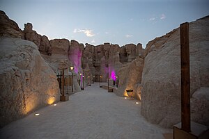
Al-Qarah Mountain or Jabal Al-Qārah (Arabic: جَبَل ٱلْقَارَة), also known as "Al-Shabaab Mountain", is a mesa of 75 metres (246 feet) in Al-Ahsa, in the Eastern Province of Saudi Arabia. This mountain counts as one of the most important natural sights in Al-Ahsa, and was registered in the UNESCO world heritage center's list in 2018, after the inclusion of Al-Ahsa Oasis. It is located 15 kilometres (9.3 miles) to the northeast of Al-Hofuf.
Al-Ahsa Water Springs
Place in Saudi Arabia
Distance: Approx. 5360 meters
Latitude and longitude: 25.38333333,49.6
Al-ahsa water spring is a flowing water spring, as described in the book Oasis of Al-Ahsa, by author Federico S. Vidal, which he wrote in 1952 when he was working in the Arabian-American Oil Company (ARAMCO) and he submitted it to Harvard University as a subject for his doctorate degree thesis in 1964. The estimated number of Al-ahsa springs is between sixty and seventy springs, including four huge springs. They flow individually sometimes, or in groups and it is artesian in its flow.
Al-Shu'ba Mountain
Place in Saudi Arabia
Distance: Approx. 4033 meters
Latitude and longitude: 25.409992,49.688549
Al-Shu'ba mountain located in east of Al-Shu'ba village at Al-Ahsa and to the north of Al-Eskan next to the road leading from eastern villages to the northern villages and to Al-Dammam. Also it extends from north to south with a length of 20 km on the eastern edge of the northern oasis and its width is 4 km.

Odeh Spring
Place in Saudi Arabia
Distance: Approx. 5360 meters
Latitude and longitude: 25.38333333,49.6
Odeh Spring (Ain Al-Odeh عين العودة in Arabic, also called Fauces Spring, Tarout Spring or Castle Spring) is a historical natural underground deep sulphur spring in Saudi Arabia, Eastern Province, Qatif, specifically in Tarout Island. Odeh Spring history goes back more than four thousand years. It contained mineral water where people utilized it to cure diseases and illnesses.

Sahood Fort
Fort near Al Mubarraz
Distance: Approx. 6764 meters
Latitude and longitude: 25.4125,49.58416667
Sahood Fort (Arabic: قصر صاهود) is situated outside the western walls of Al Mubarraz, Saudi Arabia. The fort is used as barracks for the Saudi Arabian Armed Forces.
Weather in this IP's area
broken clouds
15 Celsius
15 Celsius
15 Celsius
15 Celsius
1021 hPa
82 %
1021 hPa
1004 hPa
10000 meters
3.14 m/s
3.19 m/s
317 degree
57 %