51.146.10.236 - IP Lookup: Free IP Address Lookup, Postal Code Lookup, IP Location Lookup, IP ASN, Public IP
Country:
Region:
City:
Location:
Time Zone:
Postal Code:
IP information under different IP Channel
ip-api
Country
Region
City
ASN
Time Zone
ISP
Blacklist
Proxy
Latitude
Longitude
Postal
Route
Luminati
Country
Region
eng
City
brent
ASN
Time Zone
Europe/London
ISP
Sky UK Limited
Latitude
Longitude
Postal
IPinfo
Country
Region
City
ASN
Time Zone
ISP
Blacklist
Proxy
Latitude
Longitude
Postal
Route
IP2Location
51.146.10.236Country
Region
england
City
aylesbury
Time Zone
Europe/London
ISP
Language
User-Agent
Latitude
Longitude
Postal
db-ip
Country
Region
City
ASN
Time Zone
ISP
Blacklist
Proxy
Latitude
Longitude
Postal
Route
ipdata
Country
Region
City
ASN
Time Zone
ISP
Blacklist
Proxy
Latitude
Longitude
Postal
Route
Popular places and events near this IP address

Aylesbury
County town of Buckinghamshire, England
Distance: Approx. 152 meters
Latitude and longitude: 51.8168,-0.8124
Aylesbury ( AYLZ-bər-ee) is the county town of Buckinghamshire, South East England. It is home to the Roald Dahl Children's Gallery and the Waterside Theatre. It is located in central Buckinghamshire, midway between High Wycombe and Milton Keynes.

King's Head Inn, Aylesbury
English public house in Buckinghamshire, United Kingdom
Distance: Approx. 74 meters
Latitude and longitude: 51.816472,-0.813592
The King's Head is one of the oldest public houses with a coaching yard in the south of England. It is located in the Market Square, Aylesbury, Buckinghamshire, and is a Grade II* Listed Building. The oldest part of the current structure of the building is of 15th-century design; however, the cellars are much older, dating back to the 13th century, and may have been part of the local friary.
Greatest Hits Radio Bucks, Beds and Herts
Radio station in Aylesbury
Distance: Approx. 114 meters
Latitude and longitude: 51.8158,-0.8138
Greatest Hits Radio Bucks, Beds and Herts (formerly Mix 96) is an Independent Local Radio station, owned and operated by Bauer, which broadcasts to Buckinghamshire, Bedfordshire and Hertfordshire. It is part of the Greatest Hits Radio network. It was formerly known as Mix 96 prior to a rebrand by Bauer in 2020.

Aylesbury (UK Parliament constituency)
Parliamentary constituency in the United Kingdom, 1801 onwards
Distance: Approx. 183 meters
Latitude and longitude: 51.816,-0.817
Aylesbury is a constituency in the House of Commons of the UK Parliament, currently represented by Laura Kyrke-Smith, a member of the Labour Party.

Roald Dahl Children's Gallery
Children's museum in Aylesbury, England
Distance: Approx. 75 meters
Latitude and longitude: 51.8173,-0.8151
The Roald Dahl Children's Gallery is a children's museum that uses characters and themes from the books of Roald Dahl to stimulate children's interest in science, history and literature. It is located on Church Street, Aylesbury, Buckinghamshire, England and was opened on 23 November 1996 by Terrence Hardiman, an actor popular with children due to his role as the title role in The Demon Headmaster. The building was previously a coach-house.

Buckinghamshire County Museum
Distance: Approx. 65 meters
Latitude and longitude: 51.8172,-0.8151
The Buckinghamshire County Museum is a museum in the centre of Aylesbury, in Buckinghamshire, England. It displays artefacts pertinent to the history of Buckinghamshire including geological displays, costume, agriculture and industry. The museum also features changing art exhibits in the Buckinghamshire Art Gallery.

Aylesbury Hundred
English Administrative Division
Distance: Approx. 152 meters
Latitude and longitude: 51.8168,-0.8124
Aylesbury Hundred was a hundred in the ceremonial county of Buckinghamshire, England. It was situated in the centre of the county and was bounded on the east by Hertfordshire and on the west by Oxfordshire.

Municipal Borough of Aylesbury
Distance: Approx. 152 meters
Latitude and longitude: 51.8168,-0.8124
The town of Aylesbury formed a local government district in Buckinghamshire, England from 1849 to 1974. It was administered as a local board district from 1849 to 1894, as an urban district from 1894 to 1916, and as a municipal borough from 1917 until its abolition in 1974.

Aylesbury Waterside Theatre
Theatre in Aylesbury, England
Distance: Approx. 152 meters
Latitude and longitude: 51.8168,-0.8124
Aylesbury Waterside Theatre is a theatre in Aylesbury, England, presenting a range of West End and touring musicals and plays, along with performances of opera and ballet and a Christmas pantomime.

St Mary the Virgin's Church, Aylesbury
Church in Aylesbury, United Kingdom
Distance: Approx. 171 meters
Latitude and longitude: 51.81795,-0.81605
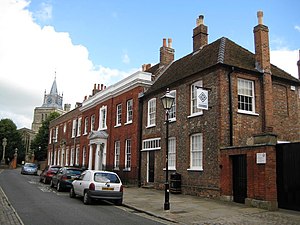
The Church of St Mary the Virgin, Aylesbury, is an Anglican church of the Diocese of Oxford, in the centre of the town of Aylesbury. There is evidence of a church from Saxon times, but the present building was built sometime between 1200 and 1250, with various additions and alterations in the 14th, 15th, 19th and 20th century. The church is one of the most recognisable sights of Aylesbury; its ornate clock tower dominates the skyline.

Aylesbury War Memorial
Distance: Approx. 121 meters
Latitude and longitude: 51.8165,-0.81287
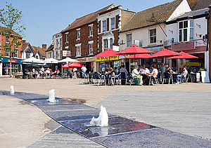
Aylesbury War Memorial is located in Market Square, Aylesbury, Buckinghamshire, England. It is a grade II listed building with Historic England.

Aylesbury Clock Tower
Clock tower in Aylesbury, Buckinghamshire, England
Distance: Approx. 158 meters
Latitude and longitude: 51.81616,-0.81248
The Aylesbury Clock Tower is located at the centre of Aylesbury, Buckinghamshire, United Kingdom's Market Square was built in 1876. It dominates the square and stands on the site of a former market house which was demolished in 1866. The tower was designed by architect D Brandon who also designed other public buildings in the town including the Corn Exchange.
Weather in this IP's area
broken clouds
4 Celsius
2 Celsius
3 Celsius
5 Celsius
1029 hPa
69 %
1029 hPa
1018 hPa
10000 meters
1.88 m/s
1.88 m/s
291 degree
78 %