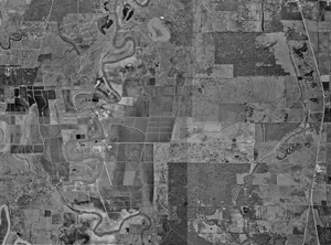
50.238.39.153 - IP Lookup: Free IP Address Lookup, Postal Code Lookup, IP Location Lookup, IP ASN, Public IP
Country:
Region:
City:
Location:
Time Zone:
Postal Code:
ISP:
ASN:
language:
User-Agent:
Proxy IP:
Blacklist:
IP information under different IP Channel
ip-api
Country
Region
City
ASN
Time Zone
ISP
Blacklist
Proxy
Latitude
Longitude
Postal
Route
db-ip
Country
Region
City
ASN
Time Zone
ISP
Blacklist
Proxy
Latitude
Longitude
Postal
Route
IPinfo
Country
Region
City
ASN
Time Zone
ISP
Blacklist
Proxy
Latitude
Longitude
Postal
Route
IP2Location
50.238.39.153Country
Region
texas
City
rosharon
Time Zone
America/Chicago
ISP
Language
User-Agent
Latitude
Longitude
Postal
ipdata
Country
Region
City
ASN
Time Zone
ISP
Blacklist
Proxy
Latitude
Longitude
Postal
Route
Popular places and events near this IP address

Bonney, Texas
Village in Brazoria County, Texas, United States
Distance: Approx. 4663 meters
Latitude and longitude: 29.31111111,-95.45083333
Bonney is a village in Brazoria County, Texas, United States. The population was 180 at the 2020 census, making it the smallest village in Texas. Bonney is, however, approximately fifteen times larger than the smallest city and the smallest town in Texas.
Rosharon, Texas
Census-designated place in Bazoria County, Texas, United States
Distance: Approx. 8 meters
Latitude and longitude: 29.35222222,-95.46027778
Rosharon ( roh-SHAIR-ən), is a census-designated place (CDP) in Brazoria County, Texas, United States, at the intersection of Farm to Market Road 521 and Farm to Market Road 1462. As of the 2010 census, it had a population of 1,152. There are areas outside of the CDP, with Rosharon postal addresses, in Fort Bend County.
Lochridge, Texas
Unincorporated community in Texas, United States
Distance: Approx. 6881 meters
Latitude and longitude: 29.35305556,-95.53111111
Lochridge is an unincorporated community located in Brazoria County, Texas, United States. It formerly had a distinct community. It is located within the Greater Houston metropolitan area.
MSR Houston
Distance: Approx. 9025 meters
Latitude and longitude: 29.27811,-95.42244
Motor Speedway Resort (MSR) Houston is a road course race track located in Angleton, Texas. The track uses a membership system similar to that of country clubs where members may use the course for a nominal fee per use. The track has recently begun hosting its own racing series for club members.
English, Brazoria County, Texas
Unincorporated community in Brazoria County, Texas
Distance: Approx. 6997 meters
Latitude and longitude: 29.37416667,-95.52777778
English is an unincorporated community located at County Road 42 and Oyster Creek in northern Brazoria County, Texas, United States. It is located within the Greater Houston metropolitan area.

Terrell Unit
Distance: Approx. 8789 meters
Latitude and longitude: 29.31027778,-95.53694444
The Charles T. Terrell Unit is a Texas Department of Criminal Justice prison located in unincorporated Brazoria County, Texas, with a Rosharon, Texas postal address; it is not inside the Rosharon census-designated place. The facility is located on Farm to Market Road 655, 4 miles (6.4 km) west of Farm to Market Road 521. The prison, has about 16,369 acres (6,624 ha) of land, is co-located with Ramsey Unit and Stringfellow Unit.
China Grove, Brazoria County, Texas
Unincorporated community in Texas, United States
Distance: Approx. 4402 meters
Latitude and longitude: 29.31277778,-95.45666667
China Grove is an unincorporated community in northwestern Brazoria County, Texas, United States. It is a part of the Greater Houston metropolitan area.

Stringfellow Unit
Distance: Approx. 9693 meters
Latitude and longitude: 29.29888889,-95.53916667
The A. M. "Mac" Stringfellow Unit (previously Ramsey II Unit) is a Texas Department of Criminal Justice prison located in unincorporated Brazoria County, Texas, with a Rosharon, Texas postal address it is not inside the Rosharon census-designated place. The prison is located on Farm to Market Road 655, 4 miles (6.4 km) west of Farm to Market Road 521, and about 30 miles (48 km) south of Houston. The unit is co-located with the Ramsey Unit and the Terrell Unit on a 16,369-acre (6,624 ha) plot of land.

Iowa Colony High School
Secondary school in Texas, United States
Distance: Approx. 8842 meters
Latitude and longitude: 29.42320302,-95.41934406
Iowa Colony High School is a senior high school in Iowa Colony, Texas. It is a part of the Alvin Independent School District (AISD) and is within the Alvin ISD Heritage Complex. The school colors are black, hunter green, and silver.
Weather in this IP's area
overcast clouds
9 Celsius
7 Celsius
9 Celsius
10 Celsius
1018 hPa
85 %
1018 hPa
1016 hPa
10000 meters
4.12 m/s
20 degree
100 %