50.223.45.37 - IP Lookup: Free IP Address Lookup, Postal Code Lookup, IP Location Lookup, IP ASN, Public IP
Country:
Region:
City:
Location:
Time Zone:
Postal Code:
IP information under different IP Channel
ip-api
Country
Region
City
ASN
Time Zone
ISP
Blacklist
Proxy
Latitude
Longitude
Postal
Route
Luminati
Country
Region
fl
City
miami
ASN
Time Zone
America/New_York
ISP
COMCAST-20214
Latitude
Longitude
Postal
IPinfo
Country
Region
City
ASN
Time Zone
ISP
Blacklist
Proxy
Latitude
Longitude
Postal
Route
IP2Location
50.223.45.37Country
Region
florida
City
west palm beach
Time Zone
America/New_York
ISP
Language
User-Agent
Latitude
Longitude
Postal
db-ip
Country
Region
City
ASN
Time Zone
ISP
Blacklist
Proxy
Latitude
Longitude
Postal
Route
ipdata
Country
Region
City
ASN
Time Zone
ISP
Blacklist
Proxy
Latitude
Longitude
Postal
Route
Popular places and events near this IP address

Lake Park, Florida
Town in the state of Florida, United States
Distance: Approx. 2487 meters
Latitude and longitude: 26.80027778,-80.06416667
Lake Park is a town in Palm Beach County, Florida, United States. Lake Park is part of the Miami metropolitan area of South Florida. The population was 9,047 at the 2020 US census.

Mangonia Park, Florida
Town in the state of Florida, United States
Distance: Approx. 2341 meters
Latitude and longitude: 26.75805556,-80.07388889
Mangonia Park is a town in Palm Beach County, Florida, United States. It is a part of the Miami metropolitan area of South Florida as well as Uptown West Palm, which includes the cities of Riviera Beach and West Palm Beach. As of 2020, the population recorded by the U.S. Census Bureau was 2,142.

Riviera Beach, Florida
City in Florida, United States
Distance: Approx. 468 meters
Latitude and longitude: 26.78,-80.06722222
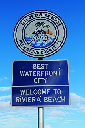
Riviera Beach is a city in Palm Beach County, Florida, United States, which was incorporated on September 29, 1922. Due to the location of its eastern boundary, it is also the easternmost municipality in the Miami metropolitan area. In the 2020 U.S. Census, the total population of Riviera Beach residents was 37,604 people.
Suncoast Community High School
Magnet high school in Riviera Beach, Palm Beach, Florida, United States of America
Distance: Approx. 1003 meters
Latitude and longitude: 26.778778,-80.081891
Suncoast Community High School (abbreviated SHS) is a public magnet high school (grades 9–12) in Riviera Beach, Florida. The school's campus was built in 1955 as Riviera Beach High School. It was desegregated in the 1960s and renamed in 1970.

Mangonia Park station
Railway station in Mangonia Park, Florida
Distance: Approx. 2341 meters
Latitude and longitude: 26.758383,-80.076459
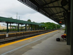
Mangonia Park is a Tri-Rail commuter rail station in Mangonia Park, Florida. This is the system's northernmost station. The station is located on 45th Street (CR 702), just west of Australian Avenue (CR 704A).
WZZR
Radio station in West Palm Beach, Florida
Distance: Approx. 2343 meters
Latitude and longitude: 26.799778,-80.075583
WZZR, known on-air as "Real Radio 92.1", is a hot talk and alternative rock radio station licensed to serve West Palm Beach, Florida, where its studios and transmitter tower are separately located. It is owned by iHeartMedia (formerly Clear Channel Communications), and broadcasts on 92.1 FM. The station is simulcast in Vero Beach on WCZR (101.7 FM). WZZR is licensed by the FCC to broadcast in the HD (digital) format, and simulcasts sister station "Jam'n 93.3" on its HD2 subchannel, which broadcasts a classic hip-hop format; the primary frequency for "Jam'n" is FM translator W227CX (93.3) in North Palm Beach.

WOLL
Radio station in Hobe Sound–West Palm Beach, Florida
Distance: Approx. 1993 meters
Latitude and longitude: 26.762,-80.078083
WOLL (105.5 MHz) is a commercial FM radio station licensed to Hobe Sound, Florida. The station is owned by iHeartMedia, Inc., and airs an adult contemporary radio format. WOLL serves Florida's Treasure Coast and the Palm Beaches.

Kelsey City City Hall
United States historic place
Distance: Approx. 2245 meters
Latitude and longitude: 26.79916667,-80.07138889
The Kelsey City City Hall (also known as the Lake Park Town Hall) is a historic site in Lake Park, Florida. It is located at 535 Park Avenue. On September 3, 1981, it was added to the U.S. National Register of Historic Places.
WRLX
Radio station in Riviera Beach, Florida
Distance: Approx. 1993 meters
Latitude and longitude: 26.762,-80.078083
WRLX (94.3 FM) is a radio station that serves the Port St. Lucie/Stuart/West Palm Beach/Fort Lauderdale/Miami area with a Spanish-language top 40 (CHR) format. Its studios and transmitter tower are in West Palm Beach (separately).
WLLY-FM
Regional Mexican radio station in Palm Beach Gardens, Florida, United States
Distance: Approx. 1990 meters
Latitude and longitude: 26.762,-80.078
WLLY-FM (99.5 MHz, "La Ley 99.5") is a commercial radio station licensed to Palm Beach Gardens, Florida and serving the Greater West Palm Beach area. The station's format is Regional Mexican.

Suncoast Stadium
Distance: Approx. 1297 meters
Latitude and longitude: 26.77765556,-80.08476389
Suncoast Stadium is the multi-purpose home venue for the Suncoast Chargers High School athletics program (FHSAA). This state-of-the-art multi-purpose facility is equipped with an air-conditioned 3-room press box (220 sq ft), natural grass turf, two food concession and public restroom buildings (home and visitor), and energy efficient lighting for night games or events. The combination steel and aluminum bleacher design has a seating capacity of 3,889 (2,879 home; 1,010 visitors).
13th Street station (Tri-Rail)
Distance: Approx. 987 meters
Latitude and longitude: 26.773719,-80.0638282
13th Street is a proposed Tri-Rail Coastal Link Green Line station in Riviera Beach, Florida. The station is planned for construction at 13th Street and President Barack Obama Highway (formerly Old Dixie Highway), just west of Broadway (US 1).
Weather in this IP's area
overcast clouds
20 Celsius
20 Celsius
19 Celsius
21 Celsius
1018 hPa
71 %
1018 hPa
1017 hPa
10000 meters
3.5 m/s
5.16 m/s
175 degree
100 %