Country:
Region:
City:
Latitude and Longitude:
Time Zone:
Postal Code:
IP information under different IP Channel
ip-api
Country
Region
City
ASN
Time Zone
ISP
Blacklist
Proxy
Latitude
Longitude
Postal
Route
Luminati
Country
ASN
Time Zone
America/Chicago
ISP
COMCAST-7725
Latitude
Longitude
Postal
IPinfo
Country
Region
City
ASN
Time Zone
ISP
Blacklist
Proxy
Latitude
Longitude
Postal
Route
db-ip
Country
Region
City
ASN
Time Zone
ISP
Blacklist
Proxy
Latitude
Longitude
Postal
Route
ipdata
Country
Region
City
ASN
Time Zone
ISP
Blacklist
Proxy
Latitude
Longitude
Postal
Route
Popular places and events near this IP address

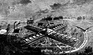
International Cotton Exposition
Exposition held in Atlanta, Georgia, USA it 1881
Distance: Approx. 420 meters
Latitude and longitude: 33.784457,-84.41574
International Cotton Exposition (I.C.E.) was a world's fair held in Atlanta, Georgia, from October 4 to December 31 of 1881. The location was along the Western & Atlantic Railroad tracks near the present-day King Plow Arts Center development in the West Midtown area. It planned to show the progress made since the city's destruction during the Battle of Atlanta and new developments in cotton production.
Upper Westside, Atlanta
Distance: Approx. 158 meters
Latitude and longitude: 33.785917,-84.411222
Upper Westside is a colloquial area, comprising many historical neighborhoods located in Atlanta, Georgia. The neighborhood is located in the northwestern sector of Atlanta, west of I-75 and inside I-285, to the south of Vinings and to the west of Buckhead. It was developed in the 19th century as an industrial hub.
West Midtown
Neighborhood in Atlanta, Georgia, US
Distance: Approx. 158 meters
Latitude and longitude: 33.785917,-84.411222
West Midtown, also known as Westside, is a colloquial area, comprising many historical neighborhoods located in Atlanta, Georgia. Once largely industrial, West Midtown is now the location of urban lofts, art galleries, live music venues, retail and restaurants.
Howell Interlocking Historic District
Historic district in Georgia, United States
Distance: Approx. 416 meters
Latitude and longitude: 33.784547,-84.415694
Howell Interlocking Historic District is the area in West Midtown, Atlanta where four railroad lines converge. It is adjacent to the Marietta Street Artery neighborhood, an area rich in industrial history, as an original industrial district built along Atlanta's first railway line (1837).
PatchWerk Recording Studios
Recording studio in Atlanta, Georgia
Distance: Approx. 446 meters
Latitude and longitude: 33.78472222,-84.40638889
Patchwerk Recording Studios is a recording studio located at 1094 Hemphill Avenue, West Midtown in Atlanta, GA. It was established in 1993 by former NFL offensive tackle Bob Whitfield of the Atlanta Falcons, and is currently owned and operated by Curtis Daniel III and Mike Wilson. The facility features two totally isolated recording studios, namely Studio 995 and Studio 9000, along with Studio 1019, a vocal tracking and editing studio in the 9000 wing of the building. Apart from the facility's use as a recording studio, the premises are also used for audio mastering in the Mastering Studio, a Production Studio for beatmakers, as well as offering Paperwerk Registration, Video and Photography, and Graphic Design services.
Goat Farm Arts Center
United States historic place
Distance: Approx. 503 meters
Latitude and longitude: 33.786228,-84.416226
The Goat Farm Arts Center is a visual and performing arts center located in West Midtown, Atlanta, Georgia. The center is housed in a 19th-century complex of industrial buildings and contains the studio space of over 300 artists. Goat Farm hosts music concerts, traditional and experimental theatrical performances, film screenings, contemporary dance performances, art exhibitions, artist residency programs, and professional ballet and contemporary dance classes.

Westside Provisions
Neighborhood in Georgia, United States
Distance: Approx. 297 meters
Latitude and longitude: 33.787163,-84.411344
Westside Provisions is a mixed use neighborhood located in the West Midtown area of Atlanta, Georgia, United States.
Howard School (Atlanta)
School in Atlanta, Georgia, United States
Distance: Approx. 598 meters
Latitude and longitude: 33.787131,-84.416833
The Howard School (THS) is located in Atlanta, Georgia, United States. It was founded by Marian Howard in 1950 to give students alternative approaches to learning. Students with language-based learning disabilities and learning differences from grades K-12 may attend the school.
Midtown West (commercial development)
Distance: Approx. 531 meters
Latitude and longitude: 33.779733,-84.411405
Midtown West is a 12-acre commercial development in West Midtown, Atlanta. It consists of historic warehouse space renovated for use as restaurants, other hospitality and offices. It includes the Brickworks building at the intersection of Howell Mill Rd.
Antico Pizza
Restaurant in Georgia, United States
Distance: Approx. 519 meters
Latitude and longitude: 33.784659,-84.40559
Antico Pizza Napoletana is a pizzeria located in Atlanta, Georgia. In 2015, it is considered the 7th highest rated pizzeria in the United States by TripAdvisor.
Hayakawa (restaurant)
Restaurant in Atlanta, Georgia, U.S.
Distance: Approx. 115 meters
Latitude and longitude: 33.78347222,-84.41125
Hayakawa (formerly Sushi Hayakawa) is a restaurant in Atlanta, Georgia. The restaurant serves Japanese cuisine and received a Michelin star in 2023.
Mujō (restaurant)
Restaurant in Atlanta, Georgia, U.S.
Distance: Approx. 180 meters
Latitude and longitude: 33.78611111,-84.41138889
Mujō is a restaurant in Atlanta, Georgia. The restaurant serves Japanese cuisine and received a Michelin star in 2023.
Weather in this IP's area
overcast clouds
18 Celsius
18 Celsius
17 Celsius
19 Celsius
1023 hPa
57 %
1023 hPa
989 hPa
10000 meters
6.17 m/s
90 degree
100 %
07:04:39
17:38:29


