50.216.147.70 - IP Lookup: Free IP Address Lookup, Postal Code Lookup, IP Location Lookup, IP ASN, Public IP
Country:
 USA
USARegion:
City:
Location:
Time Zone:
Postal Code:
ISP:
ASN:
language:
User-Agent:
Proxy IP:
Blacklist:
IP information under different IP Channel
ip-api
Country
Region
City
ASN
Time Zone
ISP
Blacklist
Proxy
Latitude
Longitude
Postal
Route
db-ip
Country
Region
City
ASN
Time Zone
ISP
Blacklist
Proxy
Latitude
Longitude
Postal
Route
IPinfo
Country
Region
City
ASN
Time Zone
ISP
Blacklist
Proxy
Latitude
Longitude
Postal
Route
IP2Location
50.216.147.70Country
usRegion
colorado
City
wheat ridge
Time Zone
America/Denver
ISP
Language
User-Agent
Latitude
Longitude
Postal
ipdata
Country
Region
City
ASN
Time Zone
ISP
Blacklist
Proxy
Latitude
Longitude
Postal
Route
Popular places and events near this IP address
Edgewater, Colorado
City in Colorado, United States
Distance: Approx. 2105 meters
Latitude and longitude: 39.75082,-105.062615
The City of Edgewater is a home rule municipality located in Jefferson County, Colorado, United States. The city population was 5,005 at the 2020 United States Census. Edgewater is surrounded by Denver to the east, Lakewood to the south and west, and Wheat Ridge to the north.

Mountain View, Colorado
Town in Colorado, United States
Distance: Approx. 1994 meters
Latitude and longitude: 39.77472222,-105.05666667
The Town of Mountain View is a home rule municipality located in Jefferson County, Colorado, United States. Mountain View is situated west of, and adjacent to, the city and county of Denver. As of the 2020 census, the population of Mountain View was 541.

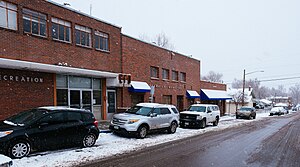
Wheat Ridge, Colorado
City in Colorado, United States
Distance: Approx. 11 meters
Latitude and longitude: 39.76611111,-105.07722222
The City of Wheat Ridge is a home rule municipality located in Jefferson County, Colorado, United States. Wheat Ridge is located immediately west of Denver and is a part of the Denver–Aurora–Lakewood, CO Metropolitan Statistical Area. The Wheat Ridge Municipal Center is approximately 5 miles (8 km) west-northwest of the Colorado State Capitol in Denver.

Lakeside Amusement Park
Amusement park in Lakeside, Colorado
Distance: Approx. 2034 meters
Latitude and longitude: 39.77833333,-105.05944444
Lakeside Amusement Park is a family-owned amusement park in Lakeside, Colorado, adjacent to Denver. Opened in 1908, it is the oldest amusement park in Colorado still operating in its original location, and is the lone remaining American amusement park to have had the name White City. The park, comprising nearly half of the Town of Lakeside that it was responsible for creating in 1907, features the landmark Tower of Jewels.

Lake Rhoda
Natural freshwater lake in Jefferson County, Colorado
Distance: Approx. 2301 meters
Latitude and longitude: 39.7808,-105.0582
Lake Rhoda is a natural lake in the town of Lakeside, Colorado, located between Interstate 70 and West 44th Avenue. Originally named West Berkeley Lake, it was renamed for Rhoda Krasner by her father, Ben Krasner, who rescued Lakeside Amusement Park from bankruptcy during the Great Depression.
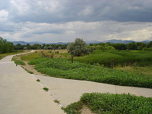
Crown Hill Park
Park in Colorado, United States
Distance: Approx. 1936 meters
Latitude and longitude: 39.75969,-105.09813
Crown Hill Park is a 242-acre (0.98 km2) recreation area operated by Jefferson County Open Space in unincorporated Jefferson County, Colorado. The park is located between the cities of Wheat Ridge and Lakewood. Within the borders of the park is a National Urban Wildlife Refuge.

Wheat Ridge High School
Public secondary school in Wheat Ridge, Colorado, United States
Distance: Approx. 2336 meters
Latitude and longitude: 39.763323,-105.104162
Wheat Ridge High School is a public secondary school operated by the Jefferson County School District R-1 in Wheat Ridge, Colorado, United States.

Tower of Memories
United States historic place
Distance: Approx. 1754 meters
Latitude and longitude: 39.75805556,-105.09472222
The Tower of Memories is a mausoleum located at Crown Hill Cemetery in unincorporated Jefferson County, Colorado, US. The seven-story building is 158 feet (48.16 m) tall; its entrance is at 29th Avenue and Wadsworth Boulevard. The building was designed with Gothic detailing by Charles A. Smith in 1926. After his firm failed in 1928, the architects William and Arthur Fisher were commissioned to continue the construction.
Our Lady of the Rosary Academy
Private, coeducational school in Mountain View, , Colorado, United States
Distance: Approx. 1742 meters
Latitude and longitude: 39.77388889,-105.05944444
Our Lady of the Rosary Academy is a private, Roman Catholic high school in Mountain View, Colorado. It is operated independent of the Roman Catholic Archdiocese of Denver.
Jefferson High School (Edgewater, Colorado)
Public secondary school in Edgewater, Colorado, United States
Distance: Approx. 1754 meters
Latitude and longitude: 39.750786,-105.072276
Jefferson High School is a high school located in Edgewater, Colorado, United States. It is operated by Jefferson County Public Schools.
List of people from Wheat Ridge, Colorado
List of some notable people who have lived in the City of Wheat Ridge, Colorado, United States
Distance: Approx. 9 meters
Latitude and longitude: 39.7661,-105.0772
This is a list of some notable people who have lived in the City of Wheat Ridge, Colorado, United States.

Cyclone (Lakeside Amusement Park)
American roller coaster
Distance: Approx. 2566 meters
Latitude and longitude: 39.7808,-105.054
The Cyclone is a wooden roller coaster located at Lakeside Amusement Park in Lakeside, Colorado. Designed by Edward A. Vettel, the coaster opened in 1940. Following the closure of Blue Streak at Conneaut Lake Park, Cyclone is the last remaining roller coaster ever designed by Edward A. Vettel.
Weather in this IP's area
broken clouds
7 Celsius
7 Celsius
1 Celsius
9 Celsius
1010 hPa
45 %
1010 hPa
825 hPa
10000 meters
0.83 m/s
0.88 m/s
278 degree
76 %