50.207.80.86 - IP Lookup: Free IP Address Lookup, Postal Code Lookup, IP Location Lookup, IP ASN, Public IP
Country:
 USA
USARegion:
City:
Location:
Time Zone:
Postal Code:
ISP:
ASN:
language:
User-Agent:
Proxy IP:
Blacklist:
IP information under different IP Channel
ip-api
Country
Region
City
ASN
Time Zone
ISP
Blacklist
Proxy
Latitude
Longitude
Postal
Route
db-ip
Country
Region
City
ASN
Time Zone
ISP
Blacklist
Proxy
Latitude
Longitude
Postal
Route
IPinfo
Country
Region
City
ASN
Time Zone
ISP
Blacklist
Proxy
Latitude
Longitude
Postal
Route
IP2Location
50.207.80.86Country
usRegion
colorado
City
arvada
Time Zone
America/Denver
ISP
Language
User-Agent
Latitude
Longitude
Postal
ipdata
Country
Region
City
ASN
Time Zone
ISP
Blacklist
Proxy
Latitude
Longitude
Postal
Route
Popular places and events near this IP address

Arvada, Colorado
A Home Rule City in Jefferson and Adams counties, Colorado, United States.
Distance: Approx. 0 meters
Latitude and longitude: 39.8028,-105.0875
Arvada () is a Home Rule City located in Jefferson and Adams counties, Colorado, United States. The city population was 124,402 at the 2020 United States Census, with 121,510 residing in Jefferson County and 2,892 in Adams County. Arvada is the seventh most populous city in Colorado.

Ralston Creek (Colorado)
River
Distance: Approx. 2899 meters
Latitude and longitude: 39.79805556,-105.05416667
Ralston Creek is a tributary of Clear Creek, approximately 32 miles (51 km) long, in central Colorado in the United States. It drains a suburban and urban area of the northwestern Denver Metropolitan Area. It rises in the foothills in northeastern Gilpin County, in southern Golden Gate Canyon State Park.

Arvada High School
American high school in Colorado
Distance: Approx. 1467 meters
Latitude and longitude: 39.8158333,-105.085
Arvada High School is a public secondary school operated by Jefferson County School District R-1 in Arvada, Colorado, United States.

Arvada Center for the Arts and Humanities
Arts center in Arvada, Colorado
Distance: Approx. 2302 meters
Latitude and longitude: 39.823252,-105.083531
The Arvada Center for the Arts and Humanities is a nonprofit, multi-use cultural facility in Arvada, Colorado, United States, which opened in 1976. The Arvada Center facility comprises the Arvada History Museum, three theatres, 10,000 square feet of art galleries, music, dance, and theatre rehearsal rooms, classrooms, a conference center, and an amphitheater.

Olde Town Arvada
United States historic place
Distance: Approx. 593 meters
Latitude and longitude: 39.80027778,-105.08138889
Olde Town Arvada is a 15.1-acre (6.1 ha) historic district in Arvada, Colorado bounded by Ralston Road, Teller Road, Grandview Avenue and Yukon Street. It was listed on the National Register of Historic Places in 1998. The listing included 42 contributing buildings.

Arvada Flour Mill
United States historic place
Distance: Approx. 757 meters
Latitude and longitude: 39.79833333,-105.08083333
Arvada Flour Mill, also known as Tiller's Moving & Storage, Inc. is a vacant flour mill in Arvada, Colorado, that is or was owned by Tiller's Moving & Storage, Inc. It was listed on the National Register of Historic Places in 1975.
Foothills Academy (Colorado)
School in Wheat Ridge, Jefferson County, Colorado, United States
Distance: Approx. 3222 meters
Latitude and longitude: 39.783311,-105.11535
Foothills Academy has been out of business for several years Foothill Academy is a private school in Wheat Ridge, Colorado. It offers pre-kindergarten through Grade 12. The school was founded in 1984.
Lewis Ralston
Distance: Approx. 2738 meters
Latitude and longitude: 39.798,-105.0561
Lewis Ralston was an American placer gold prospector from Georgia who made the first recorded discovery of gold in the Rocky Mountain region.
Hackberry Hill
Hill in Arvada, Colorado
Distance: Approx. 2738 meters
Latitude and longitude: 39.82694444,-105.08138889
Hackberry Hill is a hill in northeast Arvada, Colorado between the Ralston Creek and Little Dry Creek watersheds.
List of people from Arvada, Colorado
List of some notable people who have lived in the City of Arvada, Colorado, United States.
Distance: Approx. 0 meters
Latitude and longitude: 39.8028,-105.0875
This is a list of some notable people who have lived in the City of Arvada, Colorado, United States.

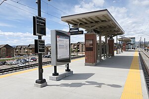
Olde Town Arvada station
Commuter rail station in Arvada, Colorado
Distance: Approx. 747 meters
Latitude and longitude: 39.799,-105.0803
Olde Town Arvada station is a commuter rail station on the G Line of the Denver RTD system in Denver, Colorado. It is located in downtown Arvada, Colorado and is the fifth stop from Denver Union Station. The station includes 600 parking spaces in a parking garage that is shared with local businesses.
Arvada Ridge station
Commuter rail station in Arvada, Colorado
Distance: Approx. 2343 meters
Latitude and longitude: 39.7925,-105.11138889
Arvada Ridge station is a Regional Transportation District (RTD) commuter rail station on the G Line between Denver Union Station and Wheat Ridge, Colorado. The station is located in western Arvada, Colorado, on the west side of Kipling Parkway and near Red Rocks Community College's Arvada campus. It includes bus bays, a 200-stall park and ride, and a pedestrian underpass connecting the platform to Ridge Road and the park and ride.
Weather in this IP's area
clear sky
3 Celsius
2 Celsius
-0 Celsius
7 Celsius
1010 hPa
55 %
1010 hPa
822 hPa
10000 meters
1.54 m/s