Country:
Region:
City:
Latitude and Longitude:
Time Zone:
Postal Code:
IP information under different IP Channel
ip-api
Country
Region
City
ASN
Time Zone
ISP
Blacklist
Proxy
Latitude
Longitude
Postal
Route
Luminati
Country
Region
ca
City
sanfrancisco
ASN
Time Zone
America/Los_Angeles
ISP
AS-SONICTELECOM
Latitude
Longitude
Postal
IPinfo
Country
Region
City
ASN
Time Zone
ISP
Blacklist
Proxy
Latitude
Longitude
Postal
Route
db-ip
Country
Region
City
ASN
Time Zone
ISP
Blacklist
Proxy
Latitude
Longitude
Postal
Route
ipdata
Country
Region
City
ASN
Time Zone
ISP
Blacklist
Proxy
Latitude
Longitude
Postal
Route
Popular places and events near this IP address
Rincon Hill, San Francisco
Neighborhood of San Francisco
Distance: Approx. 402 meters
Latitude and longitude: 37.78555556,-122.39194444
Rincon Hill (Spanish Rincón, meaning "corner") is a neighborhood in San Francisco, California. It is one of San Francisco's many hills, and one of its original "Seven Hills". The relatively compact neighborhood is bounded by Folsom Street to the north, the Embarcadero to the east, Bryant Street on the south, and Essex Street to the west.

One Rincon Hill
Upscale residential complex on the apex of Rincon Hill in San Francisco
Distance: Approx. 422 meters
Latitude and longitude: 37.785778,-122.392139
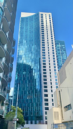
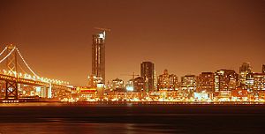
One Rincon Hill is an upscale residential complex on the apex of Rincon Hill in San Francisco, California, United States. The complex, designed by Solomon, Cordwell, Buenz and Associates and developed by Urban West Associates, consists of two skyscrapers that share a common townhouse podium. It is part of the San Francisco skyline and is visible from several parts of the Bay Area.

LUMINA
Residential condominiums in San Francisco, California
Distance: Approx. 555 meters
Latitude and longitude: 37.7887,-122.3919
LUMINA, also known as 201 Folsom Street, is a 655-unit residential condominium project in the Rincon Hill neighborhood of San Francisco. Developed by Tishman Speyer, it is located one block to the southwest of its sister project, The Infinity.

Pier 26 (San Francisco, California)
Historic pier in the US
Distance: Approx. 395 meters
Latitude and longitude: 37.78874167,-122.38770556
The existing historic Pier 26 in San Francisco is located on the Embarcadero with its entrance directly under the San Francisco–Oakland Bay Bridge, several blocks southeast of the Ferry Building. The pier is a single story gable timber structure that rests partially on concrete retainage but mostly on pier foundations on the bay. Its surface area measures approximately 100,000 square feet (9,300 m2), currently used for parking and storage.
Maritime Hall
Distance: Approx. 491 meters
Latitude and longitude: 37.78638889,-122.39277778
The Maritime Hall is a historic 3,000-capacity concert hall in San Francisco's South of Market neighborhood that operated from 1995 through 2001 as a popular music venue and nightclub. It was located at 450 Harrison Street (at First Street) at the Sailors Union of the Pacific building.

The Embarcadero and Brannan station
Distance: Approx. 114 meters
Latitude and longitude: 37.78436667,-122.38814722
Brannan and The Embarcadero station (often simply Brannan) is a Muni Metro light rail station located in the median of The Embarcadero south of Brannan Street in the South Beach area of San Francisco, California. Muni Metro trains use a high-level island platform, while historic streetcars use a pair of side platforms at the south end of the station.
2nd and King station
Light rail station in San Francisco, California
Distance: Approx. 114 meters
Latitude and longitude: 37.78436667,-122.38814722
2nd and King station is a Muni Metro light rail station located in the median of King Street near Second Street in the China Basin neighborhood of San Francisco, California. It is adjacent to Oracle Park. Muni Metro trains use a high-level island platform, while historic streetcars use a pair of side platforms just to the south.

399 Fremont Street
Residential skyscraper in San Francisco, U.S.
Distance: Approx. 470 meters
Latitude and longitude: 37.7872,-122.3921
399 Fremont Street is a 122 m (400 ft) residential skyscraper in the Rincon Hill neighborhood of San Francisco, California. The tower has 447 residential units on 42 floors, and 25,000 sq ft (2,300 m2) of amenity space.

340 Fremont Street
Residential apartments in San Francisco, California
Distance: Approx. 530 meters
Latitude and longitude: 37.78704,-122.39296
340 Fremont Street is a 440-foot (130 m) residential skyscraper in the Rincon Hill neighborhood of San Francisco, California. The tower has 348 residential units on 40 floors.
Lydia (whaling bark)
United States historic place and shipwreck site
Distance: Approx. 493 meters
Latitude and longitude: 37.78083333,-122.38833333
The Lydia is a wrecked whaling ship located below the foot of King Street in San Francisco, California. The ship was built in 1840 and wrecked in 1907. San Francisco was later built up over the site of the wreck, and it was not rediscovered until a sewer construction project unearthed the remains in 1980.

Rincon Point (San Francisco)
Distance: Approx. 413 meters
Latitude and longitude: 37.78888889,-122.38694444
Rincon Point, was a cape marking the southern extremity of Yerba Buena Cove in what is now San Francisco, California. Rincón is Spanish for "corner", and the point formed the southern corner of the cove. With the cove filled in and the Point landlocked, it is now the location where the Oakland Bay Bridge terminates in San Francisco.

BridgeView (San Francisco)
Residential apartments in San Francisco, California
Distance: Approx. 432 meters
Latitude and longitude: 37.786909,-122.3918129
BridgeView is a 333-foot (101 m) residential skyscraper in the Rincon Hill neighborhood of San Francisco, California. The tower has 245 residential units on 26 floors.
Weather in this IP's area
scattered clouds
19 Celsius
18 Celsius
18 Celsius
21 Celsius
1015 hPa
41 %
1015 hPa
1014 hPa
10000 meters
3.09 m/s
360 degree
40 %
06:44:04
17:02:53


