5.61.127.252 - IP Lookup: Free IP Address Lookup, Postal Code Lookup, IP Location Lookup, IP ASN, Public IP
Country:
Region:
City:
Location:
Time Zone:
Postal Code:
ISP:
ASN:
language:
User-Agent:
Proxy IP:
Blacklist:
IP information under different IP Channel
ip-api
Country
Region
City
ASN
Time Zone
ISP
Blacklist
Proxy
Latitude
Longitude
Postal
Route
db-ip
Country
Region
City
ASN
Time Zone
ISP
Blacklist
Proxy
Latitude
Longitude
Postal
Route
IPinfo
Country
Region
City
ASN
Time Zone
ISP
Blacklist
Proxy
Latitude
Longitude
Postal
Route
IP2Location
5.61.127.252Country
Region
scotland
City
blackburn
Time Zone
Europe/London
ISP
Language
User-Agent
Latitude
Longitude
Postal
ipdata
Country
Region
City
ASN
Time Zone
ISP
Blacklist
Proxy
Latitude
Longitude
Postal
Route
Popular places and events near this IP address

Blackburn, West Lothian
Town in West Lothian, Scotland
Distance: Approx. 969 meters
Latitude and longitude: 55.872,-3.621
Blackburn is a town in West Lothian, Scotland, near both Bathgate and Livingston, two of the larger towns in the county. It is situated approximately 20 miles (32 km) west of Edinburgh and 25 miles (40 km) east of Glasgow on the old A8 road.

Addiewell
Human settlement in Scotland
Distance: Approx. 2700 meters
Latitude and longitude: 55.845,-3.614
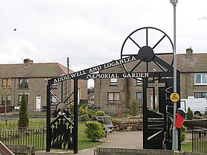
Addiewell (Scots: Aidieswall, Scottish Gaelic: Tobar Adaidh) is a former mining village in the Scottish council area of West Lothian. Historically it lies within the County of Midlothian. A new prison, HMP Addiewell, opened in 2008.

Seafield, West Lothian
Human settlement in Scotland
Distance: Approx. 2995 meters
Latitude and longitude: 55.877,-3.589
Seafield is a small village in West Lothian, Scotland. Seafield lies 1+1⁄4 miles (2.0 km) east of Blackburn, 2 miles (3.2 km) southeast of Bathgate (grid reference NT007660) and 3 miles (4.8 km) west of Livingston.

Stoneyburn
Human settlement in Scotland
Distance: Approx. 2087 meters
Latitude and longitude: 55.848,-3.631
Stoneyburn is a village in West Lothian, Scotland. The village was the site of a large coalmine, since discontinued. Nearby towns include Bathgate, Whitburn, Addiewell and Blackburn.
Blackburn United F.C.
Association football club in Scotland
Distance: Approx. 1151 meters
Latitude and longitude: 55.873368,-3.619214
Blackburn United Football Club are a Scottish football club from the town of Blackburn, West Lothian. The team plays at Tier 6 of the Scottish Football Pyramid in the East of Scotland League First Division having moved from the junior leagues in 2018. Blackburn United became full members of the Scottish Football Association in June 2019.

Blackburn House, West Lothian
Historic site in Bathgate, UK
Distance: Approx. 2299 meters
Latitude and longitude: 55.8731,-3.5983
Blackburn House is a category A-listed Georgian house, situated between Blackburn and Seafield near Bathgate in West Lothian, Scotland. The house comprises a compact central Palladian mansion house, with substantial east and west pavilions. The house was built by George Moncrieff in 1772.

East Whitburn
Human settlement in Scotland
Distance: Approx. 1612 meters
Latitude and longitude: 55.868,-3.659
East Whitburn is a small village in Scottish county of West Lothian. Bordering the mining town of Whitburn, East Whitburn has grown significantly in the past few years due to developments of large houses. It has one local store and a hairdressers on the main road passing through the village.
Whitburn Academy
Secondary school in Whitburn, West Lothian, Scotland
Distance: Approx. 2893 meters
Latitude and longitude: 55.8686,-3.6795
Whitburn Academy is a mixed secondary school in Whitburn, West Lothian, Scotland.

St Kentigern's Academy
Secondary school in Blackburn, West Lothian, Scotland
Distance: Approx. 526 meters
Latitude and longitude: 55.8714,-3.6342
St. Kentigern's Academy is a Roman Catholic, comprehensive school in Blackburn, West Lothian, Scotland. The school was built in 1945 and refurbished in 1973 and 2009.

Bents railway station
Disused railway station in Bents, West Lothian
Distance: Approx. 2969 meters
Latitude and longitude: 55.8419,-3.6508
Bents railway station served the village of Bents, West Lothian, Scotland, from 1865 to 1955 on the Longridge and Bathgate Extension Railway.

Whitburn railway station
Disused railway station in East Whitburn, West Lothian
Distance: Approx. 1636 meters
Latitude and longitude: 55.8689,-3.6592
Whitburn railway station served the town of East Whitburn, West Lothian, Scotland from 1850 to 1930 on the Longridge and Bathgate Extension Railway.

Foulshiels railway station
Short-lived railway station in Bathgate, West Lothian
Distance: Approx. 1429 meters
Latitude and longitude: 55.8556,-3.6448
Foulshiels railway station served the villages of nearby Stoneyburn and Whitburn, Scotland, from 1850 to 1852 on the Longridge and Bathgate Extension Railway.
Weather in this IP's area
clear sky
4 Celsius
4 Celsius
4 Celsius
6 Celsius
1029 hPa
100 %
1029 hPa
1008 hPa
10000 meters
1.03 m/s
320 degree