5.61.126.0 - IP Lookup: Free IP Address Lookup, Postal Code Lookup, IP Location Lookup, IP ASN, Public IP
Country:
Region:
City:
Location:
Time Zone:
Postal Code:
ISP:
ASN:
language:
User-Agent:
Proxy IP:
Blacklist:
IP information under different IP Channel
ip-api
Country
Region
City
ASN
Time Zone
ISP
Blacklist
Proxy
Latitude
Longitude
Postal
Route
db-ip
Country
Region
City
ASN
Time Zone
ISP
Blacklist
Proxy
Latitude
Longitude
Postal
Route
IPinfo
Country
Region
City
ASN
Time Zone
ISP
Blacklist
Proxy
Latitude
Longitude
Postal
Route
IP2Location
5.61.126.0Country
Region
england
City
preston
Time Zone
Europe/London
ISP
Language
User-Agent
Latitude
Longitude
Postal
ipdata
Country
Region
City
ASN
Time Zone
ISP
Blacklist
Proxy
Latitude
Longitude
Postal
Route
Popular places and events near this IP address

Preston, Dorset
Human settlement in England
Distance: Approx. 673 meters
Latitude and longitude: 50.64583333,-2.42361111
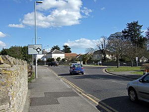
Preston is a coastal village and suburb of Weymouth in south Dorset, England. It is approximately 3 kilometres (2 mi) north-east of Weymouth town centre and 2 kilometres (1 mi) west of the village of Osmington. Preston contains two Haven campsites, Seaview and Weymouth Bay.

Jordan Hill Roman Temple
Distance: Approx. 1569 meters
Latitude and longitude: 50.637547,-2.427116
Jordan Hill Roman Temple is a Romano-Celtic temple and Roman ruin situated on Jordan Hill above Bowleaze Cove in the eastern suburbs of Weymouth in Dorset, England. Original amateur archaeological excavations on the site were carried out by J. Medhurst in 1843-6. These were followed by excavations by C.D. Drew and C.S. Prideaux during 1931-32 suggesting that the site was in operation between c. AD 69–79 to the late 4th century.

Osmington White Horse
Hill figure near Osmington, Dorset, England
Distance: Approx. 1199 meters
Latitude and longitude: 50.65741,-2.40438
The Osmington White Horse is a hill figure cut into the limestone of Osmington Hill just north of Weymouth in Dorset in 1808. It is in the South Dorset Downs in the parish of Osmington. The figure depicts King George III riding his horse and can be seen for miles around.
Culliford Tree Hundred
Hundred in Dorset, England
Distance: Approx. 1819 meters
Latitude and longitude: 50.664,-2.43
Culliford Tree Hundred was a hundred in the county of Dorset, England, containing the following parishes:

Bowleaze Cove
Distance: Approx. 1626 meters
Latitude and longitude: 50.6356,-2.4206
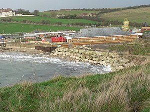
Bowleaze Cove is a small sand and shingle beach, near the village of Preston, just to the northeast of Weymouth, Dorset, England. The cove is on the Jurassic Coast and is known for its geology. Just to the west is Furzy Cliff.

Chalbury Hill and Quarry
Site of Special Scientific Interest in Dorset
Distance: Approx. 1283 meters
Latitude and longitude: 50.65307,-2.43422
Chalbury Hill And Quarry (grid reference SY694838) is an 11.9 hectare biological and geological Site of Special Scientific Interest in Dorset, England, notified in 1977. The site consists of grassland (10.3 hectare) and a disused limestone quarry (1.6 hectare). The SSSI includes the area covered by Chalbury Hill Fort.

Jordan Hill, Dorset
Hill in Dorset, England
Distance: Approx. 1461 meters
Latitude and longitude: 50.639,-2.428
See also Jordan Hill (disambiguation). Jordan Hill (50 m) is located near the coast close to the village of Preston, just to the east of Weymouth, Dorset, England. The hill leads down to Furzy Cliff on the coast to the south.

Furzy Cliff
Geological formation in Dorset, England
Distance: Approx. 1815 meters
Latitude and longitude: 50.6352,-2.4275
Furzy Cliff, also known as Jordan's Cliff, is located on the coast near the village of Preston, just to the east of Weymouth in Dorset, England. It is at the north-eastern end of Weymouth Beach, looking out over Weymouth Bay to Portland Harbour and the Isle of Portland. Close by to the east is Bowleaze Cove.

Broadrock
Distance: Approx. 1647 meters
Latitude and longitude: 50.6354,-2.4129
Broadrock is a cliff on the coast in Dorset, southern England. It faces out into Weymouth Bay between Bowleaze Cove and Redcliff Point. There are many landslips on the cliffs at this point.

River Jordan, Dorset
River in Dorset, England
Distance: Approx. 1551 meters
Latitude and longitude: 50.636371,-2.421231
The River Jordan (archaically known as the River Jordon) is a river in the county of Dorset, England. The river is approximately 3 miles (4.8 km) long, and includes the tributaries of the Osmington Brook and the Preston River. The River Jordan discharges into the English Channel at Bowleaze Cove, northeast of Weymouth.

Chalbury Hillfort
Iron Age hillfort in Dorset, England
Distance: Approx. 1167 meters
Latitude and longitude: 50.65361111,-2.43222222
Chalbury Hillfort is an Iron Age hillfort about 1 mile (1.6 km) south-east of the village of Bincombe, in Dorset, England. It is a scheduled monument.

Riviera Hotel, Weymouth
Hotel in Dorset, England
Distance: Approx. 1529 meters
Latitude and longitude: 50.6363,-2.4182
Riviera Hotel is a hotel at Bowleaze Cove, Weymouth, Dorset, England. Overlooking Weymouth Bay, the hotel was built in 1936–37 and has been a Grade II listed building since 1997. Historic England has remarked that it "epitomises the austere approach of the modernists in the immediate pre-war era, and suggests the designer's acquaintance with contemporary work in Rome and elsewhere".
Weather in this IP's area
clear sky
6 Celsius
6 Celsius
6 Celsius
6 Celsius
1034 hPa
90 %
1034 hPa
1026 hPa
10000 meters
1.39 m/s
1.4 m/s
117 degree
5 %