5.61.123.180 - IP Lookup: Free IP Address Lookup, Postal Code Lookup, IP Location Lookup, IP ASN, Public IP
Country:
Region:
City:
Location:
Time Zone:
Postal Code:
ISP:
ASN:
language:
User-Agent:
Proxy IP:
Blacklist:
IP information under different IP Channel
ip-api
Country
Region
City
ASN
Time Zone
ISP
Blacklist
Proxy
Latitude
Longitude
Postal
Route
db-ip
Country
Region
City
ASN
Time Zone
ISP
Blacklist
Proxy
Latitude
Longitude
Postal
Route
IPinfo
Country
Region
City
ASN
Time Zone
ISP
Blacklist
Proxy
Latitude
Longitude
Postal
Route
IP2Location
5.61.123.180Country
Region
england
City
lancaster
Time Zone
Europe/London
ISP
Language
User-Agent
Latitude
Longitude
Postal
ipdata
Country
Region
City
ASN
Time Zone
ISP
Blacklist
Proxy
Latitude
Longitude
Postal
Route
Popular places and events near this IP address

Poulton-le-Sands
Distance: Approx. 1807 meters
Latitude and longitude: 54.074,-2.858
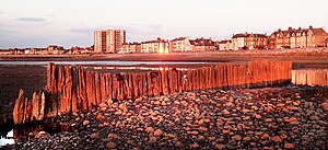
Poulton-le-Sands is one of three small villages that combined to create Morecambe, Lancashire, England, the other two being Torrisholme and Bare. A local board of health was established in 1852, which, taking its name from Morecambe Bay, became the borough of Morecambe in 1902. Poulton is known locally for its many murals which depict the origin of Poulton as a fishing village.
Christie Park (Morecambe)
Former stadium in Lancashire, England
Distance: Approx. 906 meters
Latitude and longitude: 54.0675,-2.8471
Christie Park was the home of Morecambe FC, located on the corner of Christie Avenue and Lancaster Road in Morecambe, Lancashire, England. Christie Park had a capacity of approximately 6,400. It comprised three covered stands and one uncovered stand.

Morecambe Bay Academy
Academy in Morecambe, Lancashire, England
Distance: Approx. 1481 meters
Latitude and longitude: 54.0755,-2.8503
Morecambe Bay Academy is a coeducational secondary school and sixth form located in Morecambe, Lancashire, England. It was founded as Morecambe Grammar School in 1919, moving to its current site on Dallam Avenue in 1938 on a former golf links course. In 2019, it was renamed to Morecambe Bay Academy during the process of becoming an academy.

Bare Lane railway station
Railway station in Lancashire, England
Distance: Approx. 892 meters
Latitude and longitude: 54.0746566,-2.8349663
Bare Lane is a railway station on the Morecambe Branch Line, which runs between Lancaster and Heysham Port. The station, situated 2+1⁄2 miles (4 km) west of Lancaster, serves the suburb of Bare in Morecambe, Lancashire. It is owned by Network Rail and managed by Northern Trains.
Lancaster and Morecambe College
College in Lancashire, England
Distance: Approx. 597 meters
Latitude and longitude: 54.0626,-2.8274
Lancaster and Morecambe College is a further education College situated on Torrisholme Road, between Lancaster and Morecambe, Lancashire, England. The college has been providing the local area with access to further and higher education since it was built in the 1950s although it can trace its mission back to Lancaster Mechanics Institute in 1824.

Bare, Morecambe
Human settlement in England
Distance: Approx. 1063 meters
Latitude and longitude: 54.076,-2.837
Bare is a suburb of and electoral ward in Morecambe, within the City of Lancaster district in Lancashire, England. The population of the ward as taken at the Census 2011 was 4,067. Bare has a high street (Princes Crescent), and a railway station connecting it to Morecambe and Lancaster.

Torrisholme
Human settlement in England
Distance: Approx. 229 meters
Latitude and longitude: 54.066,-2.83
Torrisholme is a suburb of Morecambe, Lancashire, on the North West coast of England. In the 2001 census, the Torrisholme Ward had a population of 6,758 living in 3,118 households, decreasing marginally to 6,755 at the 2011 Census. Torrisholme was referred to as Toredholme in the Domesday Book.

Holy Trinity Church, Morecambe
Church in Lancashire, England
Distance: Approx. 1809 meters
Latitude and longitude: 54.0746,-2.8575
Holy Trinity Church, Morecambe, or Morecambe Parish Church, is in Church Street, Morecambe, Lancashire, England. It is the Anglican parish church of Morecambe, in the deanery of Lancaster, the archdeaconry of Lancaster and the diocese of Blackburn. The church is recorded in the National Heritage List for England as a designated Grade II listed building.

St Christopher's Church, Bare
Distance: Approx. 1426 meters
Latitude and longitude: 54.0774,-2.8453
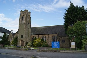
St Christopher's Church is in Marine Road East, Bare, Morecambe, Lancashire, England. It is an active Anglican parish church in the deanery of Lancaster and Morecambe, the archdeaconry of Lancaster, and the diocese of Blackburn. The church was built in 1933 to a design by Henry Paley of the Lancaster practice of Austin and Paley at a cost of £5,957 (equivalent to £240,000 in 2023).

Queen Victoria Hospital, Morecambe
Hospital in England
Distance: Approx. 1817 meters
Latitude and longitude: 54.0728,-2.8591
The Queen Victoria Hospital is a health facility on Thornton Road in Thornton Road, Morecambe, Lancashire, England. It is managed by the University Hospitals of Morecambe Bay NHS Foundation Trust.
Scale Hall railway station
Former station in Lancashire, England
Distance: Approx. 1709 meters
Latitude and longitude: 54.0555,-2.8154
Scale Hall railway station served the suburb of Scale Hall in Lancaster, Lancashire, England. The station was located near Scale Hall Lane on Morecambe Road. The station opened in 1957 and closed to passengers in 1966 with the line between Lancaster Green Ayre, and Morecambe Promenade.
Morecambe Poulton Lane railway station
Disused station in Lancashire, England
Distance: Approx. 1528 meters
Latitude and longitude: 54.07,-2.856
Morecambe Poulton Lane was the original terminus station of the London and North Western Railway's branch to Morecambe, Lancaster, Lancashire, England. It was opened to passengers in 1864 and closed in 1886, when it was replaced by Morecambe Euston Road. The line remains open between Morecambe and Lancaster, however nothing remains of the station.
Weather in this IP's area
scattered clouds
4 Celsius
3 Celsius
4 Celsius
4 Celsius
1032 hPa
99 %
1032 hPa
1026 hPa
10000 meters
1.74 m/s
1.7 m/s
168 degree
42 %