5.61.121.59 - IP Lookup: Free IP Address Lookup, Postal Code Lookup, IP Location Lookup, IP ASN, Public IP
Country:
Region:
City:
Location:
Time Zone:
Postal Code:
ISP:
ASN:
language:
User-Agent:
Proxy IP:
Blacklist:
IP information under different IP Channel
ip-api
Country
Region
City
ASN
Time Zone
ISP
Blacklist
Proxy
Latitude
Longitude
Postal
Route
db-ip
Country
Region
City
ASN
Time Zone
ISP
Blacklist
Proxy
Latitude
Longitude
Postal
Route
IPinfo
Country
Region
City
ASN
Time Zone
ISP
Blacklist
Proxy
Latitude
Longitude
Postal
Route
IP2Location
5.61.121.59Country
Region
england
City
grizebeck
Time Zone
Europe/London
ISP
Language
User-Agent
Latitude
Longitude
Postal
ipdata
Country
Region
City
ASN
Time Zone
ISP
Blacklist
Proxy
Latitude
Longitude
Postal
Route
Popular places and events near this IP address

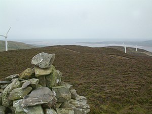
Kirkby Moor
Moorland area and SSSI in the South Lakeland district of Cumbria, England
Distance: Approx. 2325 meters
Latitude and longitude: 54.2454,-3.13863
Kirkby Moor is a poorly defined moorland area in southern Cumbria, England, named after the village of Kirkby-in-Furness, but stretching both sides of the A5092 road, and thus spanning the border of the Lake District National Park. The highest area, to the south of the road, and therefore outside the national park, is named Lowick High Common on Ordnance Survey maps, but "Kirkby Moor" is more commonly but incorrectly used. Lowick High common is the first UK SOTA summit to be activated 100 times.

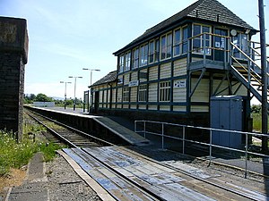
Kirkby-in-Furness railway station
Railway station in Cumbria, England
Distance: Approx. 2718 meters
Latitude and longitude: 54.2329033,-3.1872166
Kirkby-in-Furness is a railway station on the Cumbrian Coast Line, which runs between Carlisle and Barrow-in-Furness. The station, situated 9+1⁄4 miles (15 km) north of Barrow-in-Furness, serves the village of Kirkby-in-Furness in Cumbria. It is owned by Network Rail and managed by Northern Trains.

Foxfield railway station
Railway station in Cumbria, England
Distance: Approx. 3011 meters
Latitude and longitude: 54.2587172,-3.2161134
Foxfield is a railway station on the Cumbrian Coast Line, which runs between Carlisle and Barrow-in-Furness. The station, situated 11+1⁄2 miles (19 km) north of Barrow-in-Furness, serves the villages of Broughton-in-Furness and Foxfield in Cumbria. It is owned by Network Rail and managed by Northern Trains.

Kirkby-in-Furness
Village in the Furness district of Cumbria, England
Distance: Approx. 2907 meters
Latitude and longitude: 54.231,-3.187
Kirkby-in-Furness, generally referred to simply as Kirkby locally, is a village that is the major part of the parish of Kirkby Ireleth in the Furness district of Cumbria, England. Historically part of Lancashire, it is close to the Lake District National Park. It is about 3 miles (5 km) south of Broughton in Furness, 5 miles (8 km) northwest of Ulverston and 9 miles (14 km) north of Barrow-in-Furness.

Foxfield, Cumbria
Human settlement in England
Distance: Approx. 2930 meters
Latitude and longitude: 54.258,-3.215
Foxfield is a village on the west coast of Cumbria, England, in the Furness district that was part of Lancashire from 1182 to 1974. It lies on the Duddon Estuary, just outside the Lake District National Park, around ten miles to the north-east of Barrow-in-Furness and one mile out of Broughton-in-Furness. It is part of the parish of Broughton West.

Angerton, Westmorland and Furness
Civil parish in England
Distance: Approx. 2179 meters
Latitude and longitude: 54.239,-3.189
Angerton is a civil parish in the Westmorland and Furness district of the ceremonial county of Cumbria, England, historically part of the Furness portion of Lancashire. The parish includes a few houses, Angerton Hall, and Angerton Marsh. The 2001 census recorded a population of 14.

Kirkby Slate Quarries
Distance: Approx. 1421 meters
Latitude and longitude: 54.2467,-3.1539
Kirkby Slate Quarries, formally known as Burlington Slate Quarries, are located near Kirkby-in-Furness in Cumbria, England. The quarries have produced a characteristic blue-grey slate for over 450 years, with large-scale production starting in the early 19th century, when the Cavendish family organised small-scale quarrying activities by local farmers into a larger group of quarries, which then attracted others into the area to live and work in the quarries from the 1820s onwards. The slates were formed during the Early Devonian when a slaty cleavage was imposed on the Ordovician and Silurian rocks of the area.

Beanthwaite
Hamlet in Cumbria, England
Distance: Approx. 955 meters
Latitude and longitude: 54.253,-3.156
Beanthwaite is a hamlet in Cumbria, England.

Kirkby Ireleth
Parish in the Furness district of Cumbria, England
Distance: Approx. 2886 meters
Latitude and longitude: 54.232,-3.19
Kirkby Ireleth is a civil parish in the Westmorland and Furness district of the English county of Cumbria. It includes the villages of Grizebeck and Kirkby-in-Furness - which is really a collection of six different hamlets, namely: Soutergate, Wall End, Beck Side, Sand Side, Marshside and Chapels; and other outlying settlements including Bailiff Ground, Gargreave, Friars' Ground, Beanthwaite, Dove Bank, Dove Ford and Woodland. The parish had a population of 1,247 at the 2001 Census.

Eccle Riggs
Distance: Approx. 3174 meters
Latitude and longitude: 54.2705,-3.2114
Eccle Riggs is a country house located on Eccle Riggs, a ridge of land about 0.75 miles (1.2 km) to the south of Broughton-in-Furness, Cumbria, England. It was built in 1865 in Tudor style for Viscount Richard Assheton Cross, Home Secretary between 1874 and 1880 and 1885 and 1886. The house was designed by the Lancaster architect E. G. Paley.

Burney (hill)
Distance: Approx. 2064 meters
Latitude and longitude: 54.26333333,-3.14166667
Burney is a hill in Cumbria, England, to the north of the A5092 road between Greenodd and Broughton-in-Furness. It is the subject of a chapter of Wainwright's book The Outlying Fells of Lakeland. It reaches 979 feet (298 m) and has a trig point at the summit.

Gawthwaite
Human settlement in England
Distance: Approx. 3267 meters
Latitude and longitude: 54.254,-3.12
Gawthwaite is a village in Cumbria, England. It is located along the A5092 road, 4.8 miles (7.7 km) north of Ulverston. It is on the Gawthwaite Beck stream, on the edge of Lake District National Park.
Weather in this IP's area
overcast clouds
3 Celsius
-2 Celsius
3 Celsius
3 Celsius
992 hPa
91 %
992 hPa
976 hPa
10000 meters
6.77 m/s
13.7 m/s
122 degree
89 %