5.56.45.19 - IP Lookup: Free IP Address Lookup, Postal Code Lookup, IP Location Lookup, IP ASN, Public IP
Country:
Region:
City:
Location:
Time Zone:
Postal Code:
ISP:
ASN:
language:
User-Agent:
Proxy IP:
Blacklist:
IP information under different IP Channel
ip-api
Country
Region
City
ASN
Time Zone
ISP
Blacklist
Proxy
Latitude
Longitude
Postal
Route
db-ip
Country
Region
City
ASN
Time Zone
ISP
Blacklist
Proxy
Latitude
Longitude
Postal
Route
IPinfo
Country
Region
City
ASN
Time Zone
ISP
Blacklist
Proxy
Latitude
Longitude
Postal
Route
IP2Location
5.56.45.19Country
Region
grand-est
City
saint-germain
Time Zone
Europe/Paris
ISP
Language
User-Agent
Latitude
Longitude
Postal
ipdata
Country
Region
City
ASN
Time Zone
ISP
Blacklist
Proxy
Latitude
Longitude
Postal
Route
Popular places and events near this IP address
University of Technology of Troyes
Distance: Approx. 2871 meters
Latitude and longitude: 48.269155,4.067087
The University of Technology of Troyes (Université de Technologie de Troyes; UTT) is a French university, in the academy of Reims. The UTT is part of the network of the three universities of technology, found by the University of Technology of Compiègne. Inspired by the American University of Pennsylvania in Philadelphia, these three universities (UTC, UTBM and UTT) are a French mixture between the universities of this country and its schools of engineers (Grandes Ecoles).UTT is ranked in the top 10 engineering schools 2017 in France by Usine Nouvelle.
Laines-aux-Bois
Commune in Grand Est, France
Distance: Approx. 4160 meters
Latitude and longitude: 48.2342,3.9886
Laines-aux-Bois (French pronunciation: [lɛn o bwa]) is a commune in the Aube department in north-central France.
La Rivière-de-Corps
Commune in Grand Est, France
Distance: Approx. 3585 meters
Latitude and longitude: 48.2886,4.0206
La Rivière-de-Corps (French pronunciation: [la ʁivjɛʁ də kɔʁ]) is a commune in the Aube department in north-central France.
Rosières-près-Troyes
Commune in Grand Est, France
Distance: Approx. 2964 meters
Latitude and longitude: 48.2611,4.0722
Rosières-près-Troyes (French pronunciation: [ʁozjɛʁ pʁɛ tʁwa], lit. 'Rosières near Troyes') is a commune in the Aube department in north-central France.

Saint-André-les-Vergers
Commune in Grand Est, France
Distance: Approx. 3058 meters
Latitude and longitude: 48.2806,4.0547
Saint-André-les-Vergers (French pronunciation: [sɛ̃t‿ɑ̃dʁe le vɛʁʒe]) is a commune in the Aube department in north-central France.
Sainte-Savine
Commune in Grand Est, France
Distance: Approx. 4437 meters
Latitude and longitude: 48.2956,4.0497
Sainte-Savine (French pronunciation: [sɛ̃t savin]) is a commune in the Aube department in north-central France.

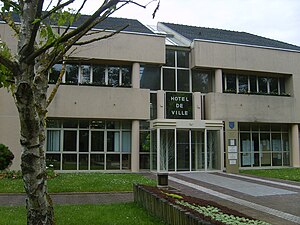
Saint-Germain, Aube
Commune in Grand Est, France
Distance: Approx. 134 meters
Latitude and longitude: 48.2586,4.0325
Saint-Germain (French pronunciation: [sɛ̃ ʒɛʁmɛ̃]) is a commune in the Aube department in north-central France.

Saint-Léger-près-Troyes
Commune in Grand Est, France
Distance: Approx. 4066 meters
Latitude and longitude: 48.2375,4.0786
Saint-Léger-près-Troyes (French pronunciation: [sɛ̃ leʒe pʁɛ tʁwa], literally 'Saint-Léger near Troyes') is a commune in the Aube department in north-central France.
Saint-Pouange
Commune in Grand Est, France
Distance: Approx. 3620 meters
Latitude and longitude: 48.2256,4.0428
Saint-Pouange is a commune in the Aube department in north-central France.

Torvilliers
Commune in Grand Est, France
Distance: Approx. 4638 meters
Latitude and longitude: 48.2764,3.9769
Torvilliers (French pronunciation: [tɔʁvilje]) is a commune in the Aube department in north-central France.

Croix la Beigne
Distance: Approx. 3960 meters
Latitude and longitude: 48.29119444,4.01588889
The Croix La Beigne or Croix la Motte is a cross located in the commune of Sainte-Savine (Aube department) in north-central France. The cross was built on a protohistoric tumulus (diameter : 15m - height : 3m), which is designated as monument historique listed by the French Ministry of Culture in 1965.

Canton of Saint-André-les-Vergers
Canton in Grand Est, France
Distance: Approx. 2827 meters
Latitude and longitude: 48.28,4.05
The canton of Saint-André-les-Vergers is an administrative division of the Aube department, northeastern France. It was created at the French canton reorganisation which came into effect in March 2015. Its seat is in Saint-André-les-Vergers.
Weather in this IP's area
light rain
8 Celsius
5 Celsius
8 Celsius
8 Celsius
1005 hPa
66 %
1005 hPa
986 hPa
10000 meters
5.14 m/s
170 degree


