5.42.139.56 - IP Lookup: Free IP Address Lookup, Postal Code Lookup, IP Location Lookup, IP ASN, Public IP
Country:
Region:
City:
Location:
Time Zone:
Postal Code:
IP information under different IP Channel
ip-api
Country
Region
City
ASN
Time Zone
ISP
Blacklist
Proxy
Latitude
Longitude
Postal
Route
Luminati
Country
Region
bw
City
muhlacker
ASN
Time Zone
Europe/Berlin
ISP
NetCom BW GmbH
Latitude
Longitude
Postal
IPinfo
Country
Region
City
ASN
Time Zone
ISP
Blacklist
Proxy
Latitude
Longitude
Postal
Route
IP2Location
5.42.139.56Country
Region
baden-wurttemberg
City
sinsheim
Time Zone
Europe/Berlin
ISP
Language
User-Agent
Latitude
Longitude
Postal
db-ip
Country
Region
City
ASN
Time Zone
ISP
Blacklist
Proxy
Latitude
Longitude
Postal
Route
ipdata
Country
Region
City
ASN
Time Zone
ISP
Blacklist
Proxy
Latitude
Longitude
Postal
Route
Popular places and events near this IP address

Technik Museum Sinsheim
Technology museum in Sinsheim, Germany
Distance: Approx. 2058 meters
Latitude and longitude: 49.23861111,8.89666667
The Technik Museum Sinsheim is a technology museum in Sinsheim, Germany. Opened in 1981, it is run by a registered association called "Auto & Technik Museum Sinsheim e. V." which also runs the nearby Technik Museum Speyer.

Sinsheim
Town in Baden-Württemberg, Germany
Distance: Approx. 466 meters
Latitude and longitude: 49.25,8.88333333
Sinsheim (German pronunciation: [ˈzɪnshaɪ̯m], South Franconian: Sinse) is a town in southwestern Germany, in the Rhine Neckar Area of the state Baden-Württemberg about 22 kilometres (14 mi) southeast of Heidelberg and about 28 kilometres (17 mi) northwest of Heilbronn in the district Rhein-Neckar.

Dietmar-Hopp-Stadion
Football venue in Hoffenheim, Germany
Distance: Approx. 3879 meters
Latitude and longitude: 49.27827778,8.84211111
The Dietmar-Hopp-Stadion (German pronunciation: [ˌdiːtmaʁˈhɔpˌʃtaːdi̯ɔn]) is a football ground in Hoffenheim, Baden-Württemberg, Germany. The 6,350-capacity stadium is the home of 1899 Hoffenheim II and the Hoffenheim women's section. It had been home to the Hoffenheim senior men's side until their promotion to the First Bundesliga for 2008–09.

Rhein-Neckar-Arena
Multi-purpose stadium in Sinsheim, Baden-Württemberg, Germany
Distance: Approx. 1772 meters
Latitude and longitude: 49.23805556,8.8875
Rhein-Neckar-Arena (German pronunciation: [ˌʁaɪnˈnɛkaʁʔaˌʁeːna] ), currently known as PreZero Arena and previously as Wirsol Rhein-Neckar-Arena [ˈvɪʁzɔl-] for sponsorship reasons, is a multi-purpose stadium in Sinsheim, Baden-Württemberg, Germany. It is used mostly for football matches and hosts the home matches of TSG Hoffenheim. The stadium has a capacity of 30,150 people.
Steinsfurt
Village of Sinsheim in Baden-Württemberg, Germany
Distance: Approx. 466 meters
Latitude and longitude: 49.25,8.88333333
Steinsfurt is a village in southwestern Germany, in the Rhine Neckar Area of the Bundesland Baden-Württemberg between Heidelberg and Heilbronn in the district Rhein-Neckar. It is one of the 13 Stadtteile of Sinsheim, of which it is part since 1973. It has a total population of 3,269 (as of December 2017).

Steinsberg Castle
Distance: Approx. 4332 meters
Latitude and longitude: 49.214,8.877
Steinsberg Castle is a castle in the village of Weiler, a suburb of Sinsheim in the German state of Baden-Württemberg.

Hoffenheim
Stadtteil of Sinsheim in Baden-Württemberg, Germany
Distance: Approx. 3289 meters
Latitude and longitude: 49.27222222,8.84444444
Hoffenheim (German pronunciation: [ˈhɔfn̩haɪm] ) is a village in Rhein-Neckar-Kreis, Baden-Württemberg, Germany. It belongs to the municipality of Sinsheim and, as of 2020, it has a population of 3,191.

Battle of Sinsheim
1674 battle
Distance: Approx. 5640 meters
Latitude and longitude: 49.2326,8.8076
The Battle of Sinsheim took place on 16 June 1674, near Sinsheim in modern Baden-Württemberg, then in the Holy Roman Empire. Part of the 1672 to 1678 Franco-Dutch War, a French army under Marshall Turenne defeated an Imperial force led by Aeneas de Caprara. The war began in May 1672, when a French army invaded the Dutch Republic.
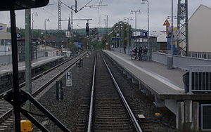
Sinsheim (Elsenz) Hauptbahnhof
Station on the Neckargemünd–Bad Friedrichshall-Jagstfeld railway
Distance: Approx. 386 meters
Latitude and longitude: 49.250537,8.874807
Sinsheim (Elsenz) Hauptbahnhof — called Sinsheim (Elsenz) station until 2010 — is a station on the Neckargemünd–Bad Friedrichshall-Jagstfeld railway in the German state of Baden-Württemberg. The station falls within the area of the Verkehrsverbund Rhein-Neckar (Transport association of Rhine-Neckar) and is an important station in the Kraichgau. In the area of the city of Sinsheim, there are also stations (all called Haltepunkte in German, "halts") at Hoffenheim, Sinsheim Museum/Arena, Steinsfurt and Reihen.

Hoffenheim station
Railway station in Sinsheim, Germany
Distance: Approx. 3607 meters
Latitude and longitude: 49.272,8.8386
Hoffenheim station (German: Bahnhof Hoffenheim) is a railway station in the municipality of Hoffenheim, located in the Rhein-Neckar-Kreis in Baden-Württemberg, Germany.

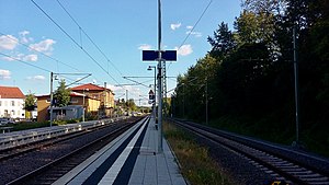
Sinsheim Museum/Arena station
Railway station in Germany
Distance: Approx. 1979 meters
Latitude and longitude: 49.2415,8.8996
Sinsheim Museum/Arena station (German: Bahnhof Sinsheim Museum/Arena) is a railway station in the municipality of Sinsheim, located in the Rhein-Neckar-Kreis in Baden-Württemberg, Germany.

Steinsfurt station
Railway station in Sinsheim, Germany
Distance: Approx. 2841 meters
Latitude and longitude: 49.236,8.908
Steinsfurt station (German: Bahnhof Steinsfurt) is a railway station in the municipality of Steinsfurt, located in the Rhein-Neckar-Kreis in Baden-Württemberg, Germany.
Weather in this IP's area
overcast clouds
2 Celsius
-2 Celsius
1 Celsius
3 Celsius
1025 hPa
83 %
1025 hPa
997 hPa
10000 meters
4.86 m/s
10.97 m/s
233 degree
100 %

