5.39.201.238 - IP Lookup: Free IP Address Lookup, Postal Code Lookup, IP Location Lookup, IP ASN, Public IP
Country:
Region:
City:
Location:
Time Zone:
Postal Code:
ISP:
ASN:
language:
User-Agent:
Proxy IP:
Blacklist:
IP information under different IP Channel
ip-api
Country
Region
City
ASN
Time Zone
ISP
Blacklist
Proxy
Latitude
Longitude
Postal
Route
db-ip
Country
Region
City
ASN
Time Zone
ISP
Blacklist
Proxy
Latitude
Longitude
Postal
Route
IPinfo
Country
Region
City
ASN
Time Zone
ISP
Blacklist
Proxy
Latitude
Longitude
Postal
Route
IP2Location
5.39.201.238Country
Region
kraj vysocina
City
cernovice
Time Zone
Europe/Prague
ISP
Language
User-Agent
Latitude
Longitude
Postal
ipdata
Country
Region
City
ASN
Time Zone
ISP
Blacklist
Proxy
Latitude
Longitude
Postal
Route
Popular places and events near this IP address

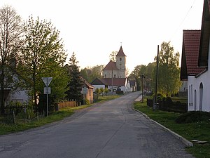
Černovice (Pelhřimov District)
Town in Vysočina, Czech Republic
Distance: Approx. 10 meters
Latitude and longitude: 49.37277778,14.96083333
Černovice (German: Tschernowitz) is a town in Pelhřimov District in the Vysočina Region of the Czech Republic. It has about 1,800 inhabitants.

Chrbonín
Municipality in South Bohemian, Czech Republic
Distance: Approx. 7166 meters
Latitude and longitude: 49.35861111,14.86444444
Chrbonín is a municipality and village in Tábor District in the South Bohemian Region of the Czech Republic. It has about 200 inhabitants. Chrbonín lies approximately 17 kilometres (11 mi) east of Tábor, 52 km (32 mi) north-east of České Budějovice, and 87 km (54 mi) south of Prague.

Vlčeves
Municipality in South Bohemian, Czech Republic
Distance: Approx. 4702 meters
Latitude and longitude: 49.35722222,14.90055556
Vlčeves is a municipality and village in Tábor District in the South Bohemian Region of the Czech Republic. It has about 100 inhabitants. Vlčeves lies approximately 20 kilometres (12 mi) east of Tábor, 53 km (33 mi) north-east of České Budějovice, and 89 km (55 mi) south-east of Prague.

Bořetín (Pelhřimov District)
Municipality in Vysočina, Czech Republic
Distance: Approx. 7014 meters
Latitude and longitude: 49.31027778,14.94777778
Bořetín is a municipality and village in Pelhřimov District in the Vysočina Region of the Czech Republic. It has about 100 inhabitants. Bořetín lies approximately 24 kilometres (15 mi) south-west of Pelhřimov, 48 km (30 mi) west of Jihlava, and 94 km (58 mi) south-east of Prague.

Dobrá Voda u Pacova
Municipality in Vysočina, Czech Republic
Distance: Approx. 5998 meters
Latitude and longitude: 49.40444444,15.02777778
Dobrá Voda u Pacova is a municipality and village in Pelhřimov District in the Vysočina Region of the Czech Republic. It has about 100 inhabitants. Dobrá Voda u Pacova lies approximately 15 kilometres (9 mi) west of Pelhřimov, 41 km (25 mi) west of Jihlava, and 88 km (55 mi) south-east of Prague.

Hojovice
Municipality in Vysočina, Czech Republic
Distance: Approx. 5771 meters
Latitude and longitude: 49.32833333,14.91972222
Hojovice is a municipality and village in Pelhřimov District in the Vysočina Region of the Czech Republic. It has about 90 inhabitants. Hojovice lies approximately 24 kilometres (15 mi) south-west of Pelhřimov, 49 km (30 mi) west of Jihlava, and 92 km (57 mi) south-east of Prague.

Kámen (Pelhřimov District)
Municipality in Vysočina, Czech Republic
Distance: Approx. 6900 meters
Latitude and longitude: 49.42333333,15.01583333
Kámen is a municipality and village in Pelhřimov District in the Vysočina Region of the Czech Republic. It has about 300 inhabitants.

Křeč
Municipality in Vysočina, Czech Republic
Distance: Approx. 3691 meters
Latitude and longitude: 49.38944444,14.91694444
Křeč is a municipality and village in Pelhřimov District in the Vysočina Region of the Czech Republic. It has about 200 inhabitants. Křeč lies approximately 23 kilometres (14 mi) west of Pelhřimov, 49 km (30 mi) west of Jihlava, and 87 km (54 mi) south-east of Prague.

Lidmaň
Municipality in Vysočina, Czech Republic
Distance: Approx. 5587 meters
Latitude and longitude: 49.38194444,15.03666667
Lidmaň is a municipality and village in Pelhřimov District in the Vysočina Region of the Czech Republic. It has about 300 inhabitants. Lidmaň lies approximately 15 kilometres (9 mi) west of Pelhřimov, 41 km (25 mi) west of Jihlava, and 90 km (56 mi) south-east of Prague.

Obrataň
Municipality in Vysočina, Czech Republic
Distance: Approx. 5955 meters
Latitude and longitude: 49.425,14.94361111
Obrataň is a municipality and village in Pelhřimov District in the Vysočina Region of the Czech Republic. It has about 800 inhabitants. Obrataň lies approximately 21 kilometres (13 mi) west of Pelhřimov, 48 km (30 mi) west of Jihlava, and 83 km (52 mi) south-east of Prague.

Věžná (Pelhřimov District)
Municipality in Vysočina, Czech Republic
Distance: Approx. 5042 meters
Latitude and longitude: 49.41416667,14.98888889
Věžná is a municipality and village in Pelhřimov District in the Vysočina Region of the Czech Republic. It has about 100 inhabitants.

Battle of Křeč
Battle of the Hussite Wars
Distance: Approx. 2601 meters
Latitude and longitude: 49.38722222,14.93277778
The Battle of Křeč occurred on 19 August 1435 and was the last real battle of the Hussite Wars. A year earlier, the Battle of Lipany brought an end to most Hussite power in Bohemia, but some groups had still continued fighting. Oldřich II of Rosenberg defeated the Taborites near the village of Křeč, which brought an end to their ability to carry out attacks.
Weather in this IP's area
overcast clouds
3 Celsius
-1 Celsius
2 Celsius
3 Celsius
1012 hPa
81 %
1012 hPa
947 hPa
10000 meters
4.75 m/s
10.49 m/s
237 degree
100 %