Country:
Region:
City:
Latitude and Longitude:
Time Zone:
Postal Code:
IP information under different IP Channel
ip-api
Country
Region
City
ASN
Time Zone
ISP
Blacklist
Proxy
Latitude
Longitude
Postal
Route
Luminati
Country
Region
21
City
zagreb
ASN
Time Zone
Europe/Zagreb
ISP
Telemach Hrvatska d.o.o.
Latitude
Longitude
Postal
IPinfo
Country
Region
City
ASN
Time Zone
ISP
Blacklist
Proxy
Latitude
Longitude
Postal
Route
db-ip
Country
Region
City
ASN
Time Zone
ISP
Blacklist
Proxy
Latitude
Longitude
Postal
Route
ipdata
Country
Region
City
ASN
Time Zone
ISP
Blacklist
Proxy
Latitude
Longitude
Postal
Route
Popular places and events near this IP address

Velika Gorica
City in Zagreb, Croatia
Distance: Approx. 1714 meters
Latitude and longitude: 45.7,16.06666667
Velika Gorica (Croatian pronunciation: [ʋêlikaː ɡǒritsa]) is the largest and most populous city in Zagreb County, Croatia. According to the 2011 census, the city itself has a population of 31,341, and the municipality has a population of 63,517 inhabitants. Velika Gorica is the centre of the historical Turopolje region.
Ribnica, Croatia
Village in Central Croatia, Croatia
Distance: Approx. 4527 meters
Latitude and longitude: 45.71666667,16.13333333
Ribnica is a small village in Croatia, 25 km south-east of Zagreb. It is administratively a part of the city of Velika Gorica and it has a population of 803 (census 2011).

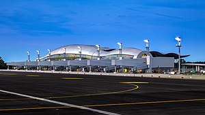
Zagreb Airport
Main international airport of Croatia; base of the Croatian Air Force and Air Defence
Distance: Approx. 3249 meters
Latitude and longitude: 45.74305556,16.06888889
Zagreb Franjo Tuđman Airport (Croatian: Zračna luka Franjo Tuđman Zagreb) or Zagreb Airport (Croatian: Zračna luka Zagreb) (IATA: ZAG, ICAO: LDZA) is an international airport serving Zagreb, Croatia. It is the largest and busiest airport in Croatia. In 2023 it handled 3.72 million passengers and some 10,859 tons of cargo.
Homeland Bridge
Bridge in Southeast Zagreb, Croatia
Distance: Approx. 6288 meters
Latitude and longitude: 45.77055556,16.06972222
Homeland Bridge (Croatian: Domovinski most) is an 840-meter-long (2,756 ft) bridge over the Sava River located in southeastern Zagreb, Croatia. Its administrative location is the city district Peščenica - Žitnjak. The bridge carries four lanes connecting the Radnička street between the Petruševec neighborhood in the north and the Kosnica interchange with the Zagreb bypass in the south.
HNK Gorica
Association football club
Distance: Approx. 1097 meters
Latitude and longitude: 45.72395,16.07317
Hrvatski nogometni klub Gorica (English: Croatian Football Club Gorica), commonly referred to as HNK Gorica, is a Croatian football club based in the town of Velika Gorica, located just south of the Croatian capital Zagreb. They play their home matches at the Gradski stadion Velika Gorica, which has a capacity of 5,200. They won the 2010–11 Croatian Second Football League title and were initially promoted to Croatian First Football League, but their top license was revoked.

Lukavec, Zagreb County
Village in Central Croatia, Croatia
Distance: Approx. 6733 meters
Latitude and longitude: 45.70333333,15.99
Lukavec is a village in central Croatia, 20 km south of Zagreb. It is administratively part of the city of Velika Gorica, Zagreb County. The population is 1,140 (census 2011).

Vukovina
Village in Central Croatia, Croatia
Distance: Approx. 4712 meters
Latitude and longitude: 45.68333333,16.11666667
Vukovina is a village in Croatia. It is connected by the D30 highway.

Stadion Radnik
Association football stadium in Velika Gorica, Croatia
Distance: Approx. 1102 meters
Latitude and longitude: 45.724,16.0732
Gradski Stadion Velika Gorica (Croatian pronunciation: [Gradski stadion Velika Gorica]), also known as Gradski stadion Velika Gorica [grǎtskiː stâdijoːn ʋêlikaː gǒrit͡sa] or Stadion ŠRC Velika Gorica, is an association football stadium in Velika Gorica, Croatia. It is the home stadium for the HNK Gorica football club. The stadium has a capacity of 4,536, all of which is seated.

Novo Čiče
Village in Central Croatia, Croatia
Distance: Approx. 3590 meters
Latitude and longitude: 45.7,16.11666667
Novo Čiče is a village in Croatia, situated about 4 km south east from center of Velika Gorica. Novo Čiče is well known for its lake, created by gravel mining. First records of the village date from 14th century when it was recorded as fiefdom near castle Želin.
Okuje
Village in Central Croatia, Croatia
Distance: Approx. 3500 meters
Latitude and longitude: 45.68333333,16.06666667
Okuje is a village in Croatia with a population of 467 (census 2011).
Petina, Croatia
Village in Central Croatia, Croatia
Distance: Approx. 4784 meters
Latitude and longitude: 45.7565,16.08608889
Petina is a Croatian village belonging to the town and municipality of Velika Gorica, in Zagreb County. In 2011, its population was 213.
Gornja Lomnica, Croatia
Village in Zagreb County, Croatia
Distance: Approx. 5851 meters
Latitude and longitude: 45.71666667,16
Gornja Lomnica is a settlement of Velika Gorica, which is part of the Zagreb metropolitan area, Croatia. The population is 580 (census 2011). The local nickname for the settlement, which is given by the last ruler (Lord Meštić), is Meštrica.
Weather in this IP's area
overcast clouds
5 Celsius
5 Celsius
4 Celsius
6 Celsius
1027 hPa
82 %
1027 hPa
1014 hPa
6000 meters
1.03 m/s
360 degree
100 %
06:48:42
16:30:42
