5.253.11.29 - IP Lookup: Free IP Address Lookup, Postal Code Lookup, IP Location Lookup, IP ASN, Public IP
Country:
Region:
City:
Location:
Time Zone:
Postal Code:
IP information under different IP Channel
ip-api
Country
Region
City
ASN
Time Zone
ISP
Blacklist
Proxy
Latitude
Longitude
Postal
Route
Luminati
Country
ASN
Time Zone
Europe/Berlin
ISP
DATAGROUP Operations GmbH
Latitude
Longitude
Postal
IPinfo
Country
Region
City
ASN
Time Zone
ISP
Blacklist
Proxy
Latitude
Longitude
Postal
Route
IP2Location
5.253.11.29Country
Region
rheinland-pfalz
City
isenburg
Time Zone
Europe/Berlin
ISP
Language
User-Agent
Latitude
Longitude
Postal
db-ip
Country
Region
City
ASN
Time Zone
ISP
Blacklist
Proxy
Latitude
Longitude
Postal
Route
ipdata
Country
Region
City
ASN
Time Zone
ISP
Blacklist
Proxy
Latitude
Longitude
Postal
Route
Popular places and events near this IP address

Anhausen
Municipality in Rhineland-Palatinate, Germany
Distance: Approx. 3837 meters
Latitude and longitude: 50.50111111,7.55361111
Anhausen is a municipality in the district of Neuwied, in Rhineland-Palatinate, Germany.

Großmaischeid
Municipality in Rhineland-Palatinate, Germany
Distance: Approx. 3383 meters
Latitude and longitude: 50.50472222,7.63388889
Großmaischeid is a municipality in the district of Neuwied, in Rhineland-Palatinate, Germany. It has approximately 2350 inhabitants and is placed in the Naturpark Rhein-Westerwald. The municipality is spelled with the 'sharp s' character ß which may ever so often be replaced by a 'ss', as e.g.
Kleinmaischeid
Municipality in Rhineland-Palatinate, Germany
Distance: Approx. 3254 meters
Latitude and longitude: 50.51166667,7.61111111
Kleinmaischeid is a municipality in the district of Neuwied, in Rhineland-Palatinate, Germany. Between 1 May 2004 and 31 December 2006, it was the centre point of the European Union. South of Kleinmaischeid lies Großmaischeid.

Meinborn
Municipality in Rhineland-Palatinate, Germany
Distance: Approx. 3193 meters
Latitude and longitude: 50.4975,7.56083333
Meinborn is a municipality in the district of Neuwied, in Rhineland-Palatinate, Germany.

Thalhausen
Municipality in Rhineland-Palatinate, Germany
Distance: Approx. 2409 meters
Latitude and longitude: 50.50305556,7.58611111
Thalhausen is a municipality in the district of Neuwied, in Rhineland-Palatinate, Germany.

Isenburg, Rhineland-Palatinate
Municipality in Rhineland-Palatinate, Germany
Distance: Approx. 994 meters
Latitude and longitude: 50.47722222,7.58972222
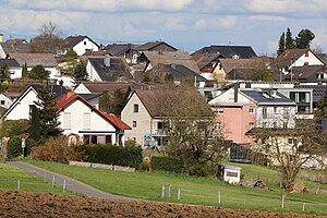
Isenburg is a municipality in the district of Neuwied, in Rhineland-Palatinate, Germany. The castle was built by the Counts of Isenburg around 1100 if not prior. Occupied by several branches of the Isenburg family (as a Ganerbenburg), it was inhabited into the early 17th century.

Alsbach, Westerwaldkreis
Municipality in Rhineland-Palatinate, Germany
Distance: Approx. 4813 meters
Latitude and longitude: 50.46555556,7.66194444
Alsbach is an Ortsgemeinde – a community belonging to a Verbandsgemeinde – in the Westerwaldkreis in Rhineland-Palatinate, Germany.

Caan, Germany
Municipality in Rhineland-Palatinate, Germany
Distance: Approx. 1225 meters
Latitude and longitude: 50.47472222,7.61083333
Caan is an Ortsgemeinde – a community belonging to a Verbandsgemeinde – in the Westerwaldkreis in Rhineland-Palatinate, Germany.

Wirscheid
Municipality in Rhineland-Palatinate, Germany
Distance: Approx. 4797 meters
Latitude and longitude: 50.47805556,7.66722222
Wirscheid is an Ortsgemeinde – a community belonging to a Verbandsgemeinde – in the Westerwaldkreis in Rhineland-Palatinate, Germany.

Nauort
Municipality in Rhineland-Palatinate, Germany
Distance: Approx. 2576 meters
Latitude and longitude: 50.46666667,7.62527778
Nauort is an Ortsgemeinde – a community belonging to a Verbandsgemeinde – in the Westerwaldkreis in Rhineland-Palatinate, Germany.

Sessenbach
Municipality in Rhineland-Palatinate, Germany
Distance: Approx. 3227 meters
Latitude and longitude: 50.47694444,7.64444444
Sessenbach is an Ortsgemeinde – a community belonging to a Verbandsgemeinde – in the Westerwaldkreis in Rhineland-Palatinate, Germany.

Neuwied Zoo
Distance: Approx. 4187 meters
Latitude and longitude: 50.453,7.565
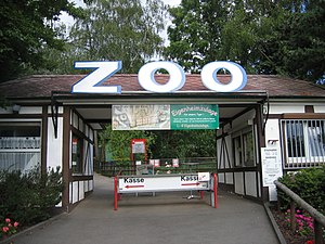
The Neuwied Zoo (German: Zoo Neuwied) is a zoo located on the edge of the town of Neuwied, Rhineland-Palatinate. It borders the Rhine-Westerwald Nature Park. In 2007, the zoo had over 270,000 visitors.
Weather in this IP's area
overcast clouds
3 Celsius
3 Celsius
2 Celsius
3 Celsius
1022 hPa
87 %
1022 hPa
990 hPa
10000 meters
0.45 m/s
2.24 m/s
220 degree
85 %
