5.226.144.255 - IP Lookup: Free IP Address Lookup, Postal Code Lookup, IP Location Lookup, IP ASN, Public IP
Country:
Region:
City:
Location:
Time Zone:
Postal Code:
IP information under different IP Channel
ip-api
Country
Region
City
ASN
Time Zone
ISP
Blacklist
Proxy
Latitude
Longitude
Postal
Route
Luminati
Country
Region
tg
City
frauenfeld
ASN
Time Zone
Europe/Zurich
ISP
Openfactory GmbH
Latitude
Longitude
Postal
IPinfo
Country
Region
City
ASN
Time Zone
ISP
Blacklist
Proxy
Latitude
Longitude
Postal
Route
IP2Location
5.226.144.255Country
Region
zurich
City
winterthur
Time Zone
Europe/Zurich
ISP
Language
User-Agent
Latitude
Longitude
Postal
db-ip
Country
Region
City
ASN
Time Zone
ISP
Blacklist
Proxy
Latitude
Longitude
Postal
Route
ipdata
Country
Region
City
ASN
Time Zone
ISP
Blacklist
Proxy
Latitude
Longitude
Postal
Route
Popular places and events near this IP address
Winterthur District
District in Switzerland
Distance: Approx. 1262 meters
Latitude and longitude: 47.5,8.76666667
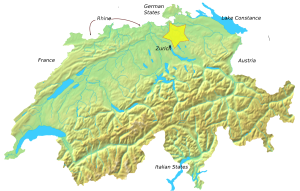
Winterthur District is one of the twelve districts of the German-speaking canton of Zürich, Switzerland. It has a population of 173,053 (as of 31 December 2020). Its capital is the city of Winterthur.

Mattenbach
District in Zürich, Switzerland
Distance: Approx. 1519 meters
Latitude and longitude: 47.487,8.747
Mattenbach is a district in the Swiss city of Winterthur. It is district number 7. The district comprises the quarters Deutweg, Gutschick and Endliker.

Talacker
Distance: Approx. 618 meters
Latitude and longitude: 47.506,8.751
Talacker is a quarter in the district 2 of Winterthur. It was formerly a part of Oberwinterthur municipality, which was incorporated into Winterthur in 1922. Talacker is also a bar in the city of Zürich (located at the Talacker-Strasse).

Grüze
Distance: Approx. 386 meters
Latitude and longitude: 47.49888889,8.75444444
Grüze is a quarter in the district 2 of Winterthur, Switzerland. It was a part of Oberwinterthur municipality, which was incorporated into Winterthur in 1922.

Battle of Winterthur
1799 battle of the French Revolutionary Wars
Distance: Approx. 56 meters
Latitude and longitude: 47.5,8.75
The Battle of Winterthur (27 May 1799) was an important action between elements of the Army of the Danube and elements of the Habsburg army, commanded by Friedrich Freiherr von Hotze, during the War of the Second Coalition, part of the French Revolutionary Wars. The small town of Winterthur lies 18 kilometers (11 mi) northeast of Zürich, in Switzerland. Because of its position at the junction of seven roads, the army that held the town controlled access to most of Switzerland and points crossing the Rhine into southern Germany.

Kunstmuseum Winterthur
Art museum in Winterthur, Switzerland
Distance: Approx. 1479 meters
Latitude and longitude: 47.50138889,8.73027778
The Kunst Museum Winterthur (The Winterthur Museum of Art) is an art museum in Winterthur, Switzerland run by the local Kunstverein. From its beginnings, the activities of the Kunstverein Winterthur were focused on contemporary art – first Impressionism, then Post-Impressionism and especially Les Nabis, through post-World War II and recently created works by Richard Hamilton, Mario Merz and Gerhard Richter.

Fotomuseum Winterthur
Art museum in Winterthur, Switzerland
Distance: Approx. 958 meters
Latitude and longitude: 47.49602,8.73902
Fotomuseum Winterthur is a museum of photography in Winterthur, Switzerland.

Oberwinterthur railway station
Railway station in Switzerland
Distance: Approx. 1154 meters
Latitude and longitude: 47.50777778,8.76083333
Oberwinterthur railway station (German: Bahnhof Oberwinterthur) is a railway station that serves Oberwinterthur, which is district number 2 in Winterthur, a city in the Canton of Zurich, Switzerland. Opened in 1855, the station is of simple design, and is owned and operated by the Swiss Federal Railways. It is served by four Zürich S-Bahn lines.
Winterthur Grüze railway station
Swiss railway station
Distance: Approx. 212 meters
Latitude and longitude: 47.49875306,8.75101889
Winterthur Grüze railway station (German: Bahnhof Winterthur Grüze) is a railway station that serves Grüze, an industrial zone in district number 2, Winterthur, a city in the canton of Zürich, Switzerland. Opened in 1855, the station was built as a junction station and is the largest freight hub in Winterthur. It forms part of both the Tösstal line and the St.

Vitudurum
Former Roman Vicus in Switzerland
Distance: Approx. 1247 meters
Latitude and longitude: 47.5,8.73333333
Vitudurum (sometimes Vitodorum) is the name of a Roman vicus, those remains are located in Oberwinterthur, a locality of the municipality of Winterthur in the canton of Zürich in Switzerland.

International School Winterthur
Defunct school in Winterthur, Switzerland
Distance: Approx. 1373 meters
Latitude and longitude: 47.5069,8.7655
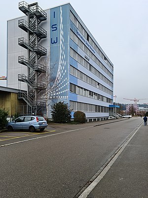
International School Winterthur (ISW) was an international school in Winterthur, Switzerland, serving ages 3 through 18. It was established in 2001, but closed suddenly on 22 May 2015 after declaring insolvency. ISW's Kindergarten and primary education programs (Primary Years Programms and part of Middle Years Programm) were approved by the bureau for elementary school (Volksschulamt), administration for education (Bildungsdirektion), canton of Zurich.

Winterthur Hegi railway station
Swiss railway station
Distance: Approx. 1463 meters
Latitude and longitude: 47.50156,8.76928806
Winterthur Hegi railway station (German: Bahnhof Winterthur Hegi) is a railway station in the municipality of Winterthur, in the Swiss canton of Zürich. It is an intermediate stop on the standard gauge St. Gallen–Winterthur line of Swiss Federal Railways.
Weather in this IP's area
scattered clouds
1 Celsius
1 Celsius
0 Celsius
2 Celsius
1027 hPa
84 %
1027 hPa
964 hPa
10000 meters
0.89 m/s
1.34 m/s
229 degree
40 %
