Country:
 Lithuania
Region:
City:
Latitude and Longitude:
Time Zone:
Postal Code:
IP information under different IP Channel
ip-api
Country
Region
City
ASN
Time Zone
ISP
Blacklist
Proxy
Latitude
Longitude
Postal
Route
IPinfo
Country
Region
City
ASN
Time Zone
ISP
Blacklist
Proxy
Latitude
Longitude
Postal
Route
MaxMind
Country
Region
City
ASN
Time Zone
ISP
Blacklist
Proxy
Latitude
Longitude
Postal
Route
Luminati
Country
LTRegion
vl
City
vilnius
ASN
Time Zone
Europe/Vilnius
ISP
UAB Cgates
Latitude
Longitude
Postal
db-ip
Country
Region
City
ASN
Time Zone
ISP
Blacklist
Proxy
Latitude
Longitude
Postal
Route
ipdata
Country
Region
City
ASN
Time Zone
ISP
Blacklist
Proxy
Latitude
Longitude
Postal
Route
Popular places and events near this IP address

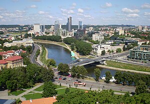
Vilnius
Capital and largest city of Lithuania
Distance: Approx. 455 meters
Latitude and longitude: 54.68722222,25.28
Vilnius ( VIL-nee-əs, Lithuanian: [ˈvʲɪlʲnʲʊs] ), previously known in English as Vilna, is the capital of and largest city in Lithuania and the second-most-populous city in the Baltic states. The city's estimated July 2024 population was 605,270, and the Vilnius urban area (which extends beyond the city limits) has an estimated population of 708,627. Vilnius is notable for the architecture of its Old Town, considered one of Europe's largest and best-preserved old towns.

Mindaugas Bridge
Bridge in Vilnius, Lithuania
Distance: Approx. 504 meters
Latitude and longitude: 54.68888889,25.28833333
The Mindaugas Bridge (Lithuanian: Mindaugo tiltas) is a bridge in Vilnius, Lithuania. It crosses Neris River and connects Žirmūnai elderate with the Old Town of Vilnius. The bridge was named after Mindaugas, King of Lithuania, and was opened in 2003 during the celebrations of the 750th anniversary of Mindaugas' coronation.
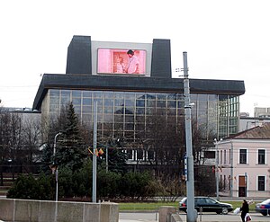
Lithuanian National Opera and Ballet Theatre
Theatre in Vilnius, Lithuania
Distance: Approx. 321 meters
Latitude and longitude: 54.68916667,25.27805556
Lithuanian National Opera and Ballet Theatre (LNOBT) (Lithuanian: Lietuvos nacionalinis operos ir baleto teatras), founded as Operos vaidykla, is an opera house and ballet theatre in Vilnius, Lithuania.

Green Bridge (Vilnius)
Bridge in Vilnius
Distance: Approx. 123 meters
Latitude and longitude: 54.69138889,25.27972222
The Green Bridge (Lithuanian: Žaliasis tiltas) is a bridge over the Neris River in Vilnius, Lithuania, that connects the city center with the district of Šnipiškės. The original 16th-century bridge was the oldest bridge in Vilnius.
Lithuanian Confederation of Industrialists
Distance: Approx. 358 meters
Latitude and longitude: 54.68944444,25.27694444
The Lithuanian Confederation of Industrialists (Lithuanian: Lietuvos pramonininku konfederacija) or LPK is a major association of industry associations and companies in Lithuania which represents the interests of large industrialists and employers. The Confederation in an umbrella organization uniting 52 trade and 5 regional associations and 24 non-associated members which comprise over 2700 medium and large enterprises from various public and private sectors. Confederation membership is entirely voluntary.

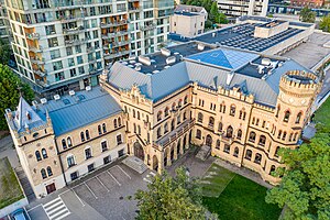
Energy and Technology Museum
Science museum, local museum in Rinktinės g. , Vilnius
Distance: Approx. 392 meters
Latitude and longitude: 54.690354,25.287515
Energy and Technology Museum (Lithuanian: Energetikos ir technikos muziejus) is an institution dedicated to researching and presenting energy history, the industrial heritage of Lithuania, and the history of Vilnius. It is housed in a former Vilnius power plant. At 5,000 square meters, this museum is the largest museum of technology in Lithuania.
Raduškevičius Palace
Distance: Approx. 145 meters
Latitude and longitude: 54.6925,25.28138889
The Raduškevičius Palace is a building in Vilnius, Kalvarijų st. 1. Currently it is headquarters of the Lithuanian Union of Architects.

Supreme Administrative Court of Lithuania
Distance: Approx. 445 meters
Latitude and longitude: 54.6884947,25.2866839
The Supreme Administrative Court of Lithuania (Lithuanian: Lietuvos vyriausiasis administracinis teismas) was formed and started its activities from the 1st of January 2001, following the amendment of Law on the Establishment of Administrative Courts of 19 September 2000.
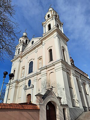
Church of St. Raphael the Archangel, Vilnius
Distance: Approx. 254 meters
Latitude and longitude: 54.69277778,25.27875
Church of St. Raphael the Archangel (Lithuanian: Šv. arkangelo Rapolo bažnyčia, Polish: Kościół Św.
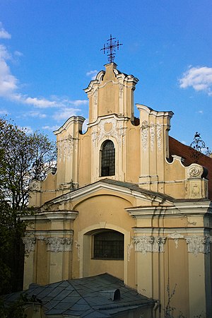
Church of St. George, Vilnius
Roman Catholic church in Vilnius, Lithuania built in 1765
Distance: Approx. 400 meters
Latitude and longitude: 54.68764444,25.28246944
Church of St. George (Lithuanian: Šv. Jurgio bažnyčia) is a Roman Catholic church in the Vilnius Old Town which was completed and consecrated in 1765.

Jakšto Street
Distance: Approx. 462 meters
Latitude and longitude: 54.688936,25.27558107
Jakšto Street (Lithuanian: Jakšto gatvė) is a short street in the central part of Vilnius, named after the Lithuanian Catholic theologist and philosopher Adomas Jakštas. It is some 350 metres long and leads from the principal Gediminas Avenue towards the Neris river, sloping by some 7 metres towards the north. The street is flanked by buildings built between the 1890s and the 2000s.
Žygimantų Street
Distance: Approx. 220 meters
Latitude and longitude: 54.69008698,25.28442604
Žygimantų Street is a street in the Vilnius Old Town, Vilnius, Lithuania. It follows the left bank of the Neris River on the stretch between the Mindaugas Bridge separating it from the Arsenal street and the Green Bridge separating it from the Albertas Goštautas street.
Weather in this IP's area
broken clouds
9 Celsius
7 Celsius
7 Celsius
9 Celsius
1020 hPa
93 %
1020 hPa
1008 hPa
10000 meters
3.09 m/s
30 degree
75 %
07:28:56
18:45:15