5.188.107.127 - IP Lookup: Free IP Address Lookup, Postal Code Lookup, IP Location Lookup, IP ASN, Public IP
Country:
Region:
City:
Location:
Time Zone:
Postal Code:
IP information under different IP Channel
ip-api
Country
Region
City
ASN
Time Zone
ISP
Blacklist
Proxy
Latitude
Longitude
Postal
Route
Luminati
Country
ASN
Time Zone
Europe/Moscow
ISP
Atomdata Jsc
Latitude
Longitude
Postal
IPinfo
Country
Region
City
ASN
Time Zone
ISP
Blacklist
Proxy
Latitude
Longitude
Postal
Route
IP2Location
5.188.107.127Country
Region
sankt-peterburg
City
pargolovo
Time Zone
Europe/Moscow
ISP
Language
User-Agent
Latitude
Longitude
Postal
db-ip
Country
Region
City
ASN
Time Zone
ISP
Blacklist
Proxy
Latitude
Longitude
Postal
Route
ipdata
Country
Region
City
ASN
Time Zone
ISP
Blacklist
Proxy
Latitude
Longitude
Postal
Route
Popular places and events near this IP address

Sertolovo
Town in Leningrad Oblast, Russia
Distance: Approx. 7661 meters
Latitude and longitude: 60.15,30.21666667
Sertolovo (Russian: Се́ртолово; Finnish: Sierattala) is a town in Vsevolozhsky District of Leningrad Oblast, Russia, located north of St. Petersburg. Population: 68,241 (2021 Census); 47,457 (2010 Census); 38,444 (2002 Census); 17,705 (1989 Soviet census).

Parnas (Saint Petersburg Metro)
Saint Petersburg Metro Station
Distance: Approx. 3887 meters
Latitude and longitude: 60.067978,30.330623
Parnas (Russian: Парна́с) is the northern terminus of the Moskovsko-Petrogradskaya Line of the Saint Petersburg Metro. It was opened on 22 December 2006 and is located between the tunnel portal and the Vyborgskoye Metro Depot. It is the northernmost subway station in Saint Petersburg and in Russia.

Levashovo (air base)
Distance: Approx. 4356 meters
Latitude and longitude: 60.08666667,30.19333333
Levashovo (also Levashevo) is an air base located to the southwest of Levashovo, within the northern limits of the federal subject of Saint Petersburg, Russia. The base is home to the 33rd Independent Composite Aviation Regiment. It houses mostly small transport planes mostly belonging to 549 AB (549th Air Base), most notably the Antonov An-12, Antonov An-26, and Tupolev Tu-134, along with Mi-6 and Mi-8 helicopters.
Levashovo Memorial Cemetery
Cemetery in Saint Petersburg, Russia
Distance: Approx. 4576 meters
Latitude and longitude: 60.09388889,30.19055556
Levashovo Memorial Cemetery (Russian: Левашовское мемориальное кладбище) commemorates the victims of political repression between 1937 and 1954: some were shot, others died in the city's prisons, all were buried here in unmarked graves. Archival evidence suggests that 19,540 bodies lie here, 8,000 of whom were shot or died during the Great Terror. The cemetery is located near the rail station at Levashovo, Saint Petersburg, in an empty area referred to in Russian as the Levashovskaya Pustosh (Russian: Левашовская пустошь), the Levashovo Wasteland.

Levashovo, Saint Petersburg
Distance: Approx. 3998 meters
Latitude and longitude: 60.1031,30.2075
Levashovo (Russian: Левашово) is a municipal settlement under the administrative jurisdiction of Vyborgsky District of the federal city of St. Petersburg, Russia, and a station of the Riihimäki – Saint Petersburg Railway. Population: 3,665 (2010 Census); 4,095 (2002 Census).
Yuny railway station
Railway station in Saint Petersburg, Russia
Distance: Approx. 6952 meters
Latitude and longitude: 60.02555556,30.29527778
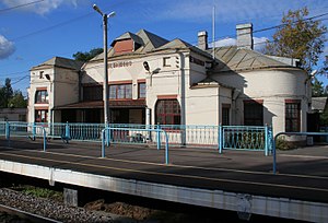
Yuny station (Russian: Ста́нция Ю́ный) is a railway station located in St. Petersburg, Russia. It was constructed by the JSC Primorskaya Saint Peterburg–Sestroretsk railway and was opened as part of the Ozerki line on July 23, 1893, under the name Grafskiy Pavilion (in translation - Count pavilion).

Ozyornaya railway station
Railway station in Saint Petersburg, Russia
Distance: Approx. 5486 meters
Latitude and longitude: 60.03916667,30.29638889
Ozyornaya station (Russian: Ста́нция Озёрная) is a railway station located in St. Petersburg, Russia. It was constructed by the JSC Prinorskaya Saint Peterburg–Sestroretsk railway and was opened on 23 July 1893 as part of the Ozerki line under the name "Ozerki".

Ozerki (Saint Petersburg Metro)
Saint Petersburg Metro Station
Distance: Approx. 6189 meters
Latitude and longitude: 60.03715,30.32151667
Ozerki (Russian: Озерки́) is a station on line 2 of the Saint Petersburg Metro, within the Ozerki historic district. It opened on 19 August 1988, and is between Udelnaya and Prospekt Prosvescheniya stations. It is a single-vault station, at a depth of 59 metres (194 ft).

Prospekt Prosvescheniya (Saint Petersburg Metro)
Saint Petersburg Metro Station
Distance: Approx. 5191 meters
Latitude and longitude: 60.05144167,30.33248889
Prospekt Prosvescheniya (Russian: Проспéкт Просвещéния, Education avenue) is a station of the Saint Petersburg Metro located between stations Ozerki and Parnas. It took its name from a nearby avenue. It was opened on 19 August 1988.
Vyborgsky District, Saint Petersburg
District in Saint Petersburg, Russia
Distance: Approx. 3448 meters
Latitude and longitude: 60.0563,30.262141
Vyborgsky District (Russian: Вы́боргский райо́н, romanized: Výborgskiy raión, IPA: [ˈvɨbərkskʲɪj rɐˈjɵn]) is an administrative and municipal district (raion), one of the 18 in Saint Petersburg, Russia.

Pargolovo
Distance: Approx. 883 meters
Latitude and longitude: 60.084,30.257
Pargolovo (Russian: Па́рголово, Finnish: Parkala, German: Pargola) is a municipal settlement in the Vyborgsky District of Saint Petersburg, Russia. Until the late 20th century, it was the city's northern suburb. The name derives from Parkola, a Karelian placename.
Ozerki (Historic district in Saint Petersburg)
District in Saint Petersburg, Russia
Distance: Approx. 6463 meters
Latitude and longitude: 60.03333333,30.31666667
Ozerki (Russian: Озерки́ - "small lakes") is a historic district in the northern part of Saint Petersburg. It has been included in the city in 1963. The district got its name from the Suzdal lakes which are located within its territory borders.
Weather in this IP's area
overcast clouds
4 Celsius
1 Celsius
4 Celsius
4 Celsius
1023 hPa
98 %
1023 hPa
1016 hPa
416 meters
4.64 m/s
13.13 m/s
254 degree
100 %
