Country:
 Poland
Region:
City:
Latitude and Longitude:
Time Zone:
Postal Code:
IP information under different IP Channel
ip-api
Country
Region
City
ASN
Time Zone
ISP
Blacklist
Proxy
Latitude
Longitude
Postal
Route
IPinfo
Country
Region
City
ASN
Time Zone
ISP
Blacklist
Proxy
Latitude
Longitude
Postal
Route
MaxMind
Country
Region
City
ASN
Time Zone
ISP
Blacklist
Proxy
Latitude
Longitude
Postal
Route
Luminati
Country
PLRegion
02
City
wilkszyn
ASN
Time Zone
Europe/Warsaw
ISP
Orange Polska Spolka Akcyjna
Latitude
Longitude
Postal
db-ip
Country
Region
City
ASN
Time Zone
ISP
Blacklist
Proxy
Latitude
Longitude
Postal
Route
ipdata
Country
Region
City
ASN
Time Zone
ISP
Blacklist
Proxy
Latitude
Longitude
Postal
Route
Popular places and events near this IP address

Wola
Major financial district in Warsaw, Poland
Distance: Approx. 832 meters
Latitude and longitude: 52.23333333,20.95722222
Wola (Polish pronunciation: [ˈvɔla] ) is a district in western Warsaw, Poland. An industrial area with traditions reaching back to the early 19th century, it underwent a transformation into a major financial district, featuring various landmarks and some of the tallest office buildings in the city.

Battle of Warsaw (1831)
Russian victory in the November Uprising
Distance: Approx. 435 meters
Latitude and longitude: 52.22722222,20.94305556
The battle of Warsaw (Polish: Bitwa pod Warszawą, Russian: Варшавская битва), also known as the battle and storming of Warsaw, was fought in September 1831 between Imperial Russia and Poland. After a two-day assault on the city's western fortifications, the Polish defences collapsed and the city was evacuated. It was the largest battle and the final episode of the Polish–Russian War of 1830–31, a conflict that became better known as the November Uprising.

Wola massacre
1944 extermination of civilians by Nazi forces in Wola, Warsaw, Poland
Distance: Approx. 771 meters
Latitude and longitude: 52.23,20.96
The Wola massacre (Polish: Rzeź Woli, lit. 'Wola slaughter') was the systematic killing of between 40,000 and 50,000 Poles in the Wola neighbourhood of the Polish capital city, Warsaw, by the German Waffen-SS and fellow Axis collaborators in the Azerbaijani Legion, as well as the predominantly-Russian RONA forces, which took place from 5 to 12 August 1944. The massacre was ordered by Heinrich Himmler, who directed to kill "anything that moves" to stop the Warsaw Uprising soon after it began. Tens of thousands of Polish civilians along with captured Home Army resistance fighters were murdered by the Germans in organised mass executions throughout Wola.

Warszawa Wola railway station
Railway station in Warsaw, Poland
Distance: Approx. 618 meters
Latitude and longitude: 52.22972222,20.95777778
Warszawa Wola railway station is a railway station in the Wola district of Warsaw, Poland. It was built on the Warsaw orbital line, which goes through Warszawa Gdańska station. In 2011, it is used exclusively by Koleje Mazowieckie who run the KM9 services from Warszawa Zachodnia through the north of the Masovian Voivodeship to Działdowo, in the Warmian-Masurian Voivodeship via Legionowo, Nasielsk, Modlin, Ciechanów and Mława, at all of which some trains terminate.

Orthodox Cemetery, Warsaw
Distance: Approx. 431 meters
Latitude and longitude: 52.23,20.94444444
The Orthodox Cemetery in Warsaw (Polish: Cmentarz Prawosławny w Warszawie) is an historic Eastern Orthodox cemetery located in the Wola district of Warsaw, Poland.

St. Lawrence's Church, Warsaw
Distance: Approx. 364 meters
Latitude and longitude: 52.22694444,20.94416667
St. Lawrence's Church (Polish: kościół św. Wawrzyńca) is a Roman Catholic church located in Warsaw's borough of Wola.
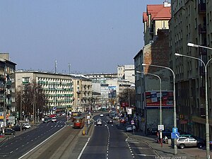
Wolska Street, Warsaw
Street in Wola, Warsaw, Poland
Distance: Approx. 434 meters
Latitude and longitude: 52.2303,20.954
Wolska (Polish: Ulica Wolska, lit. Wola Street) is the main artery of Warsaw's borough of Wola. Initially Wola district was but a western suburb of Warsaw and a road leading to it was dubbed "droga wolska" - Wola road.

St. John Climacus's Orthodox Church, Warsaw
Church in Warsaw, Poland
Distance: Approx. 202 meters
Latitude and longitude: 52.22795,20.9465
The St. John Climacus's Orthodox Church (Polish: Cerkiew św. Jana Klimaka, Russian: Церковь Святого Иоанна Лествичника) in Warsaw is an Orthodox parish church belonging to the Warsaw deanery of the diocese of Warsaw-Bielsk within the Polish Orthodox Church.

Odolany
Neighbourhood of Warsaw, Poland
Distance: Approx. 1044 meters
Latitude and longitude: 52.21931111,20.94223889
Odolany is a neighbourhood, and an area of the City Information System, in the city of Warsaw, Poland, located within the district of Wola.

Edward Szymański Park
Urban park in Warsaw, Poland
Distance: Approx. 707 meters
Latitude and longitude: 52.23388889,20.95083333
The Edward Szymański Park (Polish: Park im. Edwarda Szymańskiego) is an urban park in Warsaw, Poland. It is located in the neighbourhood of Ulrychów, within the district of Wola, between Elekcyjna Street, Wolska Street, Prymasa Tysiąclecia Avenue, and Górczewska Street.

Sowiński Park
Urban park in Warsaw, Poland
Distance: Approx. 289 meters
Latitude and longitude: 52.23,20.94777778
The General Józef Sowiński Park, also simply known as the Sowiński Park, is an urban park in Warsaw, Poland. It is located in the neighbourhood of Ulrychów, within the district of Wola, between Elekcyjna Street and Wolska Street. It was opened in 1936.

General Józef Sowiński Monument
Monument in Warsaw, Poland
Distance: Approx. 218 meters
Latitude and longitude: 52.22944444,20.94833333
The General Józef Sowiński Monument is a monument in Warsaw, Poland, located in the Sowiński Park within the district of Wola. It is dedicated to Józef Sowiński, a 19th-century officer who was a general of the Polish insurgent army during the November Uprising. It was made by Tadeusz Breyer and unveiled in 1937.
Weather in this IP's area
clear sky
21 Celsius
21 Celsius
19 Celsius
23 Celsius
1026 hPa
60 %
1026 hPa
1013 hPa
10000 meters
2.06 m/s
50 degree
06:14:22
18:47:03