5.182.50.155 - IP Lookup: Free IP Address Lookup, Postal Code Lookup, IP Location Lookup, IP ASN, Public IP
Country:
Region:
City:
Location:
Time Zone:
Postal Code:
ISP:
ASN:
language:
User-Agent:
Proxy IP:
Blacklist:
IP information under different IP Channel
ip-api
Country
Region
City
ASN
Time Zone
ISP
Blacklist
Proxy
Latitude
Longitude
Postal
Route
db-ip
Country
Region
City
ASN
Time Zone
ISP
Blacklist
Proxy
Latitude
Longitude
Postal
Route
IPinfo
Country
Region
City
ASN
Time Zone
ISP
Blacklist
Proxy
Latitude
Longitude
Postal
Route
IP2Location
5.182.50.155Country
Region
kentucky
City
london
Time Zone
America/New_York
ISP
Language
User-Agent
Latitude
Longitude
Postal
ipdata
Country
Region
City
ASN
Time Zone
ISP
Blacklist
Proxy
Latitude
Longitude
Postal
Route
Popular places and events near this IP address

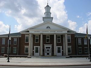
Laurel County, Kentucky
County in Kentucky, United States
Distance: Approx. 3679 meters
Latitude and longitude: 37.11067,-84.1178
Laurel County is a county located in the southeastern portion of the U.S. state of Kentucky. As of the 2020 census, the population was 62,613. Its county seat is London.
East Bernstadt, Kentucky
Census-designated place in Kentucky, United States
Distance: Approx. 8189 meters
Latitude and longitude: 37.19166667,-84.13194444
East Bernstadt is a census-designated place (CDP) and coal town in Laurel County, Kentucky, United States. The population was 716 at the 2010 census, down from 774 at the 2000 census.

London, Kentucky
City in Kentucky, United States
Distance: Approx. 817 meters
Latitude and longitude: 37.13611111,-84.08611111
London is a home rule-class city in Laurel County, Kentucky, in the United States. It is the seat of its county. The population was 8,053 at the time of the 2020 census.
Pittsburg, Kentucky
Unincorporated community in Kentucky, United States
Distance: Approx. 3902 meters
Latitude and longitude: 37.16,-84.10416667
Pittsburg is an unincorporated community and coal town in Laurel County, Kentucky. It was named for the industrial heritage of Pittsburgh, Pennsylvania. Their post office has been open since 1882.

Levi Jackson Wilderness Road State Park
State park in Kentucky, United States
Distance: Approx. 6325 meters
Latitude and longitude: 37.08305556,-84.04166667
Levi Jackson Wilderness Road Park is a former state park located just south of London, Kentucky in Laurel County. It is now a city park under the auspices of the city of London, KY. The park encompasses 896 acres (363 ha) and includes a section of the Wilderness Road that early settlers used to reach Kentucky. The park is named for Levi Jackson, an early Kentucky pioneer.

Federal Building-Courthouse (London, Kentucky)
United States historic place
Distance: Approx. 195 meters
Latitude and longitude: 37.1275,-84.0825
The Federal Building-Courthouse in London, Kentucky is a courthouse of the United States District Court for the Eastern District of Kentucky. It was built in 1911 under the supervision of architect James Knox Taylor, and was listed on the National Register of Historic Places in 1974.

Sue Bennett College
Distance: Approx. 643 meters
Latitude and longitude: 37.125,-84.0885
Sue Bennett College was a private college in London, Kentucky which operated from 1897 through 1997. It was affiliated originally with the Methodist Episcopal Church, South and later the United Methodist Church. It began as an elementary school and ended its days as a four-year college.
Sublimity City, Kentucky
Unincorporated community in Kentucky, United States
Distance: Approx. 3858 meters
Latitude and longitude: 37.09444444,-84.08361111
Sublimity City is an unincorporated community located in Laurel County, Kentucky, United States. Originally known as the Sublimity Forest Community, it was developed under the authority of the Emergency Relief Appropriation Act of 1935.

Poynter Building
United States historic place
Distance: Approx. 72 meters
Latitude and longitude: 37.12888889,-84.08416667
The Poynter Building, on Main St. in London, Kentucky, was built in 1910. It was listed on the National Register of Historic Places in 1985.
Laurel County Public Schools
School district in Kentucky, USA
Distance: Approx. 533 meters
Latitude and longitude: 37.13263889,-84.08744444
Laurel County Public Schools is a school district headquartered in London, Kentucky. It is one of two districts serving Laurel County, and is the only one of the two to operate high schools. The district was established in 1840.
East Bernstadt Independent School District
School district in Kentucky, United States
Distance: Approx. 7273 meters
Latitude and longitude: 37.18983333,-84.11361111
East Bernstadt Independent School District is a school district in East Bernstadt, Kentucky. It operates a K-8 school. Its divisions are East Bernstadt Elementary School and East Bernstadt Middle School.
Weather in this IP's area
clear sky
3 Celsius
0 Celsius
1 Celsius
3 Celsius
1019 hPa
35 %
1019 hPa
975 hPa
10000 meters
2.57 m/s
280 degree