Country:
Region:
City:
Latitude and Longitude:
Time Zone:
Postal Code:
IP information under different IP Channel
ip-api
Country
Region
City
ASN
Time Zone
ISP
Blacklist
Proxy
Latitude
Longitude
Postal
Route
Luminati
Country
Region
mc
City
molinadesegura
ASN
Time Zone
Europe/Madrid
ISP
SpainWISP, S.L.
Latitude
Longitude
Postal
IPinfo
Country
Region
City
ASN
Time Zone
ISP
Blacklist
Proxy
Latitude
Longitude
Postal
Route
db-ip
Country
Region
City
ASN
Time Zone
ISP
Blacklist
Proxy
Latitude
Longitude
Postal
Route
ipdata
Country
Region
City
ASN
Time Zone
ISP
Blacklist
Proxy
Latitude
Longitude
Postal
Route
Popular places and events near this IP address

River Mula (Spain)
River in Spain
Distance: Approx. 2465 meters
Latitude and longitude: 38.03666667,-1.22388889
The Mula is a river in Murcia, Spain. The river's source is located in Bullas, tributary of the River Segura on its right bank.

Estadio Nueva Condomina
Football stadium in Murcia, Spain
Distance: Approx. 5327 meters
Latitude and longitude: 38.04222222,-1.14472222
Estadio Nueva Condomina, currently known as Estadio Enrique Roca de Murcia for sponsorship reasons, is a multi-use stadium in Murcia, Spain. Completed in 2006, it is used mostly for football matches and hosts the home matches of Real Murcia. The stadium has a capacity of 31,179 seats, making it the 16th-largest stadium in Spain and the largest in the Region of Murcia.

University of Murcia
Distance: Approx. 4832 meters
Latitude and longitude: 38.0183,-1.17
The University of Murcia (Spanish: Universidad de Murcia) is the primary institute of higher education in Murcia, Spain. With a student population of approximately 38,000, it is the largest university in the Region of Murcia. Founded in 1272 AD, the University of Murcia is the third oldest university in Spain, following only the University of Salamanca (1218 AD) and the University of Valladolid (1241 AD), and the thirteenth oldest in the world.

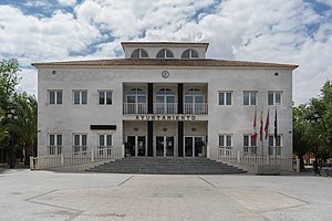
Molina de Segura
Municipality in Murcia, Spain
Distance: Approx. 833 meters
Latitude and longitude: 38.05476667,-1.21311111
Molina de Segura is a municipality of Spain in the autonomous community and province of Murcia. It is located 10 km from the provincial capital, Murcia. It borders the towns of Las Torres de Cotillas, Alguazas, Lorquí, Ulea, Archena, Abarán, Blanca, Murcia and Fortuna.

Las Torres de Cotillas
Municipality in Region of Murcia, Spain
Distance: Approx. 4515 meters
Latitude and longitude: 38.02638889,-1.24361111
Las Torres de Cotillas is a Spanish municipality in the autonomous community of Murcia and is located in the eastern half. A Roman villa existed here in the 2nd century BC. Despite the presence of two Moorish settlements in the Middle Ages, the modern town was founded in 1318. West of Torres de Cotillas at 38°1'35"N 1°15'15"W there is a 186 metres tall guyed radio mast used for mediumwave broadcasting on 855 kHz with 100 kW. The Segura River traverses the western third of the municipality.

Lorquí
Municipality in Murcia, Spain
Distance: Approx. 5524 meters
Latitude and longitude: 38.08166667,-1.255
Lorquí is a Spanish municipality in the autonomous community of Murcia. It has a population of 6,493 (2006) and an area of 15 km2 .
La Raya, Murcia
Village in Spain
Distance: Approx. 7901 meters
Latitude and longitude: 37.98333333,-1.18333333
La Raya de Santiago, or simply La Raya, is a village or pedanía (suburban district) of the municipality of Murcia, in Región de Murcia (Spain). There are 2,289 inhabitants (INE 2004) and it has an approximate area of 2,901 km². It is situated in the central area of the orchard of Murcia, on the right bank of river Segura, 4 km from Murcia city centre and 55 metres above sea level.
Alguazas
Municipality in Murcia, Spain
Distance: Approx. 3271 meters
Latitude and longitude: 38.05138889,-1.24138889
Alguazas (Spanish: [alˈɣwaθas]) is a municipality of Spain in the autonomous community and province of Murcia and it is located in the south-west of the northeastern quarter.

Guadalupe, Murcia
Place in Murcia, Spain
Distance: Approx. 6111 meters
Latitude and longitude: 38,-1.18333333
Guadalupe is a pedanía (village/suburban district) in the municipality of Murcia in the Region of Murcia, Spain. The main populated area is known as Guadalupe de Maciascoque. El Escorial Murciano, the complex that contains the Universidad Católica San Antonio de Murcia and the Monasterio de los Jerónimos de San Pedro de la Ñora, an historic Hieronymite monastery, is located here.

Ceutí
Municipality in Murcia, Spain
Distance: Approx. 6659 meters
Latitude and longitude: 38.07888889,-1.27222222
Ceutí is a municipality in the autonomous region of Murcia in southeastern Spain and is located in the south-east of the northeasternquarter of the Region. As of 2021, there are 12,199 inhabitants.

Churra, Spain
Municipality in Murcia, Spain
Distance: Approx. 6605 meters
Latitude and longitude: 38.02194444,-1.13944444
Churra is a hamlet belonging to the municipality of Murcia (Spain), with a municipal board. It is a semi-agricultural town, although in recent years it has opened its economy to industry, and especially the service sector (commerce), with two hypermarkets (Thader and Nueva Condomina). It had a population of 4,912 inhabitants (Instituto Nacional de Estadística (Spain) in 2004) and an area of 5.6 square kilometers.
Rincón de Beniscornia
Place in Murcia, Spain
Distance: Approx. 7897 meters
Latitude and longitude: 37.985,-1.176
Rincón de Beniscornia is a village in Murcia, Spain. It is part of the municipality of Murcia.
Weather in this IP's area
overcast clouds
17 Celsius
17 Celsius
17 Celsius
18 Celsius
1019 hPa
88 %
1019 hPa
1007 hPa
10000 meters
3.58 m/s
5.36 m/s
88 degree
100 %
07:46:03
17:53:07
