5.180.117.114 - IP Lookup: Free IP Address Lookup, Postal Code Lookup, IP Location Lookup, IP ASN, Public IP
Country:
 Switzerland
Region:
City:
Location:
Time Zone:
Postal Code:
ISP:
ASN:
language:
User-Agent:
Proxy IP:
Blacklist:
IP information under different IP Channel
ip-api
Country
Region
City
ASN
Time Zone
ISP
Blacklist
Proxy
Latitude
Longitude
Postal
Route
db-ip
Country
Region
City
ASN
Time Zone
ISP
Blacklist
Proxy
Latitude
Longitude
Postal
Route
IPinfo
Country
Region
City
ASN
Time Zone
ISP
Blacklist
Proxy
Latitude
Longitude
Postal
Route
IP2Location
5.180.117.114Country
chRegion
zurich
City
freienstein
Time Zone
Europe/Zurich
ISP
Language
User-Agent
Latitude
Longitude
Postal
ipdata
Country
Region
City
ASN
Time Zone
ISP
Blacklist
Proxy
Latitude
Longitude
Postal
Route
Popular places and events near this IP address

Töss (river)
River in Switzerland
Distance: Approx. 3117 meters
Latitude and longitude: 47.55211111,8.55405556
The Töss is a river in the Swiss canton of Zürich and a tributary of the High Rhine (Hochrhein). It starts at Tössscheidi, the confluence of the Vordertöss and Hindertöss (whose sources are in the canton of St. Gallen), passes through Winterthur's Töss and Wülflingen districts and ends at Tössegg near Freienstein-Teufen.

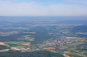
Freienstein-Teufen
Municipality in Zurich, Switzerland
Distance: Approx. 91 meters
Latitude and longitude: 47.53333333,8.58333333
Freienstein-Teufen is a municipality in the district of Bülach in the canton of Zürich in Switzerland.

Embrach
Municipality in Zürich, Switzerland
Distance: Approx. 2618 meters
Latitude and longitude: 47.51043333,8.59378333
Embrach is a municipality in the district of Bülach in the canton of Zürich in Switzerland.
Lufingen
Municipality in Zurich, Switzerland
Distance: Approx. 3865 meters
Latitude and longitude: 47.5,8.6
Lufingen is a municipality in the district of Bülach in the canton of Zürich in Switzerland.

Rorbas
Municipality in Zurich, Switzerland
Distance: Approx. 91 meters
Latitude and longitude: 47.53333333,8.58333333
Rorbas is a municipality in the district of Bülach in the canton of Zürich in Switzerland.

Berg am Irchel
Municipality in Zurich, Switzerland
Distance: Approx. 3914 meters
Latitude and longitude: 47.56666667,8.6
Berg am Irchel is a municipality in the district of Andelfingen in the canton of Zürich in Switzerland.

Buch am Irchel
Municipality in Zurich, Switzerland
Distance: Approx. 3063 meters
Latitude and longitude: 47.55,8.61666667
Buch am Irchel is a municipality in the district of Andelfingen in the canton of Zürich in Switzerland.

Irchel
Elevation in the Canton of Zürich
Distance: Approx. 1848 meters
Latitude and longitude: 47.53944444,8.60722222
Irchel is also the name of a hill in the city of Zürich, and of a campus of Zürich University located there. The Irchel is an elevation in the Canton of Zürich, located at the Rhine between the Töss and Thur rivers, on the territory of Buch am Irchel, Berg am Irchel and Freienstein-Teufen, separating the Andelfingen and Bülach districts. It is an outlying ridge of the Jura, rising to 694 m, lying east of the Lägern.

Bülach Observatory
Observatory
Distance: Approx. 1833 meters
Latitude and longitude: 47.51955,8.57065
Bülach Observatory (German: Sternwarte Bülach) is a public astronomical observatory near Bülach, canton of Zürich, Switzerland. The observatory provides infrastructure for guided tours, classes and astronomical meetings. At the heart of the spacious roof terrace is the big "twin telescope" with mirror diameters of 85 and 50 cm.

Bülach railway station
Railway station in Switzerland
Distance: Approx. 3773 meters
Latitude and longitude: 47.52388889,8.53619444
Bülach railway station (German: Bahnhof Bülach) is a railway station in the Swiss canton of Zürich and municipality of Bülach. It is located at the junction of the Winterthur to Koblenz and Oerlikon to Bülach lines of Swiss Federal Railways. Bülach is an example of a Keilbahnhof: platforms 1–3 are located on the Oerlikon–Bülach line to the west of the station, while platforms 4–6 are located on the Winterthur–Koblenz line, to the east.

Embrach-Rorbas railway station
Railway station in Switzerland
Distance: Approx. 1403 meters
Latitude and longitude: 47.520577,8.586631
Embrach-Rorbas railway station is a railway station in the Swiss canton of Zurich and municipality of Embrach. The station takes its name from that municipality, and the adjoining municipality of Rorbas. It is located on the Winterthur to Koblenz line, and is served by Zurich S-Bahn line S41.

Kantonsschule Zürcher Unterland
Distance: Approx. 3213 meters
Latitude and longitude: 47.5183,8.5478
Kantonsschule Zürcher Unterland (KZU) is a Langzeit und Kurzzeit-Mittelschule in Bülach, Switzerland in the Zurich metropolitan area.
Weather in this IP's area
overcast clouds
3 Celsius
0 Celsius
2 Celsius
4 Celsius
1029 hPa
81 %
1029 hPa
969 hPa
10000 meters
3.09 m/s
20 degree
100 %