5.18.200.16 - IP Lookup: Free IP Address Lookup, Postal Code Lookup, IP Location Lookup, IP ASN, Public IP
Country:
Region:
City:
Location:
Time Zone:
Postal Code:
IP information under different IP Channel
ip-api
Country
Region
City
ASN
Time Zone
ISP
Blacklist
Proxy
Latitude
Longitude
Postal
Route
Luminati
Country
Region
spe
City
stpetersburg
ASN
Time Zone
Europe/Moscow
ISP
JSC ER-Telecom Holding
Latitude
Longitude
Postal
IPinfo
Country
Region
City
ASN
Time Zone
ISP
Blacklist
Proxy
Latitude
Longitude
Postal
Route
IP2Location
5.18.200.16Country
Region
sankt-peterburg
City
kronshtadt
Time Zone
Europe/Moscow
ISP
Language
User-Agent
Latitude
Longitude
Postal
db-ip
Country
Region
City
ASN
Time Zone
ISP
Blacklist
Proxy
Latitude
Longitude
Postal
Route
ipdata
Country
Region
City
ASN
Time Zone
ISP
Blacklist
Proxy
Latitude
Longitude
Postal
Route
Popular places and events near this IP address

Kronstadt
Municipal town in Saint Petersburg, Russia
Distance: Approx. 314 meters
Latitude and longitude: 59.99083333,29.77472222
Kronstadt (Russian: Кроншта́дт, romanized: Kronshtadt, IPA: [krɐnˈʂtat]) is a Russian port city in Kronshtadtsky District of the federal city of Saint Petersburg, located on Kotlin Island, 30 km (19 mi) west of Saint Petersburg, near the head of the Gulf of Finland. It is linked to the former Russian capital by a combination levee-causeway-seagate, the St Petersburg Dam, part of the city's flood defences, which also acts as road access to Kotlin island from the mainland. Founded in the early 18th century by Peter the Great, it became an important international centre of commerce whose trade role was later eclipsed by its strategic significance as the primary maritime defence outpost of the former Russian capital.

Kotlin Island
Russian island in the Gulf of Finland
Distance: Approx. 3063 meters
Latitude and longitude: 60.0125,29.73361111
Kotlin (Russian: Ко́тлин; Swedish: Reitskär) is a Russian island, located near the head of the Gulf of Finland, 32 kilometres (20 mi) west of Saint Petersburg in the Baltic Sea. Kotlin separates the Neva Bay from the rest of the gulf. The fortified city of Kronstadt is located on the island and forms part of a World Heritage Site that is Saint Petersburg and Related Groups of Monuments.

Fort Alexander (Saint Petersburg)
Fort near Kronstadt
Distance: Approx. 3140 meters
Latitude and longitude: 59.9895,29.7178
Fort Alexander, also Fort Alexander I, or Plague Fort (Russian: Форт Александр Первый Fort Aleksandr Perviy or Russian: Чумный форт Chumnyi fort, English: "Plague fort") is a naval fortress on an artificial island in the Gulf of Finland near St. Petersburg and Kronstadt. From 1899 to 1917, the fort housed a research laboratory on plague and other bacterial diseases.

Kronstadt Naval Cathedral
Russian Orthodox Church cathedral building in Saint Petersburg, Russia
Distance: Approx. 318 meters
Latitude and longitude: 59.99170961,29.77787108
The Naval cathedral of Saint Nicholas in Kronstadt (Russian: Морской Никольский собор, Morskoj Nikol'skij sobor) is a Russian Orthodox cathedral built in 1903–1913 as the main church of the Russian Navy and dedicated to all fallen seamen. The cathedral was closed in 1929, was converted to a cinema, a House of Officers (1939) and a museum of the Navy (1980). The Russian Orthodox Church reinstalled the cross on the main dome in 2002 and (for the first time since 1929) served the Divine Liturgy in the cathedral in 2005.

Naval Cadet Corps (Russia)
Military school in Saint Petersburg
Distance: Approx. 992 meters
Latitude and longitude: 59.995,29.756
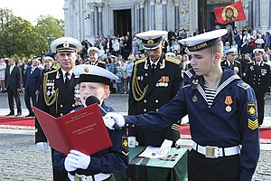
The Naval Cadet Corps (Russian: Морской кадетский корпус, romanized: Morskoy kadetskiy korpus), occasionally translated as the Marine Cadet Corps or the Sea Cadet Corps, is an educational establishment for educating naval officers for commissioning in the Russian Navy in Saint Petersburg.

Kronshtadtsky District
District in federal city of St. Petersburg, Russia
Distance: Approx. 810 meters
Latitude and longitude: 60,29.76666667
Kronshtadtsky District (Russian: Кроншта́дтский райо́н) is a district of the federal city of St. Petersburg, Russia. As of the 2010 Census, its population was 43,005; down from 43,385 recorded in the 2002 Census.

Saint Andrew's Cathedral, Kronstadt
Distance: Approx. 306 meters
Latitude and longitude: 59.99166,29.7775
St. Andrew's Cathedral was the main Russian Orthodox cathedral of Kronstadt. The church was built in 1805–1817 to Andreyan Zakharov's designs to replace a wooden church dating from 1718.
Kronstadt rebellion
1921 anti-Bolshevik revolt in Russia
Distance: Approx. 3063 meters
Latitude and longitude: 60.0125,29.73361111
The Kronstadt rebellion (Russian: Кронштадтское восстание, romanized: Kronshtadtskoye vosstaniye) was a 1921 insurrection of Soviet sailors, naval infantry, and civilians against the Bolshevik government in the Russian port city of Kronstadt. Located on Kotlin Island in the Gulf of Finland, Kronstadt defended the former capital city, Petrograd (now Saint Petersburg), as the base of the Baltic Fleet. For sixteen days in March 1921, rebels in Kronstadt's naval fortress rose in opposition to the Soviet government which they had helped to consolidate.

Kronstadt Sea Cadet Corps
Distance: Approx. 1009 meters
Latitude and longitude: 59.9941,29.7555
The Kronstadt Sea Cadet Corps (Russian: Кронштадтский морской кадетский корпус) is a military boarding school of the Russian Navy.

Russian destroyer Bespokoyny (1990)
Sovremenny-class destroyer of the Russian Navy
Distance: Approx. 1299 meters
Latitude and longitude: 59.9838108,29.7609141
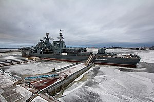
Bespokoyny is a decommissioned Sovremenny-class destroyer of the Russian Navy preserved as museum ship.

Russian destroyer Rastoropny
Sovremenny-class destroyer of the Russian Navy
Distance: Approx. 2275 meters
Latitude and longitude: 59.9739782,29.7850527
Rastoropny was a Sovremenny-class destroyer of the Soviet and later Russian navy.

Anchor Square
City square in Kronstadt, Russia
Distance: Approx. 222 meters
Latitude and longitude: 59.9919,29.7757
Anchor Square (Russian: Якорная площадь) is the central square in the city of Kronstadt, outside Saint Peterburg.
Weather in this IP's area
snow
-0 Celsius
-5 Celsius
-0 Celsius
-0 Celsius
1005 hPa
99 %
1005 hPa
1003 hPa
136 meters
4.58 m/s
8.51 m/s
62 degree
100 %
