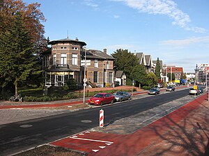
Country:
Region:
City:
Latitude and Longitude:
Time Zone:
Postal Code:
IP information under different IP Channel
ip-api
Country
Region
City
ASN
Time Zone
ISP
Blacklist
Proxy
Latitude
Longitude
Postal
Route
Luminati
Country
ASN
Time Zone
Europe/London
ISP
Soleex BV
Latitude
Longitude
Postal
IPinfo
Country
Region
City
ASN
Time Zone
ISP
Blacklist
Proxy
Latitude
Longitude
Postal
Route
db-ip
Country
Region
City
ASN
Time Zone
ISP
Blacklist
Proxy
Latitude
Longitude
Postal
Route
ipdata
Country
Region
City
ASN
Time Zone
ISP
Blacklist
Proxy
Latitude
Longitude
Postal
Route
Popular places and events near this IP address

Blaricum
Municipality and village in Netherlands
Distance: Approx. 3579 meters
Latitude and longitude: 52.26666667,5.25
Blaricum (Dutch pronunciation: [ˈblaːrikʏm] ) is a municipality and village in the province of North Holland, the Netherlands. It is part of the region of Gooiland and part of the Amsterdam Metropolitan Area (Metropoolregio Amsterdam). It is known for its many monumental farm buildings, local cafes and restaurants, nature, several annual community events, and extensive up-market residential areas.

Bussum
Town and former municipality in North Holland, Netherlands
Distance: Approx. 5140 meters
Latitude and longitude: 52.28333333,5.16666667
Bussum (Dutch pronunciation: [ˈbʏsʏm] ) is a commuter town and former municipality in the Gooi region in the south east of the province of North Holland in the Netherlands near Hilversum. Since 2016, Bussum has been part of the new municipality of Gooise Meren. Bussum had a population of 33,595 in 2019 and covered an area of 8.15 km2 (3.15 sq mi).

Huizen
Municipality in North Holland, Netherlands
Distance: Approx. 831 meters
Latitude and longitude: 52.3,5.25
Huizen (pronounced [ˈɦœyzə(n)] ) is a municipality and a village in the province of North Holland, the Netherlands. The name "Huizen" is Dutch for "houses" and this usage has been linked to the belief that the first stone houses in the region, instead of the more common sod houses of the time, appeared here. Huizen is part of the metropolitan area of Amsterdam.

Laren, North Holland
Town and municipality in North Holland, Netherlands
Distance: Approx. 5354 meters
Latitude and longitude: 52.25,5.23333333
Laren (Dutch pronunciation: [ˈlaːrə(n)] ) is a town and municipality in the province of North Holland, Netherlands. Located in the Gooi region, it is the oldest town in the area. Together with its neighbor Blaricum, Laren is one of the most affluent towns in the Netherlands.

Naarden
City in North Holland, Netherlands
Distance: Approx. 5184 meters
Latitude and longitude: 52.29527778,5.16222222
Naarden (Dutch pronunciation: [ˈnaːrdə(n)] ) is a city and former municipality in the Gooi region in the province of North Holland, Netherlands. It has been part of the new municipality of Gooise Meren since 2016.
Almere Haven
Borough of Almere in Flevoland, Netherlands
Distance: Approx. 4773 meters
Latitude and longitude: 52.33944444,5.22027778
Almere Haven is the oldest borough of Almere (although the first houses of Almere were built in the neighborhood now known as Oostvaardersdiep in Almere Buiten). Although Almere Haven does not have its own railway station, it is well-connected to Amsterdam and the rest of Almere by a good bus rapid transit system. Almere Haven has a small harbour, as well as a marina and is surrounded by large forests of poplars containing buzzards, foxes, small deer, and owls.
Gooimeer
Bordering lake between North Holland and Flevoland, the Netherlands
Distance: Approx. 3992 meters
Latitude and longitude: 52.32277778,5.19583333
The Gooimeer (Gooi Lake) is a bordering lake in the Netherlands between the southeastern part of North Holland (the Gooi) and Flevoland. There is a railroad bridge over the narrow west side, between Weesp and Almere Poort, with a parallel highway bridge, the Hollandse Brug. The narrow eastern border of the lake is crossed by two parallel highway bridges.

Huizen transmitter
Distance: Approx. 1200 meters
Latitude and longitude: 52.28751111,5.24232778
The Huizen transmitter was one of the first large-scale radio transmitting stations to be built in the Netherlands.

Singer Laren
Art museum and concert hall in Laren, the Netherlands
Distance: Approx. 4428 meters
Latitude and longitude: 52.25944444,5.22222222
Singer Laren is a museum and concert hall located in the center of Laren, the Netherlands. The museum is devoted to presenting and preserving the collection of the American artist William Henry Singer Jr. (1868–1943) and his wife Anna (1878–1962).
Dutch Fortress Museum
Distance: Approx. 5352 meters
Latitude and longitude: 52.29333333,5.16
The Dutch Fortress Museum (Nederlands Vestingmuseum) is located in the city of Naarden, the Netherlands. The museum was established by volunteers in 1955 at bastion Turfpoort, one of six bastions that give the walled city its distinctive star shape. (During World War II, allied bombers returning to Great Britain from bombing missions used it as a marker.) The fortifications themselves, including the bastions, date from the period 1575–1585, when King Philip II of Spain ordered them to be constructed.
100% NL
Radio station in Bussum, Netherlands
Distance: Approx. 3228 meters
Latitude and longitude: 52.28611111,5.195
100% NL (Dutch: 100 procent NL) is a Dutch commercial radio station which broadcasts nationwide on FM since 8 July 2006. 100% NL runs primarily Dutch products.

Gooise Meren
Municipality in North Holland, Netherlands
Distance: Approx. 5139 meters
Latitude and longitude: 52.2833,5.1667
Gooise Meren (pronounced [ˈɣoːisə ˈmeːrə(n)]) is a municipality in the province of North Holland, the Netherlands. It has about 58,000 inhabitants and covers an area of about 77 km2 (30 sq mi). Gooise Meren has existed since 2016.
Weather in this IP's area
overcast clouds
10 Celsius
10 Celsius
9 Celsius
11 Celsius
1026 hPa
95 %
1026 hPa
1026 hPa
10000 meters
2.61 m/s
3.29 m/s
266 degree
96 %
08:00:39
16:46:59


