5.159.26.19 - IP Lookup: Free IP Address Lookup, Postal Code Lookup, IP Location Lookup, IP ASN, Public IP
Country:
Region:
City:
Location:
Time Zone:
Postal Code:
ISP:
ASN:
language:
User-Agent:
Proxy IP:
Blacklist:
IP information under different IP Channel
ip-api
Country
Region
City
ASN
Time Zone
ISP
Blacklist
Proxy
Latitude
Longitude
Postal
Route
db-ip
Country
Region
City
ASN
Time Zone
ISP
Blacklist
Proxy
Latitude
Longitude
Postal
Route
IPinfo
Country
Region
City
ASN
Time Zone
ISP
Blacklist
Proxy
Latitude
Longitude
Postal
Route
IP2Location
5.159.26.19Country
Region
niedersachsen
City
grasleben
Time Zone
Europe/Berlin
ISP
Language
User-Agent
Latitude
Longitude
Postal
ipdata
Country
Region
City
ASN
Time Zone
ISP
Blacklist
Proxy
Latitude
Longitude
Postal
Route
Popular places and events near this IP address

Grasleben
Municipality in Lower Saxony, Germany
Distance: Approx. 1151 meters
Latitude and longitude: 52.31666667,11.01666667
Grasleben is a municipality in the district of Helmstedt, in Lower Saxony, Germany. It is situated approximately 10 km north of Helmstedt, and 20 km southeast of Wolfsburg. The Municipality Grasleben includes the villages of Grasleben and Heidwinkel.

Mariental, Germany
Municipality in Lower Saxony, Germany
Distance: Approx. 3340 meters
Latitude and longitude: 52.28333333,10.98333333
Mariental is a municipality in the district of Helmstedt, in Lower Saxony, Germany. The Municipality Mariental includes the villages of Mariental-Dorf and Mariental-Horst. See also Mariental Abbey.

Querenhorst
Municipality in Lower Saxony, Germany
Distance: Approx. 4435 meters
Latitude and longitude: 52.33333333,10.96666667
Querenhorst is a municipality in the district of Helmstedt, in Lower Saxony, Germany.

Rennau
Municipality in Lower Saxony, Germany
Distance: Approx. 6711 meters
Latitude and longitude: 52.3,10.91666667
Rennau is a municipality in the district of Helmstedt, in Lower Saxony, Germany. The Municipality Rennau includes the villages of Ahmstorf, Rennau and Rottorf am Klei.
Grasleben (Samtgemeinde)
Samtgemeinde in Lower Saxony
Distance: Approx. 1190 meters
Latitude and longitude: 52.317,11.017
Grasleben is a Samtgemeinde ("collective municipality") in the district of Helmstedt, in Lower Saxony, Germany. Its seat is in the village Grasleben.
Walbeck, Börde
Stadtteil of Oebisfelde-Weferlingen in Saxony-Anhalt, Germany
Distance: Approx. 4372 meters
Latitude and longitude: 52.28333333,11.06666667
Walbeck is a village and a former municipality in the Börde district in Saxony-Anhalt, Germany. Since 1 January 2010, it is part of the town Oebisfelde-Weferlingen. Its population is 688 (2022).
Döhren
Stadtteil of Oebisfelde-Weferlingen in Saxony-Anhalt, Germany
Distance: Approx. 3001 meters
Latitude and longitude: 52.33333333,11.01666667
Döhren is a village and a former municipality in the Börde district in Saxony-Anhalt, Germany. Since 1 January 2010, it is part of the town Oebisfelde-Weferlingen.
Hödingen
Stadtteil of Oebisfelde-Weferlingen in Saxony-Anhalt, Germany
Distance: Approx. 6226 meters
Latitude and longitude: 52.30444444,11.10611111
Hödingen is a village and a former municipality in the Börde district in Saxony-Anhalt, Germany. Since 1 January 2010, it is part of the town Oebisfelde-Weferlingen.
Siestedt
Stadtteil of Oebisfelde-Weferlingen in Saxony-Anhalt, Germany
Distance: Approx. 4809 meters
Latitude and longitude: 52.31666667,11.08333333
Siestedt is a village and a former municipality in the Börde district in Saxony-Anhalt, Germany. Since 1 January 2010, it is part of the town Oebisfelde-Weferlingen.

Weferlingen
Stadtteil of Oebisfelde-Weferlingen in Saxony-Anhalt, Germany
Distance: Approx. 3072 meters
Latitude and longitude: 52.31611111,11.05694444
Weferlingen is a village and a former municipality in the Börde district in Saxony-Anhalt, Germany. Since 1 January 2010, it has been part of the town of Oebisfelde-Weferlingen. Weferlingen was featured in the Global Mobilization Creator DLC for Bohemia Interactive's ArmA 3.

Lappwald
Wooded hills in central Germany
Distance: Approx. 5868 meters
Latitude and longitude: 52.25597778,11.03980556
The Lappwald is a heavily wooded range of hills, 20 km long and up to 5 km wide, in central Germany. It stretches northwards from the town of Helmstedt. The border between Lower Saxony and Saxony-Anhalt runs through the woods, of which about three quarters is on Lower Saxon terrain.

Mariental Abbey
Distance: Approx. 3948 meters
Latitude and longitude: 52.2759,10.9851
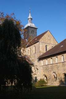
Mariental Abbey (German: Kloster Mariental), in the present-day municipality of Mariental in Lower Saxony, Germany, is a former Cistercian monastery founded in 1138, now used and owned by a Lutheran congregation of the Evangelical Lutheran Church in Brunswick.
Weather in this IP's area
overcast clouds
4 Celsius
2 Celsius
3 Celsius
5 Celsius
1006 hPa
87 %
1006 hPa
990 hPa
10000 meters
2.6 m/s
4.05 m/s
145 degree
100 %
