5.159.175.214 - IP Lookup: Free IP Address Lookup, Postal Code Lookup, IP Location Lookup, IP ASN, Public IP
Country:
Region:
City:
Location:
Time Zone:
Postal Code:
ISP:
ASN:
language:
User-Agent:
Proxy IP:
Blacklist:
IP information under different IP Channel
ip-api
Country
Region
City
ASN
Time Zone
ISP
Blacklist
Proxy
Latitude
Longitude
Postal
Route
db-ip
Country
Region
City
ASN
Time Zone
ISP
Blacklist
Proxy
Latitude
Longitude
Postal
Route
IPinfo
Country
Region
City
ASN
Time Zone
ISP
Blacklist
Proxy
Latitude
Longitude
Postal
Route
IP2Location
5.159.175.214Country
Region
navarra, comunidad foral de
City
bera
Time Zone
Europe/Madrid
ISP
Language
User-Agent
Latitude
Longitude
Postal
ipdata
Country
Region
City
ASN
Time Zone
ISP
Blacklist
Proxy
Latitude
Longitude
Postal
Route
Popular places and events near this IP address

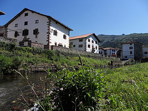
Bera, Navarre
Municipality in Navarre, Spain
Distance: Approx. 379 meters
Latitude and longitude: 43.28055556,-1.68194444
Bera is a town and municipality situated in the province and autonomous community of Navarre, in northern Spain. The town is traversed by the river Bidasoa before it enters Gipuzkoa at Endarlatsa, eventually flowing into the Cantabrian Sea (Bay of Biscay) between the towns of Hendaye and Hondarribia.

Etxalar
Town and municipality in Navarre, Spain
Distance: Approx. 6679 meters
Latitude and longitude: 43.23361111,-1.63722222
Etxalar is a town and municipality located in the province and autonomous community of Navarre, northern Spain.

Lesaka
Municipality in Navarre, Spain
Distance: Approx. 4074 meters
Latitude and longitude: 43.24722222,-1.70277778
Lesaka is a town and municipality in the province and autonomous community of Navarre, in Spain. It is situated in the merindad of Iruña, in the region of Bortziriak (Five Villas) and to 75 km of the capital of the community, Iruña/Pamplona. The population in 2014 was of 2742 inhabitants.

Ascain
Commune in Nouvelle-Aquitaine, France
Distance: Approx. 9002 meters
Latitude and longitude: 43.3467,-1.62
Ascain (French pronunciation: [askɛ̃]; Basque: Azkaine) is a commune in the Pyrénées-Atlantiques department in the Nouvelle-Aquitaine region of south-western France. The commune has been awarded three flowers by the National Council of Towns and Villages in Bloom in the Competition of cities and villages in Bloom.

Biriatou
Commune in Nouvelle-Aquitaine, France
Distance: Approx. 7370 meters
Latitude and longitude: 43.3342,-1.7419
Biriatou (French pronunciation: [biʁjatu]; Basque: Biriatu) is a village and a commune in the Pyrénées-Atlantiques department in southwestern France. It is part of the traditional Basque province of Labourd. The village lies on the edge of a hill rising east to the minor mount Xoldokogaina (486 m), the first noticeable prominence across the Spanish-French border at the lower Bidasoa.

Sare, Pyrénées-Atlantiques
Commune in Nouvelle-Aquitaine, France
Distance: Approx. 9371 meters
Latitude and longitude: 43.3136,-1.5792
Sare (French pronunciation: [saʁ]; Basque: Sara) is a village and a commune in the Pyrénées-Atlantiques department in south-western France on the border with Spain. It is part of the traditional Basque province of Labourd. It is a member of Les Plus Beaux Villages de France (The Most Beautiful Villages of France) Association.

Urrugne
Commune in Nouvelle-Aquitaine, France
Distance: Approx. 9108 meters
Latitude and longitude: 43.3631,-1.6989
Urrugne (French pronunciation: [yʁyɲ]; Basque: Urruña) is a village and a commune in the Pyrénées-Atlantiques department in south-western France. It is part of the traditional Basque province of Labourd.

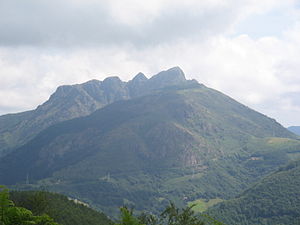
Larrun
Mountain in Navarre / France border
Distance: Approx. 5117 meters
Latitude and longitude: 43.30916667,-1.63555556
Larrun (Basque: Larhun, Larrun; French: La Rhune [la ʁyn]; Spanish: Larrún [laˈrun]; - 'good pasture', possibly a folk etymology, in French until the 20th century: Larhune) is a mountain (905 m) at the western end of the Pyrenees. It is located on the border of France and Spain, where the traditional Basque provinces of Labourd and Navarra meet. Its prominence is 670 m.

Pheasant Island
Uninhabited island between France and Spain
Distance: Approx. 9343 meters
Latitude and longitude: 43.34277778,-1.76555556
Pheasant Island (French: Île des Faisans/Île de la Conférence, Spanish: Isla de los Faisanes, Basque: Konpantzia, Faisaien Uhartea Konferentziako Uhartea) is an uninhabited river island located in the Bidasoa river, located between France and Spain, whose administration alternates between the two nations every 6 months.
Peñas de Aya
Massif in the Basque Country
Distance: Approx. 7972 meters
Latitude and longitude: 43.283325,-1.78465
Aiako Harria in Basque or Peñas de Aya in Spanish, is a massif east of the town of Oiartzun in the Basque Country. The river Oiartzun rises on its north-western face. The range is very popular with the inhabitants of the area.
Battle of Sans Culottes Camp
Battle of the War of the First Coalition
Distance: Approx. 9103 meters
Latitude and longitude: 43.36305556,-1.69888889
The Battle of Sans Culottes Camp (5 February 1794) saw a Spanish army commanded by José de Urrutia y de las Casas attack part of the French Army of the Western Pyrenees under Jean-Henri-Guy-Nicolas de Frégeville. The Spanish assault seized two key positions behind the Bidasoa River but was unable to overrun the main position, called Sans Culottes Camp after an eight-hour contest. The War of the Pyrenees action was fought at a location described as being "in front" of (that is, west of) Saint-Jean-de-Luz near the modern France–Spain border.

Fortifications of Larrun
Military works situated at Larrun
Distance: Approx. 5117 meters
Latitude and longitude: 43.30916667,-1.63555556
The fortifications of Larrun from the late modern period are a series of military works situated on the mountain of Larrun, immediately to the west of the border between Spain and France. Some of the structures were erected during the 1793-1794 campaign and repurposed to impede the advance of the Anglo-Hispano-Portuguese coalition troops, which the future Duke of Wellington led. More than twenty redoubts are distributed across the territories of Ascain, Sare, and Urrugne, with partial coverage also extending to those of Saint-Pée-sur-Nivelle and Biriatou.
Weather in this IP's area
overcast clouds
6 Celsius
5 Celsius
6 Celsius
7 Celsius
1029 hPa
93 %
1029 hPa
988 hPa
10000 meters
1.54 m/s
200 degree
100 %
